Search
You Searched For
Search Results
- Creator:
- James, Edwin, 1797-1861
- Call Number:
- Zc20 +822ja
- Image Count:
- 41
- Resource Type:
- Maps, Atlases & Globes
- Found in:
- Beinecke Rare Book and Manuscript Library > Account of an expedition from Pittsburgh to the Rocky Mountains : performed in the years 1819 and '20, by order of the Hon. J.C. Calhoun, Sec'y of War ; under the command of Major Stephen H. Long : from the notes of Major Long, Mr. T. Say, and other gentlemen of the exploring party / compiled by Edwin James, botanist and geologist for the expedition ; in two vols., with an atlas.
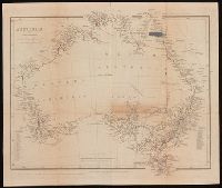
- Creator:
- Arrowsmith, John, 1790-1873, cartographer
- Published / Created:
- Apl. 1st 1846.
- Call Number:
- BrSides 2019 93
- Image Count:
- 1
- Resource Type:
- Maps, Atlases & Globes
- Found in:
- Beinecke Rare Book and Manuscript Library > Australia [cartographic material] / by John Arrowsmith.
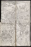
- Published / Created:
- [1560]
- Call Number:
- Peru Cwpr j553ci
- Collection Title:
- La prima parte dell historie del Perv. Dove si tratta lordine delle prouincie, delle citta nuoue in
- Image Count:
- 1
- Resource Type:
- Maps, Atlases & Globes
- Found in:
- Beinecke Rare Book and Manuscript Library > Brevis exactaq totivs novi orbis eivsq; insvlarvm descriptio recens a ioan bellero edita
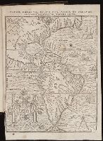
- Published / Created:
- [1567]
- Call Number:
- Peru Cwpr j567
- Collection Title:
- Levini Apollonii, Gandobrvgani, Mittelbvrgensis, de Peruuiae, regionis, inter Noui Orbis prouincias
- Image Count:
- 1
- Resource Type:
- Maps, Atlases & Globes
- Found in:
- Beinecke Rare Book and Manuscript Library > Brevis, exactaq totivs novi orbis et Pervviae regionis descriptio recens edita
- Published / Created:
- 1813
- Call Number:
- Folio Q115 H84 1B
- Collection Title:
- Atlas geographique et physique des regions equinoxiales du nouveau continent, fonde sur des
- Image Count:
- 1
- Resource Type:
- Maps, Atlases & Globes
- Found in:
- Beinecke Rare Book and Manuscript Library > Carte du Cours de Rio Apure et d'une Partie de la Chaine des Montaignes de la Nouvelle Grenade, dressee par Alexandre de Humboldt. pl. 17
- Published / Created:
- undated
- Call Number:
- Folio Q115 H84 1B
- Collection Title:
- Atlas geographique et physique des regions equinoxiales du nouveau continent, fonde sur des
- Image Count:
- 1
- Resource Type:
- Maps, Atlases & Globes
- Found in:
- Beinecke Rare Book and Manuscript Library > Carte du Rio Grande de la Magdalena depuis le 4 [degrees] Latitude jusqu'a son embouchure. No. 24
- Creator:
- Stokes, John Lort, 1811-1885, cartographer
- Published / Created:
- Feby 18th 1846.
- Call Number:
- BrSides 2019 96
- Image Count:
- 1
- Resource Type:
- Maps, Atlases & Globes
- Found in:
- Beinecke Rare Book and Manuscript Library > Chart of Bass' Strait [cartographic material] / surveyed by Capt. I. Lort Stokes & the Officers of H.M.S. Beagle, 1843.
- Published / Created:
- [1582]
- Call Number:
- Taylor 160
- Collection Title:
- Les trois mondes / par le seigneur de la Popelliniere
- Image Count:
- 1
- Found in:
- Beinecke Rare Book and Manuscript Library > Les trois mondes
- Creator:
- Friesen, F
- Published / Created:
- 1808
- Call Number:
- Folio Q115 H84 1B
- Collection Title:
- Atlas geographique et physique des regions equinoxiales du nouveau continent, fonde sur des
- Image Count:
- 1
- Resource Type:
- Maps, Atlases & Globes
- Found in:
- Beinecke Rare Book and Manuscript Library > Limite inferieure des Neiges perpetuelles a differentes Latitudes
- Creator:
- Medary, Samuel A
- Published / Created:
- 1858
- Call Number:
- 8101 1858
- Container / Volume:
- BRBL_00552
- Image Count:
- 1
- Resource Type:
- Maps, Atlases & Globes
- Found in:
- Beinecke Rare Book and Manuscript Library > Map of the Fort Ridgely & South Pass road / by Samuel A. Medary ; drawn by John R. Key.