Skip to search
Skip to main content
Skip to first result
Search
You Searched For
Date
Unknown
"North America--Maps"
Format
cartographic
Subject (Topic)
Nautical charts --West Indies --Early works to 1800
Date Created
[Missing]
New Search
Search Results
Creator:
Call Number:
1973 Folio 67
Collection Title:
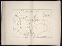
The West-India pilot: containing piloting directions for Port Royal and Kingston harbours in
Image Count:
1
Subject (Geographic):
Atlantic Ocean --Maps --Early works to 1800, Puerto Rico --Maps --Early works to 1800, and West Indies --Maps --Early works to 1800
Subject (Topic):
Harbors --Atlantic Coast (North America
Collection Created:
London : Printed for the author and sold by S. Hooper ..., MDCCLXXI [1771]
Found in:
Beinecke Rare Book and Manuscript Library > Aiguiade de Port o Rico
Call Number:
1973 Folio 67
Collection Title:
The West-India pilot: containing piloting directions for Port Royal and Kingston harbours in
Image Count:
1
Subject (Geographic):
Atlantic Ocean --Maps --Early works to 1800, Central America --Maps --Early works to 1800, and Honduras --Maps
Subject (Topic):
Harbors --Atlantic Coast (North America
Collection Created:
London : Printed for the author and sold by S. Hooper ..., MDCCLXXI [1771]
Found in:
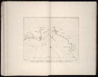
Beinecke Rare Book and Manuscript Library > Chart of the Bay of Honduras
Call Number:
1973 Folio 67
Collection Title:
The West-India pilot: containing piloting directions for Port Royal and Kingston harbours in
Image Count:
1
Subject (Geographic):
Atlantic Ocean --Maps --Early works to 1800, Central America --Maps --Early works to 1800, Providence Island (Colombia) --Maps, and Santa Catalina Island (Colombia)
Subject (Topic):
Harbors --Atlantic Coast (North America
Collection Created:
London : Printed for the author and sold by S. Hooper ..., MDCCLXXI [1771]
Found in:
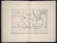
Beinecke Rare Book and Manuscript Library > Island of Old Providence
Call Number:
1973 Folio 67
Collection Title:
The West-India pilot: containing piloting directions for Port Royal and Kingston harbours in
Image Count:
1
Subject (Geographic):
Atlantic Ocean --Maps --Early works to 1800, Santo Domingo (Dominican Republic) --Maps --Early works to 1800, and West Indies --Maps --Early works to 1800
Subject (Topic):
Harbors --Atlantic Coast (North America
Collection Created:
London : Printed for the author and sold by S. Hooper ..., MDCCLXXI [1771]
Found in:
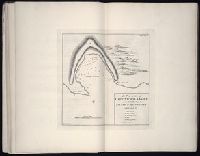
Beinecke Rare Book and Manuscript Library > Plan de la Rade du Port Paix
Call Number:
1973 Folio 67
Collection Title:
The West-India pilot: containing piloting directions for Port Royal and Kingston harbours in
Image Count:
1
Subject (Geographic):
Atlantic Ocean --Maps --Early works to 1800, Cap-Francais (Haiti), and West Indies --Maps --Early works to 1800
Subject (Topic):
Harbors --Atlantic Coast (North America
Collection Created:
London : Printed for the author and sold by S. Hooper ..., MDCCLXXI [1771]
Found in:
Beinecke Rare Book and Manuscript Library > Plan du Cap Francois
Call Number:
1973 Folio 67
Collection Title:
The West-India pilot: containing piloting directions for Port Royal and Kingston harbours in
Image Count:
1
Subject (Geographic):
Atlantic Ocean --Maps --Early works to 1800, Haiti --Maps --Early works to 1800, and West Indies --Maps --Early works to 1800
Subject (Topic):
Harbors --Atlantic Coast (North America
Collection Created:
London : Printed for the author and sold by S. Hooper ..., MDCCLXXI [1771]
Found in:
Beinecke Rare Book and Manuscript Library > Plan du cul de sac de Leogane ou le Port au Prince
Call Number:
1973 Folio 67
Collection Title:
The West-India pilot: containing piloting directions for Port Royal and Kingston harbours in
Image Count:
1
Subject (Geographic):
Atlantic Ocean --Maps --Early works to 1800, Georgia --Maps --Early works to 1800, Jekyll Island (Ga.) --Maps, and Saint Simons Island (Ga.) --Maps
Subject (Topic):
Harbors --Atlantic Coast (North America
Collection Created:
London : Printed for the author and sold by S. Hooper ..., MDCCLXXI [1771]
Found in:
Beinecke Rare Book and Manuscript Library > Plan du port de Gouadaquini now called Jekil Sound in the province of Georgia in North America
Call Number:
1973 Folio 67
Collection Title:
The West-India pilot: containing piloting directions for Port Royal and Kingston harbours in
Image Count:
1
Subject (Geographic):
Atlantic Ocean --Maps --Early works to 1800, Jamaica --Maps --Early works to 1800, and West Indies --Maps --Early works to 1800
Subject (Topic):
Harbors --Atlantic Coast (North America
Collection Created:
London : Printed for the author and sold by S. Hooper ..., MDCCLXXI [1771]
Found in:
Beinecke Rare Book and Manuscript Library > Plan of Blewfield's Harbour on the island of Jamaica
Creator:
Call Number:
1973 Folio 67
Collection Title:
The West-India pilot: containing piloting directions for Port Royal and Kingston harbours in
Image Count:
1
Subject (Geographic):
Atlantic Ocean --Maps --Early works to 1800, Central America --Maps --Early works to 1800, and Mosquitia (Nicaragua and Honduras) --Maps --Early works to 1800
Subject (Topic):
Harbors --Atlantic Coast (North America
Collection Created:
London : Printed for the author and sold by S. Hooper ..., MDCCLXXI [1771]
Found in:
Beinecke Rare Book and Manuscript Library > Plan of Blewfields Harbour on the Mosquito Shore
Call Number:
1973 Folio 67
Collection Title:
The West-India pilot: containing piloting directions for Port Royal and Kingston harbours in
Image Count:
1
Subject (Geographic):
Atlantic Ocean --Maps --Early works to 1800, Hispaniola --Maps --Early works to 1800, and West Indies --Maps --Early works to 1800
Subject (Topic):
Harbors --Atlantic Coast (North America
Collection Created:
London : Printed for the author and sold by S. Hooper ..., MDCCLXXI [1771]
Found in:
Beinecke Rare Book and Manuscript Library > Plan of Cape Nichola Mole at the n.w. end of the island of Hispaniola
Branch:v1.61.6 ,Deployed:2024-06-12T09:55:36-04:00