Search
You Searched For
Search Results
- Creator:
- Jefferys, Thomas, d. 1771
- Published / Created:
- 1762]
- Call Number:
- 71 1762
- Container / Volume:
- BRBL_00364
- Image Count:
- 3
- Resource Type:
- Maps, Atlases & Globes
- Found in:
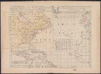
- Beinecke Rare Book and Manuscript Library > Chart of the Atlantic Ocean, with the British, French, & Spanish settlements in North America, and the West Indies, as also on the coast of Africa / by Thos. Jefferys, geographer to His Majesty.
- Creator:
- Mercator, Gerhard, 1512-1594, cartographer
- Published / Created:
- [19--]
- Call Number:
- 11 1538B
- Image Count:
- 1
- Resource Type:
- Maps, Atlases & Globes
- Found in:
- Beinecke Rare Book and Manuscript Library > [Mapamundi of 1538] [cartographic material].
- Published / Created:
- 1651
- Call Number:
- 11 1651B
- Container / Volume:
- BRBL_00003
- Image Count:
- 1
- Resource Type:
- Maps, Atlases & Globes
- Found in:
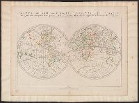
- Beinecke Rare Book and Manuscript Library > Mappe-monde, ou carte generale du monde, designée en deux plan-hemispheres / par le Sr. Sanson d'Abbeville ... ; Riuiere sculp.
- Creator:
- Mercator, Rumold, ca. 1545-1599
- Published / Created:
- 1595?]
- Call Number:
- 11 1587A
- Image Count:
- 1
- Resource Type:
- Maps, Atlases & Globes
- Found in:
- Beinecke Rare Book and Manuscript Library > Orbis terrae compendiosa descriptio : quam ex magna universali Gerardi Mercatoris Domino Richardo Gartho, geographie ac ceterarum bonarum artium amatori ac fautori summo, in veteris amicitie ac familiaritatis memoriam Rumoldus Mercator fieri curabat A[nn]
- Published / Created:
- 1745
- Call Number:
- 11 1720
- Container / Volume:
- BRBL_00004
- Image Count:
- 1
- Resource Type:
- Maps, Atlases & Globes
- Found in:
- Beinecke Rare Book and Manuscript Library > Mappemond a l'usage du Roy / par Guillaume Delisle ...
- Published / Created:
- 1719
- Call Number:
- 11 1719A
- Container / Volume:
- BRBL_00004
- Image Count:
- 1
- Resource Type:
- Maps, Atlases & Globes
- Found in:
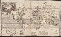
- Beinecke Rare Book and Manuscript Library > A new and correct map of the whole world ... / by Herman Moll ...
- Creator:
- Münster, Sebastian, 1489-1552
Petri, Heinrich, 1508-1579
Ptolemy, 2nd cent
- Published / Created:
- 1545?]
- Call Number:
- 11 1545
- Image Count:
- 1
- Resource Type:
- Maps, Atlases & Globes
- Found in:
- Beinecke Rare Book and Manuscript Library > Typus universalis, anno 1545 [cartographic material].
- Published / Created:
- [1733?]
- Call Number:
- 11 1733
- Container / Volume:
- BRBL_00004
- Image Count:
- 1
- Resource Type:
- Maps, Atlases & Globes
- Found in:
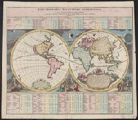
- Beinecke Rare Book and Manuscript Library > Basis geographiæ recentioris astronomica ... a Iohanne Gabrielle Doppelmaiero ... operâ Ioh. Bapt. Homanni ...
- Creator:
- Moullart-Sanson, Pierre
- Published / Created:
- 1695
- Call Number:
- 11 1695A
- Container / Volume:
- BRBL_00004
- Image Count:
- 1
- Resource Type:
- Maps, Atlases & Globes
- Found in:
- Beinecke Rare Book and Manuscript Library > Mappemonde ou carte marine universelle reduite : où sont l'Asie, l'Afrique, l'Europe, l'Amerique septentrionale, l'Amerique meridionale / par Pierre Moullart-Sanson, geographe du Roi.
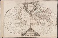
- Creator:
- Robert de Vaugondy, Didier, 1723-1786
- Published / Created:
- 1750?]
- Call Number:
- 11 1750
- Image Count:
- 1
- Resource Type:
- Maps, Atlases & Globes
- Found in:
- Beinecke Rare Book and Manuscript Library > Orbis vetus in utrâque continente ... / accurante Robert de Vaugondy.