Search
You Searched For
Search Results
- Published / Created:
- 19--?]
- Call Number:
- 778 1781
- Container / Volume:
- BRBL_00504A
- Image Count:
- 1
- Resource Type:
- Maps, Atlases & Globes
- Found in:
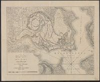
- Beinecke Rare Book and Manuscript Library > A Map and Chart of these parts of the Bay of Chesapeak. York and James Rivers wich are at present the seat of war.
- Creator:
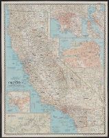
- National Geographic Society (U.S.). Cartographic Section
- Published / Created:
- 1954
- Call Number:
- 844 1954
- Container / Volume:
- BRBL_00603
- Image Count:
- 1
- Resource Type:
- Maps, Atlases & Globes
- Found in:
- Beinecke Rare Book and Manuscript Library > A map of California : with descriptive notes / compiled and drawn in the Cartographic Section of the National Geographic Society ; James M. Darley, chief cartographer.
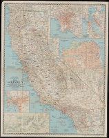
- Creator:
- National Geographic Society (U.S.). Cartographic Section
- Published / Created:
- 1954
- Call Number:
- 844 1954
- Container / Volume:
- BRBL_00603
- Image Count:
- 1
- Resource Type:
- Maps, Atlases & Globes
- Found in:
- Beinecke Rare Book and Manuscript Library > A map of California : with descriptive notes / compiled and drawn in the Cartographic Section of the National Geographic Society ; James M. Darley, chief cartographer.
- Creator:
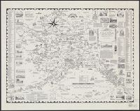
- Robinson, W. W. (William Wilcox), 1891-1972
- Published / Created:
- c1956.
- Call Number:
- 844ag 1956
- Container / Volume:
- BRBL_00612
- Image Count:
- 2
- Resource Type:
- Maps, Atlases & Globes
- Found in:
- Beinecke Rare Book and Manuscript Library > A map of the missions, presidios, pueblos, and some of the more interesting ranchos of Spanish California : together with the routes of the principal land explorations therein / compiled by W.W. Robinson and William H. Newbro, Jr. ; edited by Phil Townsen
- Creator:
- Chase, Ernest Dudley, 1878-
- Published / Created:
- c1958.
- Call Number:
- 848am 1958
- Container / Volume:
- BRBL_00635
- Image Count:
- 1
- Resource Type:
- Maps, Atlases & Globes
- Found in:
- Beinecke Rare Book and Manuscript Library > A pictorial map of Alaska : the 49th State ... / drawn and published by Ernest Dudley Chase.
- Published / Created:
- [19--?]
- Call Number:
- 771 T43 1758A
- Container / Volume:
- BRBL_00492
- Image Count:
- 1
- Resource Type:
- Maps, Atlases & Globes
- Found in:
- Beinecke Rare Book and Manuscript Library > A plan of the town and Fort of Carrillon at Ticonderoga with the attack made by the British Army ... by Genl. Abercrombie ...
- Creator:
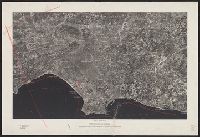
- Fairchild Aerial Surveys, inc
- Published / Created:
- c1954.
- Call Number:
- 844bc L89 1954
- Container / Volume:
- BRBL_00612
- Image Count:
- 1
- Resource Type:
- Maps, Atlases & Globes
- Found in:
- Beinecke Rare Book and Manuscript Library > Aerial photo map of Metropolitan Los Angeles / compiled by Fairchild Aerial Surveys, Inc.
- Creator:
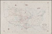
- Brayer, Garnet M
- Published / Created:
- 1949 [i.e. 1950]
- Call Number:
- 75gmb 1895
- Container / Volume:
- BRBL_00411
- Image Count:
- 1
- Resource Type:
- Maps, Atlases & Globes
- Found in:
- Beinecke Rare Book and Manuscript Library > America's cattle trails. Compiled from contemporary sources by Garnet M. Brayer and Herbert O. Brayer; Hugh T. Glen, cartographer; C.O. Froid, illustrator.
- Creator:
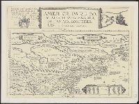
- Jode, Cornelis de, 1568-1600
- Published / Created:
- 19--?]
- Call Number:
- 71 1593
- Container / Volume:
- BRBL_00359
- Image Count:
- 1
- Resource Type:
- Maps, Atlases & Globes
- Found in:
- Beinecke Rare Book and Manuscript Library > Americae pars borealis, Florida, Baccalaos, Canada, Corterealis / A Cornelio de Iudaeis in luce edita.
- Creator:
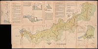
- Portugal. Ministério do Ultramar. Inspecção-geral do fomento
- Published / Created:
- [1954]
- Call Number:
- BrSides Double Folio 2019 8
- Image Count:
- 2
- Resource Type:
- Maps, Atlases & Globes
- Found in:
- Beinecke Rare Book and Manuscript Library > Aproveitamentos do Cunene, 20 VI 54.