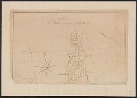
Color: pen and ink drawing with yellow detail., Lower half lacking., and Ms. cadastral map showing lands along Lake Champlain belonging to English soldiers.
Subject: Map of New England and Long Island with the states divided into cities and towns. Cartouche at lower right shows Liberty leading a Native American and pilgrims to Plymouth Rock.
Description:
"Observations on which this map is grounded.", Copy 2: Imperfect: southern sheet wanting., Includes compilation data and insets of "A plan of the town of Boston" and "A plan of the town of Boston Harbor from an accurate sur, and Prime meridian: London and Ferro.
Publisher:
November 29th 1774 Published according to Act by Thos. Jefferys geographer to His Royal Highness the Prince of Wales near Charing Cross,
Subject: Map of New England and Long Island with the states divided into cities and towns. Cartouche at lower right shows Liberty leading a Native American and pilgrims to Plymouth Rock.
Description:
"Observations on which this map is grounded.", Dissected and mounted on linen., Includes compilation data and insets of "A plan of the town of Boston" and "A plan of the town of Boston Harbor from, Prime meridian: London and Ferro., and Relief shown pictorially.
Publisher:
November 29th 1774 Published according to Act by Thos. Jefferys geographer to His Royal Highness the Prince of Wales near Charing Cross,
Subject: Map of New England and Long Island with the states divided into cities and towns. Cartouche at lower right shows Liberty leading a Native American and pilgrims to Plymouth Rock.
Description:
"Observations on which this map is grounded.", Copy 2: Imperfect: southern sheet wanting., Includes compilation data and insets of "A plan of the town of Boston" and "A plan of the town of Boston Harbor from an accurate survey," ca. 1:150,000., and Prime meridia
Publisher:
November 29th 1774 Published according to Act by Thos. Jefferys geographer to His Royal Highness the Prince of Wales near Charing Cross,
Subject: Map of New England and Long Island with the states divided into cities and towns. Cartouche at lower right shows Liberty leading a Native American and pilgrims to Plymouth Rock.
Description:
"Observations on which this map is grounded.", Copy 1: Dissected and mounted on linen., Includes compilation data and insets of "A plan of the town of Boston" and "A plan of the town of Boston Harbor from an accurate survey," ca. 1:150,000., and Prime meridian:
Publisher:
November 29th 1774 Published according to Act by Thos. Jefferys geographer to His Royal Highness the Prince of Wales near Charing Cross,
Color: pen and ink with green and blue color., Drawings of ships some labeled as the rebel ships and galleys., and Inset: A Plan of Fort Mifflin on Mud Island, before its Evacuation by the Rebels the 15th Nov. 1777.
Subject (Geographic):
Pennsylvania--Maps, Manuscript--Early works to 1800