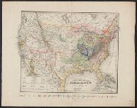
Search
You Searched For
Search Results
- Creator:
- United States. Office of Farm Management
- Published / Created:
- 1915
- Call Number:
- 75gce 1915
- Container / Volume:
- BRBL_00410
- Image Count:
- 1
- Resource Type:
- Maps, Atlases & Globes
- Subject (Geographic):
- United States--Maps
- Subject (Topic):
- Irrigation--United States--Maps
- Found in:
- Beinecke Rare Book and Manuscript Library > Irrigation map of the United States / engraved and printed by the U.S. Geological Survey ; outline of irrigated areas based upon data collected by the Bureau of the Census, 1910 ; revised by Irrigation Division, Office of Experimental Stations, and by the
- Creator:
- Rand McNally and Company
- Published / Created:
- [1882]
- Call Number:
- 75gme 1882B
- Container / Volume:
- BRBL_00413
- Image Count:
- 2
- Resource Type:
- Maps, Atlases & Globes
- Subject (Topic):
- Railroads--United States--Maps
- Found in:
- Beinecke Rare Book and Manuscript Library > A correct map of the United States of America showing the Atchison, Topeka and Santa Fe R.R. and connections.
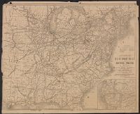
- Creator:
- Thomas, G. F
- Published / Created:
- [1864]
- Call Number:
- 75gme 1864
- Container / Volume:
- BRBL_00412
- Image Count:
- 2
- Resource Type:
- Maps, Atlases & Globes
- Subject (Topic):
- Railroads--United States--Maps
- Found in:
- Beinecke Rare Book and Manuscript Library > Appletons' railway map of the United States and the Canadas : representing railways in actual operation, and those in course of construction, also map of the territories, showing the Pacific Railroad, gold regions, &c. / carefully compiled by G. F. Thomas
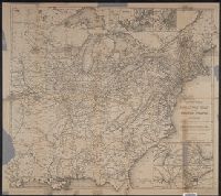
- Creator:
- Thomas, G. F
- Published / Created:
- [1876]
- Call Number:
- 754gme 1876
- Container / Volume:
- BRBL_00420
- Image Count:
- 2
- Resource Type:
- Maps, Atlases & Globes
- Subject (Topic):
- Railroads--United States--Maps
- Found in:
- Beinecke Rare Book and Manuscript Library > Appletons' railway map of the United States and the Canadas : representing railways in actual operation, and those in course of construction, also map of the territories, showing the Pacific Railroad, gold regions, &c. / carefully compiled by G. F. Thomas
- Creator:
- National Highways Association
- Published / Created:
- c1914.
- Call Number:
- 75gmb 1915A
- Container / Volume:
- BRBL_00411
- Image Count:
- 1
- Resource Type:
- Maps, Atlases & Globes
- Subject (Topic):
- Roads--United States--Maps
- Found in:
- Beinecke Rare Book and Manuscript Library > Fifty thousand miles of national highways proposed by the National Highways Association / published under direction of the National Highways Association ; John C. Mulford, cartographer.
- Published / Created:
- 1853
- Call Number:
- 75CA 1853
- Container / Volume:
- BRBL_00407A
- Image Count:
- 1
- Resource Type:
- Maps, Atlases & Globes
- Subject (Topic):
- Geology--United States--Maps
- Found in:
- Beinecke Rare Book and Manuscript Library > Geognostische Karte der Nord-Americanischen Freistaaten.
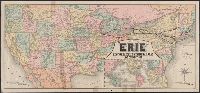
- Creator:
- Rand McNally and Company
- Published / Created:
- 1883
- Call Number:
- 75gme 1883
- Container / Volume:
- BRBL_00413
- Image Count:
- 2
- Resource Type:
- Maps, Atlases & Globes
- Subject (Topic):
- Railroads--United States--Maps
- Found in:
- Beinecke Rare Book and Manuscript Library > Map of the "Erie" : New-York, Lake Erie and Western Rail Road and connections.
- Published / Created:
- 1919
- Call Number:
- 75gmb AL14 1919
- Container / Volume:
- BRBL_00411
- Image Count:
- 1
- Resource Type:
- Maps, Atlases & Globes
- Subject (Topic):
- Roads--United States--Maps
- Found in:
- Beinecke Rare Book and Manuscript Library > Map of the Albert Pike Highway : showing every city, town, village and hamlet throughout its entire length / proposed by the Albert Pike Highway Association.
- Creator:
- Ellet, Charles, 1810-1862
- Published / Created:
- 1851
- Call Number:
- 75gme 1851
- Container / Volume:
- BRBL_00411
- Image Count:
- 1
- Resource Type:
- Maps, Atlases & Globes
- Subject (Topic):
- Railroads--United States--Maps
- Found in:
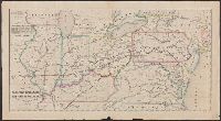
- Beinecke Rare Book and Manuscript Library > Map of the Western Railroads tributary to Philadelphia with their rival lines / prepared under the direction of Charles Ellet Jr., civil engineer ; by W. Williams, map engraver.
- Creator:
- Latrobe, Benj. H. (Benjamin Henry), 1807-1878
- Published / Created:
- 1850?]
- Call Number:
- 75gme 1850B
- Container / Volume:
- BRBL_00411
- Image Count:
- 1
- Resource Type:
- Maps, Atlases & Globes
- Subject (Topic):
- Railroads--United States--Maps
- Found in:
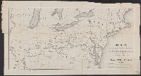
- Beinecke Rare Book and Manuscript Library > Map, exhibiting the railway route between Baltimore & St. Louis, together with the other principal lines in the Eastern, Middle & Western states / prepared under the direction of B.H. Latrobe, Ch. Engr. B. & O.R.R. ; Lith. by A. Hoen & Co.