Search
You Searched For
Search Results
- Creator:
- Vuillemin, A. (Alexandre), 1812-
- Call Number:
- 683 1862
- Container / Volume:
- BRBL_00351
- Image Count:
- 1
- Resource Type:
- Maps, Atlases & Globes
- Description:
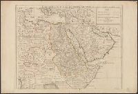
- Map of province of Constantine, Algeria
- Subject (Geographic):
- Constantine (Algeria)--Maps
- Found in:
- Beinecke Rare Book and Manuscript Library > Province de Constantine / Dressé par A. Vuillemin.
- Creator:
- Fries, Lorenz, ca. 1490-1531
- Published / Created:
- 1535?]
- Call Number:
- 67 1535
- Container / Volume:
- BRBL_00348
- Image Count:
- 2
- Resource Type:
- Maps, Atlases & Globes
- Description:
- Covers Morocco and northern Algeria.
- Subject (Geographic):
- Algeria--Maps--Early works to 1800
- Found in:
- Beinecke Rare Book and Manuscript Library > Tabula prima Aphricae continet Mauritaniam Tingitanam & Mauritaniam Caesariensem.
- Creator:
- L'Isle, Guillaume de, 1675-1726
- Published / Created:
- Nov. 1707.
- Call Number:
- 60 1707
- Container / Volume:
- BRBL_00322
- Image Count:
- 1
- Resource Type:
- Maps, Atlases & Globes
- Description:
- Covers Africa east of Algeria and north
- Found in:
- Beinecke Rare Book and Manuscript Library > Carte de l'Egypte, de la Nubie, de l'Abissinie &c. / par Guillaume Delisle de l'Academie R[oya]le des Sciences ; Desrosiers, sculp.
- Creator:
- Weigel, Christoph, 1654-1725
- Published / Created:
- 1720?]
- Call Number:
- 67 1720
- Container / Volume:
- BRBL_00348
- Image Count:
- 1
- Resource Type:
- Maps, Atlases & Globes
- Description:
- Covers Morocco and part of Algeria.
- Subject (Geographic):
- Algeria--Historical geography--Maps
- Found in:
- Beinecke Rare Book and Manuscript Library > Mauretania et Numidia / per Ch. Weigelium Norimb[ergae] cum privilegio S[acra] Caes[areae] Majestatis.
- Published / Created:
- [1740?]
- Call Number:
- 681 1740
- Container / Volume:
- BRBL_00350
- Image Count:
- 1
- Resource Type:
- Maps, Atlases & Globes
- Subject (Geographic):
- Oran (Algeria)--Maps--Early works to
- Found in:
- Beinecke Rare Book and Manuscript Library > Oran munita urbs et commodus port in Ora maritima Barbariae et propie im Regno, Telefin, quam Hispani jam Ao 1509. teńuerunt et postquam Ao 1708, à Mauris occupata fuit Hispani Ao 1732. sibi eam denuo vindicarunt. Cumt Profpectu adjacetium Littorum, jux
- Creator:
- Dezauche, J. A
- Published / Created:
- [between 1816 and 1824]
- Call Number:
- 682 1824
- Container / Volume:
- BRBL_00350
- Image Count:
- 1
- Resource Type:
- Maps, Atlases & Globes
- Subject (Geographic):
- Algiers (Algeria)--Maps
- Subject (Topic):
- Harbors--Algeria--Algiers--Maps
- Found in:
- Beinecke Rare Book and Manuscript Library > Plan d'Alger et des environs [cartographic material] / dressé d'après plusieurs plans manuscrits par J.A. Dezauche ; atelier de A. Desmadryl ; Imorimé par Engelman.
- Published / Created:
- 1840
- Call Number:
- 68 1840
- Container / Volume:
- BRBL_00349
- Image Count:
- 1
- Resource Type:
- Maps, Atlases & Globes
- Subject (Geographic):
- Algeria--Maps
- Found in:
- Beinecke Rare Book and Manuscript Library > Carte du Gouvernt. D'Alger. D'une Partie du Bassin de la Mediterranee. Donnan-t le rapport qui existe Entre la France et les Etats Barbaresques. Para. H. Dufour. Nelle Edition, Par Ch. Piquett en 1840.
- Creator:
- Vuillemin, A. (Alexandre), 1812-
- Published / Created:
- [1868?]
- Call Number:
- 682H 1868
- Container / Volume:
- BRBL_00350
- Image Count:
- 1
- Resource Type:
- Maps, Atlases & Globes
- Subject (Geographic):
- Algeria--Maps
- Found in:
- Beinecke Rare Book and Manuscript Library > Province d'Alger / Dressé par A. Vuillemin.
- Creator:
- Vuillemin, A. (Alexandre), 1812-
- Published / Created:
- [1868?]
- Call Number:
- 682H 1868
- Container / Volume:
- BRBL_00350
- Image Count:
- 1
- Resource Type:
- Maps, Atlases & Globes
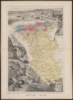
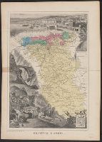
- Description:
- Map of Algeria centered among pictorial
- Subject (Geographic):
- Algeria--Maps
- Found in:
- Beinecke Rare Book and Manuscript Library > Province d'Alger / Dressé par A. Vuillemin.