Search
You Searched For
Search Results
- Creator:
- United States. Office of Naval Intelligence
- Published / Created:
- [191-?]
- Call Number:
- 556 1895
- Container / Volume:
- BRBL_00292
- Image Count:
- 1
- Resource Type:
- Maps, Atlases & Globes
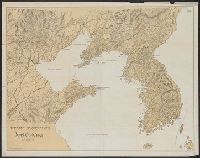
- Description:
- Korea north to the Russian border and south
- Subject (Geographic):
- Korea--Maps
- Found in:
- Beinecke Rare Book and Manuscript Library > Theater of operations, Japan-China War, 1894-5 [cartographic material] / Office of Naval Intelligence, Naval Department, Washington.
- Creator:
- United States. Hydrographic Office
- Published / Created:
- 1894
- Call Number:
- 556cea 1894
- Container / Volume:
- BRBL_00293
- Image Count:
- 1
- Resource Type:
- Maps, Atlases & Globes
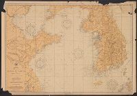
- Alternative Title:
- Asia, China and Korea :
- Subject (Geographic):
- Korea--Maps
- Subject (Topic):
- Nautical charts--Korea
- Found in:
- Beinecke Rare Book and Manuscript Library > The coasts of the Hwang Hai or Yellow Sea and Gulf of Pechili [cartographic material] : compiled from the latest information.
- Published / Created:
- 1943
- Call Number:
- 57 1943
- Container / Volume:
- BRBL_00303
- Image Count:
- 1
- Resource Type:
- Maps, Atlases & Globes
- Description:
- Shows Japan, Korea, and the eastern
- Subject (Geographic):
- Korea--Maps
- Found in:
- Beinecke Rare Book and Manuscript Library > The Japanese empire : with central and southern Manchukuo (Manchuria).
- Published / Created:
- 1943
- Call Number:
- 57 1943
- Container / Volume:
- BRBL_00303
- Image Count:
- 2
- Resource Type:
- Maps, Atlases & Globes
- Description:
- Shows Japan, Korea, and the eastern
- Subject (Geographic):
- Korea--Maps
- Found in:
- Beinecke Rare Book and Manuscript Library > The Japanese empire : with central and southern Manchukuo (Manchuria).
- Published / Created:
- 1904
- Call Number:
- 565 1904
- Container / Volume:
- BRBL_00299
- Image Count:
- 1
- Resource Type:
- Maps, Atlases & Globes
- Alternative Title:
- and Korea
- Found in:
- Beinecke Rare Book and Manuscript Library > The Illustrated London news war-map of the Russo-Japanese operations in Manchuria and Korea / compiled from observations of R.T. Turley F.R.G.S, the latest Admiralty charts & Russian maps 1904.
- Creator:
- United States. War Dept. General Staff
- Published / Created:
- 1906
- Call Number:
- 565 1906
- Container / Volume:
- BRBL_00299
- Image Count:
- 1
- Resource Type:
- Maps, Atlases & Globes
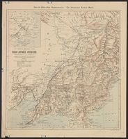
- Description:
- Inset: southern Korea, Korea Strait
- Subject (Geographic):
- Korea--Maps
- Found in:
- Beinecke Rare Book and Manuscript Library > Strategical map of part of Korea and Manchuria / prepared by the Second Division, General Staff (Military Information Division), War Department.
- Creator:
- Soviet Union. Glavnoe upravlenie geodezii i kartografii
Soviet Union. Главное управление геодезии и картографии
- Published / Created:
- 1963
- Call Number:
- 556hc 1904A
- Container / Volume:
- BRBL_00294
- Image Count:
- 2
- Resource Type:
- Maps, Atlases & Globes
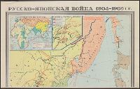
- Description:
- Covers Japan, Korea, the Maritime
- Found in:
- Beinecke Rare Book and Manuscript Library > Russko-i︠a︡ponskai︠a︡ voĭna 1904-1905 gg [cartographic material] / karta sostavlena Nauchno-redakt︠s︡ionnoĭ kartosostavitelʹskoĭ chastʹi︠u︡ GUGK v 1949 g. ; redaktor--Smirnova, N.A. ; tekhnicheskiĭ redaktor--Chekanikhin S.M.
- Creator:
- Rand McNally and Company
- Published / Created:
- c1904.
- Call Number:
- 57hc 1904
- Container / Volume:
- BRBL_00307
- Image Count:
- 2
- Resource Type:
- Maps, Atlases & Globes
- Alternative Title:
- 1904 war map of Japan, Korea, and China
- Found in:
- Beinecke Rare Book and Manuscript Library > Rand, McNally & Co.'s 1904 war map of Japan, Korea, and China ; Rand, McNally & Co.'s 1904 war map of Russia and the continent of Asia.
- Creator:
- Rand McNally and Company
- Published / Created:
- c1904.
- Call Number:
- 56 1904
- Container / Volume:
- BRBL_00296
- Image Count:
- 2
- Resource Type:
- Maps, Atlases & Globes
- Alternative Title:
- 1904 war map of Japan, Korea, and China
- Found in:
- Beinecke Rare Book and Manuscript Library > Rand, McNally & Co.'s 1904 war map of Japan, Korea, and China ; Rand, McNally & Co.'s 1904 war map of Russia and the continent of Asia.
- Creator:
- Rand McNally and Company
- Published / Created:
- c1904.
- Call Number:
- 50 1904
- Container / Volume:
- BRBL_00273
- Image Count:
- 2
- Resource Type:
- Maps, Atlases & Globes
- Alternative Title:
- 1904 war map of Japan, Korea, and China
- Found in:
- Beinecke Rare Book and Manuscript Library > Rand, McNally & Co.'s 1904 war map of Japan, Korea, and China ; Rand, McNally & Co.'s 1904 war map of Russia and the continent of Asia.