Search
You Searched For
Search Results
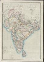
- Creator:
- Wyld, James, 1812-1887
- Published / Created:
- [185-?]
- Call Number:
- 59GM 1855
- Container / Volume:
- BRBL_00318
- Image Count:
- 1
- Resource Type:
- Maps, Atlases & Globes
- Alternative Title:
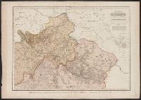
- India :
- Description:
- Includes India and parts of Bangladesh
- Subject (Geographic):
- India--Administrative and political
- Found in:
- Beinecke Rare Book and Manuscript Library > Road, railway & telegraphic map of India : shewing the post roads and dawk stations / by James Wyld, Geographer to the Queen.
- Published / Created:
- [1708?]
- Call Number:
- 27 1708
- Container / Volume:
- BRBL_00023A
- Image Count:
- 1
- Resource Type:
- Maps, Atlases & Globes
- Description:
- , Batavia. Includes: India, Farther India and
- Found in:
- Beinecke Rare Book and Manuscript Library > A map of the East-Indies and the adjacent countries ... by H. Moll, Geog.
- Published / Created:
- [18--]
- Call Number:
- 530 No. 6
- Container / Volume:
- BRBL_00287
- Image Count:
- 1
- Resource Type:
- Maps, Atlases & Globes
- Description:
- Inset: India.
- Found in:
- Beinecke Rare Book and Manuscript Library > [Ancient Near East] Antiquor? Imperiorum ... Macedonicum seu Alexandri Magni Imperium et Expeditiones. [334 B.C.] ... D. Robert de Vaugondy.
- Published / Created:
- 1816
- Call Number:
- 59 1816
- Container / Volume:
- BRBL_00317
- Image Count:
- 6
- Resource Type:
- Maps, Atlases & Globes
- Alternative Title:
- Map of India
- Subject (Geographic):
- India--Maps
- Found in:
- Beinecke Rare Book and Manuscript Library > To the Honble. the court of directors of the East India Company this improved map of India ... / A. Arrowsmith.
- Creator:
- Survey of India.
- Published / Created:
- 1827-1904.
- Call Number:
- Series 59 1827
- Image Count:
- 61
- Resource Type:
- Maps, Atlases & Globes
- Description:
- Geographer to the Secretary of State for India in
- Publisher:
- Survey of India,
- Subject (Geographic):
- India--Maps.
- Found in:
- Beinecke Rare Book and Manuscript Library > [Indian atlas 1:253 440, full sheets] / Survey of India.
- Published / Created:
- 1835
- Call Number:
- 59 1835
- Container / Volume:
- BRBL_00317
- Image Count:
- 1
- Resource Type:
- Maps, Atlases & Globes
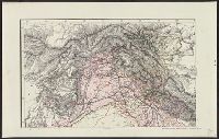
- Description:
- India and Western Tibet.
- Subject (Geographic):
- India--Maps
- Found in:
- Beinecke Rare Book and Manuscript Library > Spezial Karte vom Himalaya in Kumaon, Gurhwal, Sirmur, and c. Berghaus. Gest. V.C.F. Wolff.
- Creator:
- Survey of India
- Published / Created:
- 1885
- Call Number:
- 59gme 1885
- Container / Volume:
- BRBL_00319
- Image Count:
- 6
- Resource Type:
- Maps, Atlases & Globes
- Description:
- paper at the Litho. Office, Survey of India
- Publisher:
- Survey of India,
- Subject (Geographic):
- India--Maps
- Subject (Topic):
- Railroads--India--Maps
- Found in:
- Beinecke Rare Book and Manuscript Library > Railway map of India : corrected up to 1st March, 1885 / published under the direction of Colonel G.C. DePrée, S.C., Officiating Surveyor General of India, Survey of India Offices, Calcutta, March 1885.
- Call Number:
- 1976 1233
- Collection Title:
- Forty-two new maps of Asia, Africa, and America ... : all engrav’d, according to the latest
- Image Count:
- 1
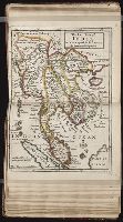
- Alternative Title:
- The east part of India, or India beyond
- Subject (Geographic):
- Ganges River (India and Bangladesh)
- Found in:
- Beinecke Rare Book and Manuscript Library > The east part of India, or India beyond the R. Ganges
- Creator:
- Survey of India
- Published / Created:
- 1904
- Call Number:
- 59gm 1903
- Container / Volume:
- BRBL_00318
- Image Count:
- 6
- Resource Type:
- Maps, Atlases & Globes
- Description:
- India. 1904."
- Publisher:
- Survey of India,
- Subject (Geographic):
- India--Maps
- Found in:
- Beinecke Rare Book and Manuscript Library > Military map of India : Corrected to 1903.
- Creator:
- Survey of India
- Published / Created:
- 1913
- Call Number:
- 592C 1913
- Container / Volume:
- BRBL_00319
- Image Count:
- 1
- Resource Type:
- Maps, Atlases & Globes
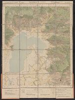
- Description:
- India Offices, Calcutta." in lower right
- Publisher:
- Survey of India,
- Subject (Geographic):
- Punjab (India)--Maps
- Found in:
- Beinecke Rare Book and Manuscript Library > Kashmīr & Jammu : No. 43 J/11 / published under the direction of S.G. Burrard, C.S.I., R.E., F.R.S., Surveyor General of India, 1913.