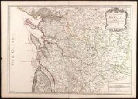
Appeared in Alexis Hubert Jaillot's Atlas, Relief shown by hachures and pictorially., and Watermark.
Publisher:
Chez l'auteur, le Sr. Jaillot, Geographe ordinaire du Roy, avec Privilege de sa Majesté,
Subject (Geographic):
Charente-Maritime (France)--Administrative and political divisions--Maps--Early works to 1800. and Charente-Maritime (France)--Maps--Early works to 1800.
Subject (Name):
Haye, G. de la and Jaillot, Alexis Hubert, 1632?-1712. Atlas françois.
Anville, Jean Baptiste Bourguignon d', 1697-1782, cartographer
Published / Created:
[1767]
Call Number:
50 1767
Container / Volume:
BRBL_00271
Image Count:
1
Resource Type:
Maps, Atlases & Globes
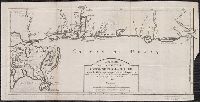
Description:
Cartographer and publication date from dealer's notes., Country labels in French., Inset: Supplement pour l'Asie et l'Afrique., Relief shown pictorially., Shows most of the Middle East, and part of Egypt., Stamp on verso: 27., and Watermark.
Publisher:
[publisher not identified],
Subject (Geographic):
Middle East--Maps--Early works to 1800, Palestine--History--To 70 A.D.--Maps--Early works to 1800, and Palestine--Maps--Early works to 1800
Histoire et description generale de la Nouvelle France
Container / Volume:
BRBL_00731
Image Count:
1
Resource Type:
Maps, Atlases & Globes
Description:
Lower left corner: 34., Prime meridian: Paris., Sheet measures 23 x 46 cm. Franklin Collection., and Watermark.
Publisher:
Pierre-François Giffart],
Subject (Geographic):
Alabama--Maps--Early works to 1800, Florida--Maps--Early works to 1800, Gulf Coast (U.S.)--Maps--Early works to 1800, Louisiana--Maps--Early works to 1800, and Mobile Bay (Ala.)--Maps--Early works to 1800
Subject (Name):
Charlevoix, Pierre-François-Xavier de, 1682-1761 and Giffart, Pierre François, 1677-1758
Subject (Topic):
Coasts--Alabama--Maps--Early works to 1800, Coasts--Florida--Maps--Early works to 1800, and Coasts--Louisiana--Maps--Early works to 1800