Search
You Searched For
Search Results
- Creator:
- Pownall, Thomas, 1722-1805
- Published / Created:
- March 25th, 1776.
- Call Number:
- 71 1776N
- Container / Volume:
- BRBL_00726
- Image Count:
- 4
- Resource Type:
- Maps, Atlases & Globes
- Found in:
- Beinecke Rare Book and Manuscript Library > A map of the middle British colonies in North America [cartographic material] : First published by Lewis Evans, of Philadelphia, in 1755 ; and since corrected and improved, as also extended, with the addition of New England, and bordering parts of Canada
- Creator:
- Pownall, Thomas, 1722-1805
- Published / Created:
- March 25th, 1776.
- Call Number:
- 755 1776P
- Container / Volume:
- BRBL_00430
- Image Count:
- 1
- Resource Type:
- Maps, Atlases & Globes
- Found in:
- Beinecke Rare Book and Manuscript Library > A map of the middle British colonies in North America [cartographic material] : First published by Lewis Evans, of Philadelphia, in 1755 ; and since corrected and improved, as also extended, with the addition of New England, and bordering parts of Canada
- Creator:
- Pownall, Thomas, 1722-1805
- Published / Created:
- March 25th, 1776.
- Call Number:
- 71 1776N
- Container / Volume:
- BRBL_00726
- Image Count:
- 1
- Resource Type:
- Maps, Atlases & Globes
- Found in:
- Beinecke Rare Book and Manuscript Library > A map of the middle British colonies in North America [cartographic material] : First published by Lewis Evans, of Philadelphia, in 1755 ; and since corrected and improved, as also extended, with the addition of New England, and bordering parts of Canada
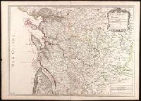
- Creator:
- Jaillot, Alexis Hubert, 1632?-1712
- Published / Created:
- 1722
- Call Number:
- BrSides Double Folio 2019 86
- Image Count:
- 1
- Resource Type:
- Maps, Atlases & Globes
- Found in:
- Beinecke Rare Book and Manuscript Library > Generalité de La Rochelle divisée en cinq elections : sçavoir La Rochelle dans le pays d'Aunis, St. Jean d'Angely, Saintes, Marennes en Saintonge, Cognac en Angoumois : dressée sur les memoires les plus nouveaux / par le Sr. Jaillot ; Delahaye sculpsit.
- Creator:
- Dodsley, Robert, 1703-1764.
- Published / Created:
- [1761]
- Call Number:
- 32 L84 1761
- Image Count:
- 1
- Resource Type:
- Maps, Atlases & Globes
- Found in:
- Beinecke Rare Book and Manuscript Library > A new and correct plan of London, Westminster and Southwark [cartographic material] : with several additional improvements not in any former survey.
- Creator:
- De Witt, Simeon, 1756-1834
- Published / Created:
- [1793?]
- Call Number:
- 771 1793
- Container / Volume:
- BRBL_00477
- Image Count:
- 1
- Resource Type:
- Maps, Atlases & Globes
- Found in:
- Beinecke Rare Book and Manuscript Library > 1st sheet of De Witt's state-map of New-York / C. Tiebout sculp. NYork.
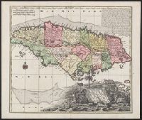
- Creator:
- Seutter, Matthaeus, 1678-1756, cartographer
- Published / Created:
- 1740?]
- Call Number:
- 8555 1740
- Container / Volume:
- BRBL_00642
- Image Count:
- 1
- Resource Type:
- Maps, Atlases & Globes
- Found in:
- Beinecke Rare Book and Manuscript Library > Nova designatio Insulae Jamaicae [cartographic material] : ex Antillanis Americae Septentrion. non postremae / secundum gubernationes suas accuratas aeri incisa et publici juris facta a Matthaeo Seuttero, Sac. Caes. et Reg. Cathol. Maj. Geogr.
- Creator:
- Robert Sayer and John Bennett (Firm)
- Published / Created:
- 1776
- Call Number:
- 755 1776
- Container / Volume:
- BRBL_00430
- Image Count:
- 1
- Resource Type:
- Maps, Atlases & Globes
- Found in:
- Beinecke Rare Book and Manuscript Library > A general map of the middle British colonies, in America [cartographic material] : Containing Virginia, Maryland, the Delaware counties, Pennsylvania and New Jersey. With the addition of New York, and the greatest part of New England, as also of the borde
- Creator:
- Bellin, Jacques Nicolas, 1703-1772, cartographer
- Published / Created:
- 1744
- Call Number:
- 85 1744
- Collection Title:
- Histoire et description generale de la Nouvelle France
- Container / Volume:
- BRBL_00731
- Image Count:
- 1
- Resource Type:
- Maps, Atlases & Globes
- Found in:
- Beinecke Rare Book and Manuscript Library > Partie de la coste de la Louisiane et de la Floride [cartographic material] : depuis le Mississipi jusqua S[t]. Marc d'Apalache / dressée sur les manuscrits du depost des plans de la Marine par N.B. Ing[r] du Roy et de la Marine.
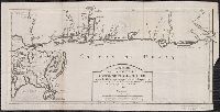
- Published / Created:
- [1754]
- Call Number:
- 755 1754
- Container / Volume:
- BRBL_00728
- Image Count:
- 1
- Resource Type:
- Maps, Atlases & Globes
- Found in:
- Beinecke Rare Book and Manuscript Library > An accurate map of the English colonies in North America, bordering on the river Ohio.