Search
You Searched For
Search Results
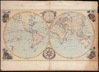
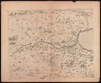
- Creator:
- Bowles, Carington, 1724-1793, cartographer.
- Published / Created:
- May 1780.
- Call Number:
- 11 1780B
- Image Count:
- 1
- Resource Type:
- Maps, Atlases & Globes
- Found in:
- Beinecke Rare Book and Manuscript Library > Bowles's new pocket map of the world : laid down from the latest observations and comprehending the new discoveries to the present time, particularly those lately made in the southern seas, by Byron, Wallis, Cook, Bougainville, and others.
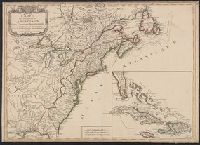
- Creator:
- Imbert, J. Leopold
- Published / Created:
- 1777
- Call Number:
- 755 1777K
- Container / Volume:
- BRBL_00431
- Image Count:
- 1
- Resource Type:
- Maps, Atlases & Globes
- Found in:
- Beinecke Rare Book and Manuscript Library > Carte des possessions angloises dans l'Amérique septentrionale : pour servir d'intelligence à la guerre presente / traduite de l'Anglois par J. Leopold Imbert.
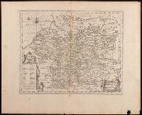
- Creator:
- Delarochette, L. (Louis), 1731-1802, cartographer.
- Call Number:
- 23 1794A
- Image Count:
- 1
- Resource Type:
- Maps, Atlases & Globes
- Found in:
- Beinecke Rare Book and Manuscript Library > Chart of the N.W. coast of America and the N.E. coast of Asia, explored in the years 1778 and 1779 / prepared by Lieut. Heny. Roberts, under the immediate inspection of Capt. Cook ; engraved by W. Palmer, No. 128, Chancery Lane.
- Creator:
- Hondius, Jodocus, 1563-1612, cartographer
- Published / Created:
- [1625]
- Call Number:
- BrSides Box 2019 13
- Image Count:
- 2
- Resource Type:
- Maps, Atlases & Globes
- Found in:
- Beinecke Rare Book and Manuscript Library > China.
- Creator:
- Keere, Pieter van den, 1571-approximately 1646, cartographer.
- Published / Created:
- [between 1652 and 1684]
- Call Number:
- BrSides Double Folio 2019 103
- Image Count:
- 1
- Resource Type:
- Maps, Atlases & Globes
- Found in:
- Beinecke Rare Book and Manuscript Library > Germaniae veteris nova descriptio / Petrus Kaerius celavit.
- Creator:
- Keere, Pieter van den, 1571-approximately 1646
- Published / Created:
- [between 1652 and 1684]
- Call Number:
- 36 1630
- Container / Volume:
- BRBL_00117
- Image Count:
- 1
- Resource Type:
- Maps, Atlases & Globes
- Found in:
- Beinecke Rare Book and Manuscript Library > Germaniae veteris nova descriptio / Petrus Kaerius celavit.
- Creator:
- Hondius, Jodocus, 1563-1612, cartographer.
- Published / Created:
- [1625]
- Call Number:
- BrSides Box 2019 14
- Image Count:
- 2
- Resource Type:
- Maps, Atlases & Globes
- Found in:
- Beinecke Rare Book and Manuscript Library > Iapan I [cartographic material].
- Creator:
- Imperatorskai︠a︡ akademīi︠a︡ nauk (Russia), cartographer, publisher.
- Call Number:
- 23 1773
- Image Count:
- 1
- Resource Type:
- Maps, Atlases & Globes
- Found in:
- Beinecke Rare Book and Manuscript Library > Nouvelle carte des decouvertes faites par les vaisseaux Russiens aux côtes inconnues de l'Amérique Septentrionale avec les pais adiacents / dressée sur des memoires authentiques de ceux qui ont assisté a ces decouvertes et sur d'autres connoissances.
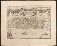
- Creator:
- Adrichem, Christiaan van, 1533-1585, cartographer.
- Published / Created:
- [between 1652 and 1684]
- Call Number:
- BrSides Double Folio 2019 97
- Image Count:
- 1
- Resource Type:
- Maps, Atlases & Globes
- Found in:
- Beinecke Rare Book and Manuscript Library > Situs Terrae Promissionis S.S. Bibliorum / intelligentiam exacte aperiens per Chr. Adrichom ; sculpserunt Everardus Sim. Hamers-veldt et Salomon Rogeri.
- Published / Created:
- [1796?]
- Call Number:
- Auchincloss Gillray v. 4
- Image Count:
- 1
- Found in:
- Beinecke Rare Book and Manuscript Library > The apotheosis of the French General Hoche / translated from the original, printed in The redacteur.
- Creator:
- Jansson, Jan, 1588-1664, cartographer, publisher.
- Published / Created:
- [between 1652 and 1684]
- Call Number:
- BrSides Double Folio 2019 100
- Image Count:
- 1
- Resource Type:
- Maps, Atlases & Globes
- Found in:
- Beinecke Rare Book and Manuscript Library > Tribvs Rvben, et Gad et partes orientales tribuum Beniamin, Ephraim, et dimidiae Manasse intra Iordanem.
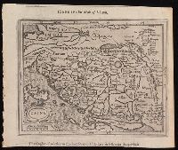
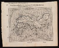
- Creator:
- Gastaldi, Giacomo, approximately 1500-approximately 1565
- Published / Created:
- [1897]
- Call Number:
- 11 1546
- Image Count:
- 1
- Resource Type:
- Maps, Atlases & Globes
- Found in:
- Beinecke Rare Book and Manuscript Library > Vniversale [cartographic material] / [Giacomo Gastaldi].
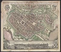
- Creator:
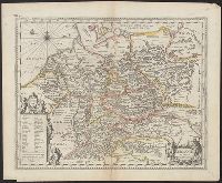
- Seutter, Matthaeus, 1678-1756, cartographer.
- Call Number:
- 36 B754 1740
- Image Count:
- 1
- Resource Type:
- Maps, Atlases & Globes
- Found in:
- Beinecke Rare Book and Manuscript Library > Wratislavia antiquissima et celeberrima Ducat. Silesiaci metropolis ac florentissimum bonarum artium et mercium emporium ad amnem viadrum = Breslau die uhralte u[nd] hochberühmte Haupt Statt des Herzogth. Schlesien auch vortrefflicher aufenthalt der Musen u[nd] florisanter Handels Plaz an dem Oder Strom / verlegts Matth. Seutter in Aug.