Skip to search
Skip to main content
Skip to first result
Search
You Searched For
Genre
Engravings
Genre
Hand coloring
Language
English
New Search
Search Results
Published / Created:
Undated
Call Number:
1976 1233
Collection Title:
Twenty four new and accurate maps of the several parts of Europe ... : all (except the last) new
Image Count:
1
Found in:
Beinecke Rare Book and Manuscript Library > The south part of France containing ye governments of Burgundy, Lyonnois, Guienne, Languedoc, Dauphine and Provence
Call Number:
1976 1233
Collection Title:
Forty-two new maps of Asia, Africa, and America ... : all engrav’d, according to the latest
Image Count:
1
Found in:
Beinecke Rare Book and Manuscript Library > The south west part of Africa containing Congo, Angola, Benguela, Monomotapa, Caffers, Terra de Natal &c
Published / Created:
Undated
Call Number:
1976 1233
Collection Title:
Twenty four new and accurate maps of the several parts of Europe ... : all (except the last) new
Image Count:
1
Found in:
Beinecke Rare Book and Manuscript Library > The south west part of Germany: containing ye dominions of ye archbishops and electors of Mentz & Treves; and of ye elec: Palatine, of ye Rhine: the circles of Franconia & Swabia: Alsace and ye dutchy of Lorrain, ye Weteraw, &c
Creator:
Published / Created:
1788 February 8
Call Number:
1982 Folio 10
Image Count:
1
Found in:
Beinecke Rare Book and Manuscript Library > The southern countries of India from Madrass to Cape Comorin : describing the routes of the armies commanded by Colonels Fullerton and Humberston, during the campaigns of 1782, 1783 & 1784, surveyed by Col. Kelly & Capt. Wersebe and others
Creator:
Published / Created:
1683
Call Number:
1973 Folio 10
Image Count:
1
Resource Type:
Maps, Atlases & Globes
Found in:
Beinecke Rare Book and Manuscript Library > The states of the empire of the Turks in Europe: subdivided according to ye extent of its governments
Creator:
Published / Created:
[1704?]
Call Number:
1973 Folio 10
Image Count:
1
Resource Type:
Maps, Atlases & Globes
Found in:
Beinecke Rare Book and Manuscript Library > The war in Portugall and Spain: with the harbours of the Groyne, Vigo & Bayonna, Porto, Lisbon [and] St. Ubes, Cadiz, and a chart from England to the streights
Call Number:
1976 1233
Collection Title:
Forty-two new maps of Asia, Africa, and America ... : all engrav’d, according to the latest
Image Count:
1
Found in:
Beinecke Rare Book and Manuscript Library > The west part of Barbary containing Fez, Marocco, Algier, and part of Biledulgerid the Canary Islands &c
Call Number:
1976 1233
Collection Title:
Forty-two new maps of Asia, Africa, and America ... : all engrav’d, according to the latest
Image Count:
1
Found in:
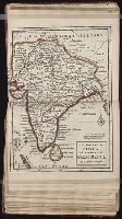
Beinecke Rare Book and Manuscript Library > The west part of India, or the empire of the Great Mogul
Creator:
Published / Created:
1789 January 1
Call Number:
1982 Folio 10
Image Count:
1
Found in:
Beinecke Rare Book and Manuscript Library > The western coast of Africa, from Cape Blanco to Cape Virga, exhibiting Senegambia proper
Creator:
Published / Created:
[ca. 1860?]
Call Number:
Shirley +285
Collection Title:
Funny leaves for the younger branches / by Baron Krakemsides of Burstenoudelafen
Container / Volume:
Copy 2
Image Count:
1
Found in:
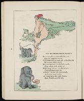
Beinecke Rare Book and Manuscript Library > Tim ponders and resolves
Branch:v1.60.98 ,Deployed:2024-05-22T15:33:12-04:00