Skip to search
Skip to main content
Skip to first result
Search
You Searched For
Date
Unknown
Genre
Engravings
Genre
Maps
Resource Type
Maps, Atlases & Globes
Date Created
[Missing]
New Search
Search Results
Call Number:
1977 +392
Collection Title:
A survey of the cities of London and Westminster : containing the original, antiquity, increase
Image Count:
1
Resource Type:
Maps, Atlases & Globes
Description:
Plate between p. 26-27.
Subject (Geographic):
London (England)--History
Collection Created:
London : Printed for A. Churchill, J. Knapton, R. Knaplock, J. Walthoe [and 6 others], 1720
Found in:
Beinecke Rare Book and Manuscript Library > Cheape Ward with its division into parishes, taken from the last survey, with corrections and additions
Call Number:
Zc86 893sc
Collection Title:
The guide-book to Alaska and the northwest coast, including the shores of Washington, British
Image Count:
1
Resource Type:
Maps, Atlases & Globes
Description:
Between p. 92-93.
Subject (Geographic):
Alaska and Northwest Coast of North America
Collection Created:
London, W. Heinemann, 1893
Found in:
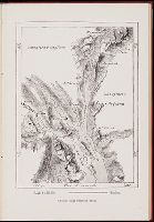
Beinecke Rare Book and Manuscript Library > Chilkat and Chilkoot Bays
Published / Created:
Undated
Call Number:
1973 845
Collection Title:
Navtica mediterranea / di Bartolomeo Crescentio Romano ... Nella quale si mostra la fabrica delle
Image Count:
1
Resource Type:
Maps, Atlases & Globes
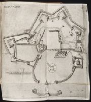
Description:
Includes bar scale labeled "canne"., Map bound in after p. 535., Negative image of the number 537 can be seen just to the right of the printed number 537 as noted above., and Printed in upper right corner: 537.
Subject (Geographic):
Civitavecchia (Italy) --Maps --Early works to 1800
Collection Created:
Roma : Appresso Bartolomeo Bonfadino, 1607
Found in:
Beinecke Rare Book and Manuscript Library > Civita Vecchia
Call Number:
1977 +392
Collection Title:
A survey of the cities of London and Westminster : containing the original, antiquity, increase
Image Count:
1
Resource Type:
Maps, Atlases & Globes
Description:
Plate between p. 52-53.
Subject (Geographic):
London (England)--History
Collection Created:
London : Printed for A. Churchill, J. Knapton, R. Knaplock, J. Walthoe [and 6 others], 1720
Found in:
Beinecke Rare Book and Manuscript Library > Coleman Street Ward and Bashishaw Ward taken from the last survey, with corrections and additions
Call Number:
1977 +392
Collection Title:
A survey of the cities of London and Westminster : containing the original, antiquity, increase
Image Count:
1
Resource Type:
Maps, Atlases & Globes
Description:
Plate between p. 108-109.
Subject (Geographic):
London (England)--History
Collection Created:
London : Printed for A. Churchill, J. Knapton, R. Knaplock, J. Walthoe [and 6 others], 1720
Found in:
Beinecke Rare Book and Manuscript Library > Cornhill Ward with its division into parishes, taken from the last survey &c
Call Number:
1977 +392
Collection Title:
A survey of the cities of London and Westminster : containing the original, antiquity, increase
Image Count:
1
Resource Type:
Maps, Atlases & Globes
Description:
Plate between p. 60-61.
Subject (Geographic):
London (England)--History
Collection Created:
London : Printed for A. Churchill, J. Knapton, R. Knaplock, J. Walthoe [and 6 others], 1720
Found in:
Beinecke Rare Book and Manuscript Library > Cow Cross being St. Sepulcher's parish without and the Charter House taken from the last survey with corrections
Creator:
Call Number:
1973 Folio 103
Collection Title:
De Nieuwe groote lichtende zee-fakkel ...
Image Count:
1
Resource Type:
Maps, Atlases & Globes
Subject (Topic):
Atlases., Islands, and Nautical charts.
Collection Created:
tAmsterdam, Johannes van Keulen, 1753-81
Found in:
Beinecke Rare Book and Manuscript Library > De Oostin-dische zee / Het Eyland Mayota
Creator:
Call Number:
1973 Folio 103
Collection Title:
De Nieuwe groote lichtende zee-fakkel ...
Image Count:
1
Resource Type:
Maps, Atlases & Globes
Subject (Geographic):
Madagascar
Subject (Topic):
Atlases., Islands, and Nautical charts.
Collection Created:
tAmsterdam, Johannes van Keulen, 1753-81
Found in:
Beinecke Rare Book and Manuscript Library > Des rivier legt op de Hoogte von 18 Graaden Zuyder Breedte aan het Land van de Megosie ter Kuste van Quama / Noord kust van't eyland ...
Call Number:
1975 +1
Collection Title:
L'isole piv famose del mondo descritte da Thomaso Porcacchi da Castiglione Arretino e intagliate da
Image Count:
1
Resource Type:
Maps, Atlases & Globes
Subject (Geographic):
Cuba
Subject (Topic):
Geography--Early works to 1800 and Islands
Collection Created:
Venetia, Appresso gli heredi di S. Galignani, 1604
Found in:
Beinecke Rare Book and Manuscript Library > Descrittione dell' isola Cuba
Call Number:
1977 +250
Collection Title:
Geografia; cioe, Descrittione vniversale della terra. Partita in due volumi, nel primo de’ quali si
Image Count:
1
Resource Type:
Maps, Atlases & Globes
Subject (Topic):
Geography, Ancient
Collection Created:
In Venetia, Appresso Gio. Battista & Giorgio Galignani, fratelli, 1597-8 [v.1 1598]
Found in:
Beinecke Rare Book and Manuscript Library > Descrittione dell'America, odell'India Occidentale. America
Branch:v1.61.8 ,Deployed:2024-06-20T11:15:15-04:00