Twenty four new and accurate maps of the several parts of Europe ... : all (except the last) new
Image Count:
1
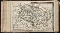
Alternative Title:
Hungary, Transilvania, &c
Description:
In pencil on verso: 23. and Table of contents for maps 20-24 misnumbered.
Subject (Geographic):
Hungary --Maps --Early works to 1800 and Transylvania (Romania) --Maps --Early works to 1800
Subject (Name):
Barker, B. (Benjamin), d. 1764, bookseller, Clements, Henry, d. 1719, bookseller, King, Charles, d. 1735, bookseller, Nicholson, John, d. ca. 1717, bookseller, Parker, Richard, fl. 1692-1725, bookseller, and Tooke, Benjamin, d. 1716, bookseller
Subject (Topic):
Atlases --Early works to 1800
Collection Created:
[London] : Sold by J. Nicholson at the King’s-Arms in Little Britain, Benj. Barker and Charles King ..., Benj. Tooke ..., Hen. Clements ..., R. Parker and Ralph Smith under the Royal-Exchange ..., [1715?]
Dorn, Sebastian Hase, Johann Matthias, 1684-1742 Homann Erben (Firm)
Published / Created:
1744
Call Number:
1983 Folio 23
Collection Title:
[Atlas factice of 50 maps, primarily by Johann Baptist Homann and/or issued by the Homann Erben
Image Count:
1
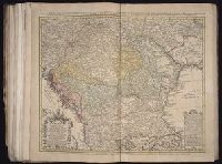
Alternative Title:
Carte d’Hongrie en general, contenant selon la division ancienne & methodique, la Hongrie, en particulier, la Croatie, la Dalmatie, la Bosnie, la Servie, la Boulgarie, la Principaute de Transylvanie, les Despotats de Walachie & de Moldav and Hungariae ampliori significatu et veteris vel methodicae, complexae regna: Hungariae Propriae, Crotiae, Dalmatiae, Bosniae, Serviae, Cumaniae, principatum: Transylvaniae, despotus: Walachiae, Moldaviae (exclusis ab eadem alienatis Galitia et Ludmomiria) in suas provincias ac partes divisae et quoad Imperantes ex Austriacis, Turcis et Venetis distinctae (juncta tamen propter commidatem Romania vel Romelia Turcica) tabula
Publisher:
Curantibus Homannianis Heredibus
Subject (Geographic):
Balkan Peninsula --Maps --Early works to 1800 and Hungary --Maps --Early works to 1800
Dorn, Sebastian Hase, Johann Matthias, 1684-1742 Homann Erben (Firm)
Published / Created:
1744
Call Number:
1973 Folio 30
Collection Title:
[Atlas factice of 32 maps and 1 distance table, produced by the Homann Erben firm]
Image Count:
2
Alternative Title:
Carte d’Hongrie en general, contenant selon la division ancienne & methodique, la Hongrie, en particulier, la Croatie, la Dalmatie, la Bosnie, la Servie, la Boulgarie, la Principaute de Transylvanie, les Despotats de Walachie & de Moldav and Hungariae ampliori significatu et veteris vel methodicae, complexae regna: Hungariae Propriae, Crotiae, Dalmatiae, Bosniae, Serviae, Cumaniae, principatum: Transylvaniae, despotus: Walachiae, Moldaviae (exclusis ab eadem alienatis Galitia et Ludmomiria) in suas provincias ac partes divisae et quoad Imperantes ex Austriacis, Turcis et Venetis distinctae (juncta tamen propter commidatem Romania vel Romelia Turcica) tabula
Publisher:
Curantibus Homannianis Heredibus
Subject (Geographic):
Balkan Peninsula --Maps --Early works to 1800 and Hungary --Maps --Early works to 1800
Homann Erben (Firm) Homann, Johann Baptist, 1663-1724
Published / Created:
[1741?]
Call Number:
1983 Folio 23
Collection Title:
[Atlas factice of 50 maps, primarily by Johann Baptist Homann and/or issued by the Homann Erben
Image Count:
1
Alternative Title:
Allemagne distingue?e en ses cercles & subdivise?e en ses e?tats, contenant son e?tendue pre?sente rectifie?e & me?thodiquement enlumine?e suivant les e?le?ments de ge?ographie de Mr. Schatz a 1741 avec privilege imperial and Imperii Romano Germanici in suos status et circulos divisi tabula generalis
Publisher:
[Homann Erben?]
Subject (Geographic):
Austria --Maps --Early works to 1800, Czechoslovakia --Maps --Early works to 1800, Germany --Maps --Early works to 1800, Hungary --Maps --Early works to 1800, and Poland --Maps --Early works to 1800
Homann Erben (Firm) Homann, Johann Baptist, 1663-1724
Published / Created:
[1746?]
Call Number:
1973 Folio 30
Collection Title:
[Atlas factice of 32 maps and 1 distance table, produced by the Homann Erben firm]
Image Count:
2
Alternative Title:
Allemagne distinguee en ses cercles & subdivisee en ses etats, contenant son etendue presente rectifiee & methodiquement enluminee suivant les elements de geographie de Mr. Schatz and Imperii Romano Germanici in suos status et circulos divisi tabula generalis
Publisher:
[Homann Erben?]
Subject (Geographic):
Austria --Maps --Early works to 1800, Czechoslovakia --Maps --Early works to 1800, Germany --Maps --Early works to 1800, Hungary --Maps --Early works to 1800, and Poland --Maps --Early works to 1800
Homann Erben (Firm) Homann, Johann Baptist, 1663-1724
Published / Created:
ca. 1741
Call Number:
1975 Folio 31
Collection Title:
[Atlas factice of 42 maps, produced by the Homann Erben firm]
Image Count:
2
Alternative Title:
Allemagne distinguee en ses cercles & subdivisee en ses etats, contenant son etendue presente rectifiee & methodiquement enluminee suivant les elements de geographie de Mr. Schatz a 1741 avec privilege imperial and Imperii Romano Germanici in suos status et circulos divisi tabula generalis
Publisher:
Homann Erben?
Subject (Geographic):
Austria --Maps --Early works to 1800, Czechoslovakia --Maps --Early works to 1800, Germany --Maps --Early works to 1800, Hungary --Maps --Early works to 1800, and Poland --Maps --Early works to 1800
Kingdom of Hungary and the states that have been subject and depended on that crown viz Transilvania, Moldavia, Valachia, Croacia, Bosnia, Dalmatia, Servia, Bulgaria ... described by Sanson, corrected and amended by William Berry
Description:
Bar scales in Italian miles, common leagues of France, common leagues or great leagues of Poland, leagues of Hungary, and leagues that are of one hours travelling., Dedicated To the most serene and most sacred majesty Charles II ... by William Berry., Ferro meridian., No. 25 of 69 maps bound together in composite atlas., Relief shown pictorially., Scale [ca. 1:2 100 000]., and Shows Hungary, Bulgaria, Romania and the northern part of the Balkan Peninsula.
Publisher:
Sold by William Berry at the sign of the Globe, between Charing-Cross, and White-Hall
Subject (Geographic):
Balkan Peninsula --Maps --Early works to 1800, Hungary --Maps --Early works to 1800, and Romania --Maps --Early works to 1800