Skip to search
Skip to main content
Skip to first result
Search
You Searched For
"Africa--Maps--Early works to 1800"
Genre
Engravings
Language
English
New Search
Search Results
Creator:
Published / Created:
1789 January 1
Call Number:
1982 Folio 10
Image Count:
1
Subject (Geographic):
Africa , West --Maps --Early works to
Subject (Topic):
Coasts --Africa , West --Maps --Early
Found in:
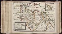
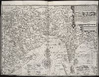
Beinecke Rare Book and Manuscript Library > The western coast of Africa, from Cape Blanco to Cape Virga, exhibiting Senegambia proper
Creator:
Published / Created:
1680
Call Number:
1973 Folio 10
Image Count:
1
Resource Type:
Maps, Atlases & Globes
Subject (Geographic):
Africa --Maps --Early works to 1800
Found in:
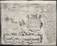
Beinecke Rare Book and Manuscript Library > Africa : divided according to the extent of its principall parts in which are distinguished one from the other the empires, monarchies, kingdoms, states and peoples, which at this time inhabite Africa
Call Number:
1976 1233
Collection Title:
Forty-two new maps of Asia, Africa, and America ... : all engrav’d, according to the latest
Image Count:
1
Subject (Geographic):
Africa --Maps --Early works to 1800
Found in:
Beinecke Rare Book and Manuscript Library > Africa, according to ye newest and most exact observations
Call Number:
1976 1233
Collection Title:
Forty-two new maps of Asia, Africa, and America ... : all engrav’d, according to the latest
Image Count:
1
Subject (Geographic):
Africa --Maps --Early works to 1800
Found in:
Beinecke Rare Book and Manuscript Library > A map of Zaara or the Desart, Negroland & Cape Virde Islands &c
Call Number:
1976 1233
Collection Title:
Forty-two new maps of Asia, Africa, and America ... : all engrav’d, according to the latest
Image Count:
1
Subject (Geographic):
Africa --Maps --Early works to 1800
Found in:
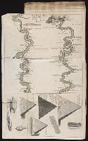
Beinecke Rare Book and Manuscript Library > An exact map of the River Nile done by Mr. Lucas
Creator:
Published / Created:
1782 March 20
Call Number:
1982 Folio 10
Image Count:
1
Subject (Geographic):
--Early works to 1800
Found in:
Beinecke Rare Book and Manuscript Library > The Dutch colony of the Cape of Good Hope
Creator:
Published / Created:
[1596?]
Call Number:
Taylor 216A
Collection Title:
John Huighen van Linschoten, his Discours of Voyages into ye Easte & West Indies
Image Count:
1
Subject (Geographic):
Africa --Maps --Early works to 1800
Found in:
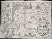
Beinecke Rare Book and Manuscript Library > Typus orarum maritimarum Guinae, Manicongo & Angolae ultra promontorium Bonae Spei ...
Creator:
Published / Created:
1787 January 6
Call Number:
1982 Folio 10
Image Count:
2
Subject (Geographic):
Africa --Maps --Early works to 1800
Found in:
Beinecke Rare Book and Manuscript Library > Africa : with all its states, kingdoms, republics, regions, islands, & ca., improved and inlarged from D'Anville's map : to which have been added a particular chart of the Gold Coast wherein are distinguished all the European forts and factories
Call Number:
1976 1233
Collection Title:
Forty-two new maps of Asia, Africa, and America ... : all engrav’d, according to the latest
Image Count:
1
Subject (Geographic):
Africa --Maps --Early works to 1800
Found in:
Beinecke Rare Book and Manuscript Library > The west part of Barbary containing Fez, Marocco, Algier, and part of Biledulgerid the Canary Islands &c
Creator:
Published / Created:
1598
Call Number:
Taylor 216A
Collection Title:
John Huighen van Linschoten, his Discours of Voyages into ye Easte & West Indies
Image Count:
1
Subject (Geographic):
Africa --Maps --Early works to 1800
Found in:
Beinecke Rare Book and Manuscript Library > Delineatio orarum maritimarum, terrae vulgo indigitatae terra do Natal item Sofalae, Mozambicae & Melindae, insulaeq[ue] sancti Laurentij ...
Call Number:
1976 1233
Collection Title:
Forty-two new maps of Asia, Africa, and America ... : all engrav’d, according to the latest
Image Count:
1
Subject (Geographic):
Africa --Maps --Early works to 1800
Found in:
Beinecke Rare Book and Manuscript Library > The east part of Barbary containing Tunis, Tripoli, Barca, Egypt, Nubia, part of Biledulgerid and Zaara or desart
Creator:
Published / Created:
Undated
Call Number:
Taylor 216A
Collection Title:
Iohn Huighen van Linschoten, his Discours of Voyages into ye Easte & West Indies : deuided into
Image Count:
1
Subject (Geographic):
Africa --Maps --Early works to 1800
Found in:
Beinecke Rare Book and Manuscript Library > [Map of southern Africa and Madagascar]
Creator:
Published / Created:
1780 June 28
Call Number:
1982 Folio 10
Image Count:
1
Subject (Topic):
Coasts --Africa , North --Maps --Early
Found in:
Beinecke Rare Book and Manuscript Library > A chart of the coasts of Spain and Portugal, with the Balearic Islands, and part of the coast of Barbary
Call Number:
1974 Folio 72
Collection Title:
The English pilot: describing the West-India navigation, from Hudson's-Bay to the river Amazones
Image Count:
1
Subject (Geographic):
Africa --Maps --Early works to 1800
Found in:
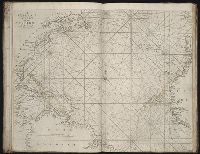
Beinecke Rare Book and Manuscript Library > A new and correct chart of the western and southern oceans
Call Number:
1973 Folio 116
Collection Title:
The English pilot: describing the West-India navigation, from Hudson's-Bay to the river Amazones
Image Count:
2
Subject (Geographic):
Africa --Maps --Early works to 1800
Found in:
Beinecke Rare Book and Manuscript Library > A new and correct chart of the western and southern oceans
Call Number:
1973 Folio 114
Collection Title:
The English pilot: describing the West-India navigation, from Hudson's-Bay to the river Amazones
Image Count:
1
Resource Type:
Maps, Atlases & Globes
Subject (Geographic):
Africa --Maps --Early works to 1800
Found in:
Beinecke Rare Book and Manuscript Library > A new and correct chart of the western and southern oceans ...
Creator:
Call Number:
1978 Folio 10
Collection Title:
The English pilot: describing the West-India navigation, from Hudson's-Bay to the river Amazones
Image Count:
1
Subject (Geographic):
Africa --Maps --Early works to 1800
Found in:
Beinecke Rare Book and Manuscript Library > A new and correct chart shewing the variations of the compass in the western & southern oceans
Creator:
Published / Created:
1787 January 1
Call Number:
1982 Folio 10
Image Count:
2
Subject (Geographic):
Africa , North --Maps --Early works to
Found in:
Beinecke Rare Book and Manuscript Library > Europe divided into its empires, kingdoms, states, republics, & ca
Creator:
Published / Created:
[ca. 1689?]
Call Number:
1973 Folio 10
Image Count:
1
Resource Type:
Maps, Atlases & Globes
Subject (Geographic):
Africa , North --Maps --Early works to
Found in:
Beinecke Rare Book and Manuscript Library > The empire of the great Turke [sic] in Europe, Asia, [and] Africa : divided into all its Beglerbeglicz or governments in which are also distinguished the states that are tributary to him
Call Number:
1974 Folio 72
Collection Title:
The English pilot: describing the West-India navigation, from Hudson's-Bay to the river Amazones
Image Count:
1
Subject (Geographic):
Africa --Maps --Early works to 1800
Found in:
Beinecke Rare Book and Manuscript Library > A new generall chart for the West Indies
Call Number:
1978 Folio 10
Collection Title:
The English pilot: describing the West-India navigation, from Hudson's-Bay to the river Amazones
Image Count:
1
Subject (Geographic):
Africa --Maps --Early works to 1800
Found in:
Beinecke Rare Book and Manuscript Library > A new generall chart for the West Indies
Call Number:
1973 Folio 116
Collection Title:
The English pilot: describing the West-India navigation, from Hudson's-Bay to the river Amazones
Image Count:
1
Subject (Geographic):
Africa --Maps --Early works to 1800
Found in:
Beinecke Rare Book and Manuscript Library > A new generall chart for the West Indies
Call Number:
1973 Folio 114
Collection Title:
The English pilot: describing the West-India navigation, from Hudson's-Bay to the river Amazones
Image Count:
2
Resource Type:
Maps, Atlases & Globes
Subject (Geographic):
Africa --Maps --Early works to 1800
Found in:
Beinecke Rare Book and Manuscript Library > A new generall chart for the West Indies
Creator:
Published / Created:
[1596]
Call Number:
Taylor 216A
Collection Title:
John Huighen van Linschoten, his Discours of Voyages into ye Easte & West Indies
Image Count:
1
Subject (Geographic):
Africa --Maps --Early works to 1800
Found in:
Beinecke Rare Book and Manuscript Library > Deliniatur in hac tabula, Orae maritimae Abexiae, freti Mecani al Maris Rubri Arabiae ...
Creator:
Call Number:
1973 Folio 76
Collection Title:
The English pilot: describing the sea-coasts, capes, head-lands, rivers, bays, roads, havens
Image Count:
1
Subject (Geographic):
Africa --Maps --Early works to 1800
Found in:
Beinecke Rare Book and Manuscript Library > A generall chart of the West Indies
Call Number:
1974 Folio 72
Collection Title:
The English pilot: describing the West-India navigation, from Hudson's-Bay to the river Amazones
Image Count:
2
Subject (Geographic):
Africa , West --Maps --Early works to
Found in:
Beinecke Rare Book and Manuscript Library > A generall chart of the western ocean
Call Number:
1973 Folio 116
Collection Title:
The English pilot: describing the West-India navigation, from Hudson's-Bay to the river Amazones
Image Count:
1
Subject (Geographic):
Africa , West --Maps --Early works to
Found in:
Beinecke Rare Book and Manuscript Library > A general chart of the western ocean
Call Number:
1973 Folio 114
Collection Title:
The English pilot: describing the West-India navigation, from Hudson's-Bay to the river Amazones
Image Count:
1
Resource Type:
Maps, Atlases & Globes
Subject (Geographic):
Africa , West --Maps --Early works to
Found in:
Beinecke Rare Book and Manuscript Library > A general chart of the western ocean
Call Number:
1978 Folio 10
Collection Title:
The English pilot: describing the West-India navigation, from Hudson's-Bay to the river Amazones
Image Count:
1
Subject (Geographic):
Africa , West --Maps --Early works to
Found in:
Beinecke Rare Book and Manuscript Library > A generall chart of the western ocean
Branch:v1.60.98 ,Deployed:2024-04-24T10:14:35-04:00