Search
You Searched For
Search Results
- Creator:
- Berry, William, fl. 1669-1708, creator
Sanson, Nicolas, 1600-1667
- Published / Created:
- 1680
- Call Number:
- 1973 Folio 10
- Image Count:
- 1
- Resource Type:
- Maps, Atlases & Globes
- Subject (Geographic):
- Africa --Maps --Early works to 1800
- Found in:
- Beinecke Rare Book and Manuscript Library > Africa : divided according to the extent of its principall parts in which are distinguished one from the other the empires, monarchies, kingdoms, states and peoples, which at this time inhabite Africa
- Creator:
- Blaeu, Joan, 1596-1673, creator
- Published / Created:
- [ca. 1690]
- Call Number:
- 1973 Folio 10
- Image Count:
- 1
- Resource Type:
- Maps, Atlases & Globes
- Subject (Geographic):
- Africa, Central --Maps --Early works to
- Found in:
- Beinecke Rare Book and Manuscript Library > Aethiopia inferior vel exterior: partes magis Septentrionales, quae hic desiderantur, vide in tabula Aethiopiae superioris
- Creator:
- Blaeu, Joan, 1596-1673, creator
- Published / Created:
- [ca. 1690?]
- Call Number:
- 1973 Folio 10
- Image Count:
- 1
- Resource Type:
- Maps, Atlases & Globes
- Subject (Geographic):
- Africa, Central --Maps --Early works to
- Found in:
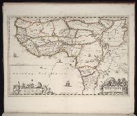
- Beinecke Rare Book and Manuscript Library > Aethiopia superior vel interior, vulgo Abissinorum sive Presbiteri Ioannis imperium
- Creator:
- Blaeu, Joan, 1596-1673, creator
- Published / Created:
- [ca. 1670]
- Call Number:
- 1973 Folio 10
- Image Count:
- 1
- Resource Type:
- Maps, Atlases & Globes
- Subject (Geographic):
- Africa, North --Maps --Early works to
- Found in:
- Beinecke Rare Book and Manuscript Library > Barbaria
- Creator:
- Blaeu, Joan, 1596-1673, creator
- Published / Created:
- [1662?]
- Call Number:
- 1973 Folio 10
- Image Count:
- 1
- Resource Type:
- Maps, Atlases & Globes
- Subject (Geographic):
- Africa, West --Maps --Early works to
- Found in:
- Beinecke Rare Book and Manuscript Library > Nigritarum regio
- Call Number:
- 1973 Folio 114
- Collection Title:
- The English pilot: describing the West-India navigation, from Hudson's-Bay to the river Amazones
- Image Count:
- 1
- Resource Type:
- Maps, Atlases & Globes
- Subject (Geographic):
- Africa --Maps --Early works to 1800
- Found in:
- Beinecke Rare Book and Manuscript Library > A new and correct chart of the western and southern oceans ...
- Creator:
- Berry, William, fl. 1669-1708, creator
Sanson, Nicolas, 1600-1667
- Published / Created:
- [ca. 1689?]
- Call Number:
- 1973 Folio 10
- Image Count:
- 1
- Resource Type:
- Maps, Atlases & Globes
- Subject (Geographic):
- Africa, North --Maps --Early works to
- Found in:
- Beinecke Rare Book and Manuscript Library > The empire of the great Turke [sic] in Europe, Asia, [and] Africa : divided into all its Beglerbeglicz or governments in which are also distinguished the states that are tributary to him
- Call Number:
- 1973 Folio 114
- Collection Title:
- The English pilot: describing the West-India navigation, from Hudson's-Bay to the river Amazones
- Image Count:
- 2
- Resource Type:
- Maps, Atlases & Globes
- Subject (Geographic):
- Africa --Maps --Early works to 1800
- Found in:
- Beinecke Rare Book and Manuscript Library > A new generall chart for the West Indies
- Call Number:
- 1973 Folio 114
- Collection Title:
- The English pilot: describing the West-India navigation, from Hudson's-Bay to the river Amazones
- Image Count:
- 1
- Resource Type:
- Maps, Atlases & Globes
- Subject (Geographic):
- Africa, West --Maps --Early works to
- Found in:
- Beinecke Rare Book and Manuscript Library > A general chart of the western ocean