
Search


Limit your search
- Public159
- cartographic159
- Engravings✖[remove]159
- Maps159
- Maps in books159
- Marginalia12
- Autographs2
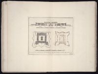
- Architectural drawings1
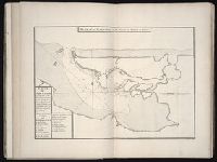
- Pilot guides --Caribbean Area --Early works to 1800✖[remove]159
- Navigation --Early works to 1800132
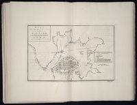
- Pilot guides --Atlantic Coast (U.S.) --Early works to 1800132
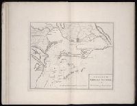
- Harbors --Atlantic Coast (North America) --Maps --Early works to 180027
- Nautical charts --Atlantic Coast (North America) --Early works to 180027
- Nautical charts --Caribbean Area --Early works to 180027
- Nautical charts --West Indies --Early works to 180027
- Pilot guides --Atlantic Coast (North America) --Early works to 180027
- Pilot guides --West Indies --Early works to 180027