Search
You Searched For
Search Results
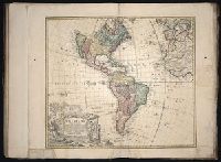
- Creator:
- Cóvens et Mortier
- Published / Created:
- ca. 1730-ca. 1800]
- Call Number:
- 1973 Folio 71
- Image Count:
- 1
- Resource Type:
- Maps, Atlases & Globes
- Found in:
- Beinecke Rare Book and Manuscript Library > [Atlas nouveau contenant toutes les parties du monde ou sont exactement marqués les empires, monarchies, royaumes, états, republiques &c. Le tout recueilli par les meilleurs geógraphes.]
- Creator:
- Moll, Herman, d. 1732
- Published / Created:
- [178-?]
- Call Number:
- 1973 Folio 113
- Image Count:
- 2
- Resource Type:
- Maps, Atlases & Globes
- Found in:
- Beinecke Rare Book and Manuscript Library > Atlas minor: or A new and curious set of sixty two maps, in which are shewn all the empires, kingdoms, countries, states in all the known parts of the earth ... by Herman Moll ...
- Creator:
- Chauveau, François, 1613-1676
Jaillot, Alexis Hubert, 1632?-1712. Atlas nouveau
Sanson, Guillaume
- Published / Created:
- 1673
- Call Number:
- 1973 Folio 57
- Collection Title:
- Composite atlas of 41 maps from Alexis Hubert Jaillot's Atlas nouveau.
- Image Count:
- 1
- Found in:
- Beinecke Rare Book and Manuscript Library > Provinces-Unies des Pays-Bas : auec leurs acquisitions dans La Flandre, Le Brabant, Le Limbourg, et Le Lyege, et les places queílles possedoient sur le Rhein, dans le Ducheí de Cleves, et dans l'Archevescheí et Eslectorat de Cologne / par le Sr. Sanson
- Creator:
- Moll, Herman, d. 1732
- Published / Created:
- 17--]
- Call Number:
- 1978 47
- Collection Title:
- Atlas minor.
- Image Count:
- 1
- Found in:
- Beinecke Rare Book and Manuscript Library > The Island of St. Christophers By Her. Moll Geographer
- Creator:
- Hole, William, d. 1624, engraver
- Published / Created:
- [ca. 1606]
- Call Number:
- Taylor 301
- Collection Title:
- The generall historie of Virginia, New-England, and the Summer Iles : with the names of the
- Image Count:
- 1
- Found in:
- Beinecke Rare Book and Manuscript Library > Virginia
- Published / Created:
- 1783
- Call Number:
- Cb21 35B
- Collection Title:
- History of the war with America, France, Spain, and Holland; commencing in 1775 and ending in 1783
- Image Count:
- 1
- Found in:
- Beinecke Rare Book and Manuscript Library > A Map of the United States of America, as settled by the peace of 1783
- Creator:
- Tanner, Henry Schenck, 1786-1858
- Published / Created:
- 1822
- Call Number:
- 2003 Folio 81
- Collection Title:
- The New American Atlas ...
- Container / Volume:
- No. IV [4]
- Image Count:
- 1
- Found in:
- Beinecke Rare Book and Manuscript Library > A Map of North America, Constructed According to the Latest Information by H. S. Tanner
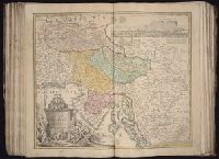
- Creator:
- Boehme, August Gottlieb, 1719-1797
Hase, Johann Matthias, 1684-1742
Homann Erben (Firm)
- Published / Created:
- MDCCXXXXVI [i.e., 1759]
- Call Number:
- 1983 Folio 23
- Collection Title:
- [Atlas factice of 50 maps, primarily by Johann Baptist Homann and/or issued by the Homann Erben
- Image Count:
- 1
- Found in:
- Beinecke Rare Book and Manuscript Library > Americae mappa generalis : secundum legitimas projectionis stereographicae regulas, relationesque recentissimas et observationes sociorum Acad. reg. sc. quae Parisiis est aliorumque auctorum nec non secundum mentem D.I.M. Hasii ; M.P.P. in partes suas met
- Creator:
- Homann, Johann Baptist, 1663-1724
- Published / Created:
- [ca. 1715]
- Call Number:
- 1983 Folio 23
- Collection Title:
- [Atlas factice of 50 maps, primarily by Johann Baptist Homann and/or issued by the Homann Erben
- Image Count:
- 1
- Found in:
- Beinecke Rare Book and Manuscript Library > Tabula Ducatus Carnioliae, vindorum Marchiae et Histriae et mente Mustr. quondam J.B. Valvasorii / concinnatia et exhibita a Io. Bapt. Homanno, S.C.M. Geogr
- Creator:
- Guessefeld, F. L. (Franz Ludwig), 1744-1807
Homann Erben (Firm)
- Published / Created:
- 1775
- Call Number:
- 1983 Folio 23
- Collection Title:
- [Atlas factice of 50 maps, primarily by Johann Baptist Homann and/or issued by the Homann Erben
- Image Count:
- 1
- Found in:
- Beinecke Rare Book and Manuscript Library > Lubomeriae et Galliciae regni tabula geographica / [cartographic material] / F.I.G