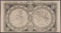
[Atlas factice of 42 maps, produced by the Homann Erben firm]
Image Count:
1
Resource Type:
Maps, Atlases & Globes
Alternative Title:
Belgium Catholicum seu decem provinciae Germaniae inferioris and Carte des Pais Bas catholiques ou des X provinces de l’Allegmagne inferieure, etc. dessinee au juste selon les exactes observations astronomiques et operations geometriques des Messur. Cassini, Snellius, Muschenbrok, etc. dressee par Sr. Tobias Maier, mathematicien; aux depens des Heritiers de Homann
Publisher:
Edentibus Homannianis heredib
Subject (Geographic):
Belgium --Maps --Early works to 1800 and Luxembourg --Maps --Early works to 1800
Bar scales given in mill. Germanica sive geometrica 15 in uno gradu and milliaria Gallica magna sive horae itineris., No. 14 of 69 maps bound together in composite atlas., Relief shown pictorially., and Scale [ca. 1:680 000].
Bar scales given in mille pas geometriques, ou milles d'Italie, lieues communes de France, lieues d'une heure de Chemin, lieues communes d'Allemagne, and lieues communes de Suisse., Includes 33 coats of arms., No. 15 of 69 maps bound together in composite atlas., Relief shown pictorially., and Scale [ca. 1:585 000].
Publisher:
Chez H. Iaillot
Subject (Geographic):
Switzerland --Administrative and political divisions --Maps --Early works to 1800 and Switzerland --Maps --Early works to 1800
Cercle de Franconie, ou sont les eveches De Wurtzburg, de Bamberg, et d'Aichstet, les estats du grand Maistre des Chevaliers Teutons, les Marquisats de Cullembach, et d'Ohnspach, les Comtes d'Henneberg, d'Holach, de Reineck, de Wertheim, d'erpach, de Schwartzenberg, et de Castel, les Baronies de Limpurg, et de Sensheim, et les villes imperiales de Nurenberg, de Rotenburg, de Schweinfurt, Windsheim, et de Weissenburg
Description:
Bar scales in Italian miles, common leagues of Germany, great leagues of Germany, common leagues of France, great leagues of France, and leagues of one hours traveling., Dresse sur les Memoires les plus Nouveaux par le Sr. Sanson., Ferro meridian., No. 30 of 69 maps bound together in composite atlas., Relief shown pictorially., and Scale [ca. 1:510 000].
A re-issue by Jaillot of Jaugeon's 1688 map--Cf. Shirley, R. Mapping of the world, no. 538., Bernard Jaillot was the son of map maker Alexis Hubert Jaillot., Cross collection no. 21., and Relief shown pictorially.
All volumes bound to match 1973 Folio 72. Factitious collection of about 549 maps taken from the atlases of the 17th and the beginning of the 18th cent., put together with the title "Atlas" and bound in 6 volumes. These volumes originally bore the imprint: Amstelaedamii apvd Reiniervm & Josvam Ottens. Over these words on the title-pages of v. 1-2, 4-6 is the name of Henrik de Leth who painted them. Volume 3 has only the erased imprint of Ottens., For fuller description see Phillips 3448 and C. Koeman's Atlantes Neerlandici, bibliography of terrestrial, maritime and celestial atlases and pilot books, published in the Netherlands up to 1800, Amsterdam c1967-71, v. 2, p. 63-83., and Maps by P. Schenck and son, G. Valck, F. de Wit, N. Visscher and others.
Publisher:
chez J. Covens & C. Mortier,
Subject (Geographic):
Denmark --Maps --Early works to 1800
Subject (Name):
Reiner et Josua Ottens (Firm), Schenk, Peter, 1660-1718 or 1719., and Valck, G. (Gerard), 1651 or 1652-1726.