Search
You Searched For
Search Results
- Creator:
- Berry, William, fl. 1669-1708, creator
Sanson, Nicolas, 1600-1667
- Published / Created:
- 1682
- Call Number:
- 1973 Folio 10
- Image Count:
- 1
- Resource Type:
- Maps, Atlases & Globes
- Found in:
- Beinecke Rare Book and Manuscript Library > Italy: distinguished according to the extent of all the states, kingdoms, republicks, dukedoms, principalities etc. that doe at present divide it
- Creator:
- Cordier, Louis, d. 1711, engraver
Jaillot, Alexis Hubert, 1632?-1712, creator
Sanson, Guillaume
- Published / Created:
- [ca. 1692]
- Call Number:
- 1973 Folio 10
- Image Count:
- 1
- Resource Type:
- Maps, Atlases & Globes
- Found in:
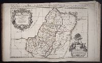
- Beinecke Rare Book and Manuscript Library > Iudea seu Terra Sancta quae Hebraeorum sive Israelitarum in suas duodecim tribus divisa : secretis ab invicem regnis Iuda et Israel expressis in super sex ultimi temporis ejusdem terrae provincijs
- Creator:
- Jaillot, Alexis Hubert, 1632?-1712
Sanson, Nicolas, 1600-1667, creator
- Published / Created:
- 1693
- Call Number:
- 1973 Folio 10
- Image Count:
- 1
- Resource Type:
- Maps, Atlases & Globes
- Found in:
- Beinecke Rare Book and Manuscript Library > La Suisse divisee en ses treze cantons, ses alliez [et] ses sujets
- Creator:
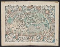
- Münster, Sebastian, 1489-1552
Münster, Sebastian, 1489-1552. Cosmographei
Ptolemy, fl. 2nd cent
- Published / Created:
- 1552?]
- Call Number:
- 13 1552
- Container / Volume:
- BRBL_00011
- Image Count:
- 2
- Resource Type:
- Maps, Atlases & Globes
- Found in:
- Beinecke Rare Book and Manuscript Library > La seconde table generale selon Ptol[omée].
- Creator:
- Jaillot, Alexis Hubert, 1632?-1712
Sanson, Nicolas, 1600-1667, creator
- Published / Created:
- 1696
- Call Number:
- 1973 Folio 10
- Image Count:
- 1
- Resource Type:
- Maps, Atlases & Globes
- Found in:
- Beinecke Rare Book and Manuscript Library > Le cercle de Franconie : subdivise en tous les estats qui le composent
- Creator:
- Friesen, F
- Published / Created:
- 1808
- Call Number:
- Folio Q115 H84 1B
- Collection Title:
- Atlas geographique et physique des regions equinoxiales du nouveau continent, fonde sur des
- Image Count:
- 1
- Resource Type:
- Maps, Atlases & Globes
- Found in:
- Beinecke Rare Book and Manuscript Library > Limite inferieure des Neiges perpetuelles a differentes Latitudes
- Creator:
- Wit, Frederik de., creator
Witsen, Nicolaas, 1641-1717
- Published / Created:
- [1700?]
- Call Number:
- 1973 Folio 10
- Image Count:
- 1
- Resource Type:
- Maps, Atlases & Globes
- Found in:
- Beinecke Rare Book and Manuscript Library > Magnae Tartariae : magni Mogolis imperii, Iaponiae et Chinae : nova descriptio ex tabula ampliss viri D.N. Witsen pro majori parte aliis auctoribus excerpta et dita
- Creator:
- Wyld, James, 1812-1887
- Published / Created:
- [1845?]
- Call Number:
- 1977 Folio 193
- Collection Title:
- A new general atlas of modern geography, consisting of a complete collection of maps of the four
- Image Count:
- 1
- Resource Type:
- Maps, Atlases & Globes
- Found in:
- Beinecke Rare Book and Manuscript Library > Map of the United Kingdom of Great Britain and Ireland
- Creator:
- Wyld, James, 1812-1887, cartographer
- Call Number:
- 13 1873A
- Container / Volume:
- BRBL_00011
- Image Count:
- 1
- Resource Type:
- Maps, Atlases & Globes
- Found in:
- Beinecke Rare Book and Manuscript Library > Map of the countries between England & India : designed to shew the over-land and sea-routes to the east, and the relative position of Russia to England & Hindostan / by James Wyld.
- Creator:
- Marker, J. P
- Published / Created:
- undated
- Call Number:
- WA MSS 328
- Image Count:
- 1
- Resource Type:
- Maps, Atlases & Globes
- Found in:
- Beinecke Rare Book and Manuscript Library > Map of the ’Great Blue-Gravel Lead’ of Northern California /by J. P. Marker