Search
You Searched For
Search Results
- Published / Created:
- [1920?]
- Call Number:
- 515 1920
- Container / Volume:
- BRBL_00707
- Image Count:
- 13
- Resource Type:
- Maps, Atlases & Globes
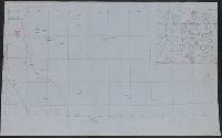
- Found in:
- Beinecke Rare Book and Manuscript Library > [Manuscript maps showing ruin sites etc. in the Transjordan and adjacent areas].
- Published / Created:
- [1870?]
- Call Number:
- 766 N46 1870H
- Container / Volume:
- BRBL_00712
- Image Count:
- 4
- Resource Type:
- Maps, Atlases & Globes
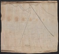
- Found in:
- Beinecke Rare Book and Manuscript Library > Manuscript maps of New Haven.
- Published / Created:
- 1823
- Call Number:
- 32 L9431 1823
- Container / Volume:
- BRBL_00701
- Image Count:
- 5
- Resource Type:
- Maps, Atlases & Globes
- Found in:
- Beinecke Rare Book and Manuscript Library > [Manuscript map of Lovell Hill, Berkshire].
- Creator:
- Bruner, L. D.
- Published / Created:
- [1867?]
- Call Number:
- BrSides Elephant Folio 2018 14
- Image Count:
- 7
- Resource Type:
- Maps, Atlases & Globes
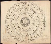
- Found in:
- Beinecke Rare Book and Manuscript Library > [Collection of five manuscript nautical charts of the World, the South Atlantic, and the East Indies with "Course indicator of U.S.S. 'Idaho'" drawn by L.D. Bruner].
- Published / Created:
- 1939
- Call Number:
- 356fd 1939C
- Container / Volume:
- BRBL_00702
- Image Count:
- 1
- Resource Type:
- Maps, Atlases & Globes
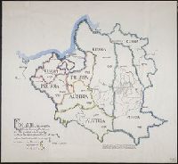
- Found in:
- Beinecke Rare Book and Manuscript Library > Poland, showing the Eighteenth Century Partitions; at its greatest extent, 1772: before the second partition of 1793: before the third partition of 1795.
- Published / Created:
- 1837
- Call Number:
- 39hc Sa54 1837
- Container / Volume:
- BRBL_00703
- Image Count:
- 1
- Resource Type:
- Maps, Atlases & Globes
- Found in:
- Beinecke Rare Book and Manuscript Library > Plan of the Operations in Spain between the 10th and 16th of March 1837.
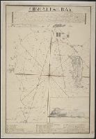
- Published / Created:
- [1800?]
- Call Number:
- 399 1800
- Container / Volume:
- BRBL_00704
- Image Count:
- 1
- Resource Type:
- Maps, Atlases & Globes
- Found in:
- Beinecke Rare Book and Manuscript Library > Gibraltar Bay.
- Published / Created:
- 1684
- Call Number:
- 18 1684
- Container / Volume:
- BRBL_00700
- Image Count:
- 1
- Resource Type:
- Maps, Atlases & Globes
- Found in:
- Beinecke Rare Book and Manuscript Library > The Northern part of ye World projected upon the Plaine of the Equator. By Anthony Payne ... A. AE 15 1/2. 1684.
- Published / Created:
- 1798
- Call Number:
- 27cea 1798
- Container / Volume:
- BRBL_00700
- Image Count:
- 1
- Resource Type:
- Maps, Atlases & Globes
- Found in:
- Beinecke Rare Book and Manuscript Library > A New Chart of the Eastern Straits or the Straits of the East of Java, with a part of the Banda Sea; corrected and improved chiefly from the observation of Captn. - Williams.
- Published / Created:
- [Between 1721 and 1724]
- Call Number:
- 352am Sa25 1721
- Container / Volume:
- BRBL_00702
- Image Count:
- 1
- Resource Type:
- Maps, Atlases & Globes
- Found in:
- Beinecke Rare Book and Manuscript Library > The E.S.E. prospective of St. Peterboug [sic] up the Goulff of Fienlad [sic] with part of the River Neva.