Search
You Searched For
Search Results
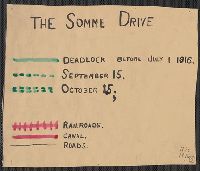
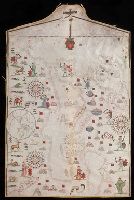
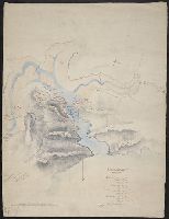
- Published / Created:
- 1916
- Call Number:
- 11hc 1916
- Container / Volume:
- BRBL_00010C
- Image Count:
- 1
- Resource Type:
- Maps, Atlases & Globes
- Found in:
- Beinecke Rare Book and Manuscript Library > [The Somme Drive.]
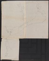
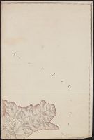
- Published / Created:
- [187-?]
- Call Number:
- 582 B22 187X
- Container / Volume:
- BRBL_00707
- Image Count:
- 1
- Resource Type:
- Maps, Atlases & Globes
- Found in:
- Beinecke Rare Book and Manuscript Library > [Thailand, from Bangkok west to Phet Buri].
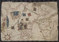
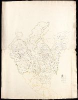
- Call Number:
- 32cea 1550
- Container / Volume:
- BRBL_00701
- Image Count:
- 2
- Resource Type:
- Maps, Atlases & Globes
- Found in:
- Beinecke Rare Book and Manuscript Library > [Section of a portolan chart spanning Great Britain in the west to the Adriatic Sea in the east.]
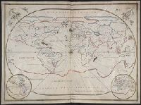
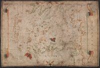
- Published / Created:
- 1643
- Call Number:
- 11 1643
- Container / Volume:
- BRBL_00700
- Image Count:
- 1
- Resource Type:
- Maps, Atlases & Globes
- Found in:
- Beinecke Rare Book and Manuscript Library > [Portolan chart of the World].
- Creator:
- Oliva, Joan, fl. 1580-1615
- Call Number:
- Art Storage 30cea 1555
- Image Count:
- 2
- Resource Type:
- Maps, Atlases & Globes
- Found in:
- Beinecke Rare Book and Manuscript Library > [Portolan chart of the Mediterranean Sea, the North Atlantic Ocean, the Baltic Sea, and the northwestern African coast].
- Published / Created:
- 1590
- Call Number:
- 49cea 1590
- Image Count:
- 2
- Resource Type:
- Maps, Atlases & Globes
- Found in:
- Beinecke Rare Book and Manuscript Library > [Portolan chart of the Mediterranean Sea and Europe].
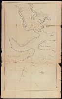
- Published / Created:
- [1550?]
- Call Number:
- 488 1550
- Container / Volume:
- BRBL_00706
- Image Count:
- 1
- Resource Type:
- Maps, Atlases & Globes
- Found in:
- Beinecke Rare Book and Manuscript Library > [Portolan chart of the Aegean Sea].
- Published / Created:
- [1780?]
- Call Number:
- BrSides Double Folio 2019 75
- Image Count:
- 1
- Resource Type:
- Maps, Atlases & Globes
- Found in:
- Beinecke Rare Book and Manuscript Library > [Map showing a part of the Ukraine and Moldova].
- Published / Created:
- [between 1790 and 1799?]
- Call Number:
- BrSides Folio 2017 123
- Image Count:
- 1
- Resource Type:
- Maps, Atlases & Globes
- Found in:
- Beinecke Rare Book and Manuscript Library > [Map of the confluence of Saint Marys and Amelia Rivers on the border between Georgia and Florida].
- Published / Created:
- [1780?]
- Call Number:
- BrSides Folio 2019 54
- Image Count:
- 1
- Resource Type:
- Maps, Atlases & Globes
- Found in:
- Beinecke Rare Book and Manuscript Library > [Map of the Perm province].
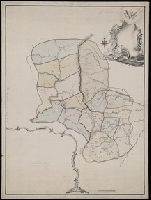
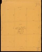
- Published / Created:
- [1848?]
- Call Number:
- Small Manuscript 766 N46 1848
- Image Count:
- 4
- Resource Type:
- Maps, Atlases & Globes
- Found in:
- Beinecke Rare Book and Manuscript Library > [Map of the Nine Squares of New Haven, showing dimensions].
- Creator:
- Loginov, Matveĭ
Логинов, Матвей
- Published / Created:
- [between 1750 and 1800?]
- Call Number:
- BrSides Double Folio 2019 79
- Image Count:
- 1
- Resource Type:
- Maps, Atlases & Globes
- Found in:
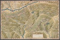
- Beinecke Rare Book and Manuscript Library > [Map of the Central and Southern Ural Mountains].
- Published / Created:
- [1872?]
- Call Number:
- BrSides Folio 2018 139
- Image Count:
- 1
- Resource Type:
- Maps, Atlases & Globes
- Found in:
- Beinecke Rare Book and Manuscript Library > [Map of Thunder Bay District, Canada, showing silver lands owned by Peter Mitchell & others, Sept. 7th, 1872].
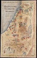
- Creator:
- Paucker, Fred
- Published / Created:
- 1957
- Call Number:
- 51 1957
- Image Count:
- 1
- Resource Type:
- Maps, Atlases & Globes
- Found in:
- Beinecke Rare Book and Manuscript Library > [Map of Israel] / Fred Paucker.
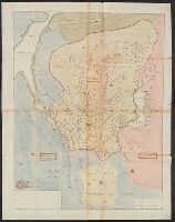
- Published / Created:
- [1920?]
- Call Number:
- 515 1920
- Container / Volume:
- BRBL_00707
- Image Count:
- 13
- Resource Type:
- Maps, Atlases & Globes
- Found in:
- Beinecke Rare Book and Manuscript Library > [Manuscript maps showing ruin sites etc. in the Transjordan and adjacent areas].
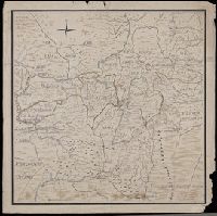
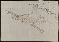
- Published / Created:
- [1830]
- Call Number:
- 42 Sa39 1830
- Container / Volume:
- BRBL_00706
- Image Count:
- 1
- Resource Type:
- Maps, Atlases & Globes
- Found in:
- Beinecke Rare Book and Manuscript Library > [Manuscript map showing part of the province of Salzburg]. Gezeichnet Franz Weys.
- Published / Created:
- [1846?]
- Call Number:
- 54635 K836 1846
- Container / Volume:
- BRBL_00707
- Image Count:
- 1
- Resource Type:
- Maps, Atlases & Globes
- Found in:
- Beinecke Rare Book and Manuscript Library > [Manuscript map showing part of the Bering Island or Komandor Islands and the position of the wreck of the ship "Baltic" out of New Bedford].
- Published / Created:
- [between 1840 and 1849?]
- Call Number:
- BrSides Folio 2018 146
- Image Count:
- 1
- Resource Type:
- Maps, Atlases & Globes
- Found in:
- Beinecke Rare Book and Manuscript Library > [Manuscript map of the regions in northern Italy].
- Published / Created:
- [after 1842]
- Call Number:
- BrSides Elephant Folio 2018 19
- Image Count:
- 1
- Resource Type:
- Maps, Atlases & Globes
- Found in:
- Beinecke Rare Book and Manuscript Library > [Manuscript map of the northern third of Maine].
- Published / Created:
- [between 1800 and 1810?]
- Call Number:
- BrSides Double Folio 2018 83
- Image Count:
- 1
- Resource Type:
- Maps, Atlases & Globes
- Found in:
- Beinecke Rare Book and Manuscript Library > [Manuscript map of the coastline of the Gulf of Mexico from the border of Louisiana and Texas to the Yucatán Peninsula].
- Published / Created:
- [1750]
- Call Number:
- 655gmg 1750
- Container / Volume:
- BRBL_00708
- Image Count:
- 1
- Resource Type:
- Maps, Atlases & Globes
- Found in:
- Beinecke Rare Book and Manuscript Library > [Manuscript map of the coastline of Western Africa].
- Published / Created:
- 1764
- Call Number:
- 764 1764
- Container / Volume:
- BRBL_00710
- Image Count:
- 1
- Resource Type:
- Maps, Atlases & Globes
- Found in:
- Beinecke Rare Book and Manuscript Library > [Manuscript map of the Western boundaries of Massachusetts] sworn this line has bin measured this year 1764 ... a true copy N. Dwight. Saml. Messinger surveyor.
- Published / Created:
- [ca. 1760]
- Call Number:
- 85cea 1760
- Container / Volume:
- BRBL_00719
- Image Count:
- 2
- Resource Type:
- Maps, Atlases & Globes
- Found in:
- Beinecke Rare Book and Manuscript Library > [Manuscript map of the West Indies].
- Published / Created:
- [1690?]
- Call Number:
- 521 J565 1690
- Container / Volume:
- BRBL_00707
- Image Count:
- 1
- Resource Type:
- Maps, Atlases & Globes
- Found in:
- Beinecke Rare Book and Manuscript Library > [Manuscript map of the Red Sea around the town of Jiddah (or Jedda.)].
- Published / Created:
- [1650?]
- Call Number:
- 28 1650
- Container / Volume:
- BRBL_00700
- Image Count:
- 2
- Resource Type:
- Maps, Atlases & Globes
- Found in:
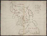
- Beinecke Rare Book and Manuscript Library > [Manuscript map of the Philippines].
- Published / Created:
- [1700?]
- Call Number:
- 761 1700
- Container / Volume:
- BRBL_00709
- Image Count:
- 1
- Resource Type:
- Maps, Atlases & Globes
- Found in:
- Beinecke Rare Book and Manuscript Library > [Manuscript map of the Maine Coastline].
- Published / Created:
- [1745]
- Call Number:
- 732cea C16 1745
- Container / Volume:
- BRBL_00709
- Image Count:
- 1
- Resource Type:
- Maps, Atlases & Globes
- Found in:
- Beinecke Rare Book and Manuscript Library > [Manuscript map of the Gut of Canse].
- Published / Created:
- [1790]
- Call Number:
- 352 D64 1790
- Container / Volume:
- BRBL_00702
- Image Count:
- 2
- Resource Type:
- Maps, Atlases & Globes
- Found in:
- Beinecke Rare Book and Manuscript Library > [Manuscript map of the Dnieper River Area, Crimea].
- Published / Created:
- 1919?]
- Call Number:
- 11hcf 1919C-1-3
- Container / Volume:
- BRBL_00010S
- Image Count:
- 1
- Resource Type:
- Maps, Atlases & Globes
- Found in:
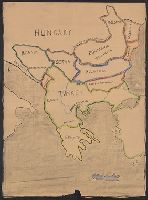
- Beinecke Rare Book and Manuscript Library > [Manuscript map of the Balkan Peninsula].
- Published / Created:
- 1824
- Call Number:
- 761 B41 1824
- Container / Volume:
- BRBL_00710
- Image Count:
- 3
- Resource Type:
- Maps, Atlases & Globes
- Found in:
- Beinecke Rare Book and Manuscript Library > [Manuscript map of part of Belfast, Maine by George Watson].
- Published / Created:
- [between 1875 and 1900?]
- Call Number:
- BrSides Box 2018 74
- Image Count:
- 1
- Resource Type:
- Maps, Atlases & Globes
- Found in:
- Beinecke Rare Book and Manuscript Library > [Manuscript map of mine locations in the vicinity of Mass City, Michigan].
- Published / Created:
- [between 1875 and 1900?]
- Call Number:
- BrSides 2018 155
- Image Count:
- 1
- Resource Type:
- Maps, Atlases & Globes
- Found in:
- Beinecke Rare Book and Manuscript Library > [Manuscript map of mine locations in Michigan].
- Published / Created:
- [between 1875 and 1900?]
- Call Number:
- BrSides Folio 2018 133
- Image Count:
- 1
- Resource Type:
- Maps, Atlases & Globes
- Found in:
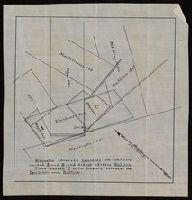
- Beinecke Rare Book and Manuscript Library > [Manuscript map of delineations of unknown property owned by Richard H. Rickard].
- Published / Created:
- [after 1811]
- Call Number:
- BrSides Folio 2018 123
- Image Count:
- 3
- Resource Type:
- Maps, Atlases & Globes
- Found in:
- Beinecke Rare Book and Manuscript Library > [Manuscript map of a portion of Veracruz-Llave in Mexico].
- Published / Created:
- 1759
- Call Number:
- 36hc M66 1759A
- Container / Volume:
- BRBL_00703
- Image Count:
- 1
- Resource Type:
- Maps, Atlases & Globes
- Found in:
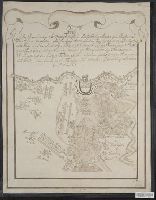
- Beinecke Rare Book and Manuscript Library > [Manuscript map of a battle in the vicinity of Minden].
- Published / Created:
- [1837]
- Call Number:
- 394hc 1837
- Container / Volume:
- BRBL_00703
- Image Count:
- 1
- Resource Type:
- Maps, Atlases & Globes
- Found in:
- Beinecke Rare Book and Manuscript Library > [Manuscript map of Passages, Spain].
- Published / Created:
- [1810?]
- Call Number:
- 28cea M314 1810
- Container / Volume:
- BRBL_00700
- Image Count:
- 1
- Resource Type:
- Maps, Atlases & Globes
- Found in:
- Beinecke Rare Book and Manuscript Library > [Manuscript map of Manila Harbor and Bay Lake].
- Published / Created:
- 1823
- Call Number:
- 32 L9431 1823
- Container / Volume:
- BRBL_00701
- Image Count:
- 5
- Resource Type:
- Maps, Atlases & Globes
- Found in:
- Beinecke Rare Book and Manuscript Library > [Manuscript map of Lovell Hill, Berkshire].
- Published / Created:
- [1800?]
- Call Number:
- 402 1800
- Container / Volume:
- BRBL_00705
- Image Count:
- 12
- Resource Type:
- Maps, Atlases & Globes
- Found in:
- Beinecke Rare Book and Manuscript Library > [Manuscript map of Lombardy]. Fratelli Bordiga inc.
- Published / Created:
- [between 1840 and 1849?]
- Call Number:
- BrSides Elephant Folio 2018 31
- Image Count:
- 1
- Resource Type:
- Maps, Atlases & Globes
- Found in:
- Beinecke Rare Book and Manuscript Library > [Manuscript map of Lombardy, Italy].
- Published / Created:
- 1777
- Call Number:
- 906 1777
- Container / Volume:
- BRBL_00721
- Image Count:
- 1
- Resource Type:
- Maps, Atlases & Globes
- Found in:
- Beinecke Rare Book and Manuscript Library > [Manuscript map of Guiana].
- Published / Created:
- [ca. 1750]
- Call Number:
- 733 B384 1750
- Container / Volume:
- BRBL_00709
- Image Count:
- 1
- Resource Type:
- Maps, Atlases & Globes
- Found in:
- Beinecke Rare Book and Manuscript Library > [Manuscript map of Fort Beauséjour, Acadia].
- Published / Created:
- [1700?]
- Call Number:
- 428 In7 1700
- Container / Volume:
- BRBL_00706
- Image Count:
- 1
- Resource Type:
- Maps, Atlases & Globes
- Found in:
- Beinecke Rare Book and Manuscript Library > [Manuscript map of Environs North & West of Insprugg].
- Published / Created:
- 1661
- Call Number:
- 764ad D728 1661
- Container / Volume:
- BRBL_00711
- Image Count:
- 1
- Resource Type:
- Maps, Atlases & Globes
- Found in:
- Beinecke Rare Book and Manuscript Library > [Manuscript map of Dorchester, Massachusetts].
- Published / Created:
- 1665
- Call Number:
- 764ad D728 1665
- Container / Volume:
- BRBL_00711
- Image Count:
- 1
- Resource Type:
- Maps, Atlases & Globes
- Found in:
- Beinecke Rare Book and Manuscript Library > [Manuscript map of Dorchester, Massachusetts] ... by me, Joshua Fisher, 1665.
- Published / Created:
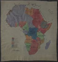
- [1915?]
- Call Number:
- 60fd 1915
- Container / Volume:
- BRBL_00707
- Image Count:
- 1
- Resource Type:
- Maps, Atlases & Globes
- Found in:
- Beinecke Rare Book and Manuscript Library > [Manuscript map of Colonial Africa].
- Published / Created:
- [1740?]
- Call Number:
- 40 B45 1740
- Container / Volume:
- BRBL_00705
- Image Count:
- 1
- Resource Type:
- Maps, Atlases & Globes
- Found in:
- Beinecke Rare Book and Manuscript Library > [Manuscript map of Bergamo].
- Published / Created:
- 1919?]
- Call Number:
- 11hcf 1919C-3-15
- Container / Volume:
- BRBL_00010U
- Image Count:
- 1
- Resource Type:
- Maps, Atlases & Globes
- Found in:
- Beinecke Rare Book and Manuscript Library > [Manuscript map of Balkan Peninsula and Eastern Europe].
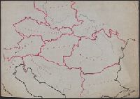
- Published / Created:
- 1919?]
- Call Number:
- 11hcf 1919C-3-13
- Container / Volume:
- BRBL_00010U
- Image Count:
- 1
- Resource Type:
- Maps, Atlases & Globes
- Found in:
- Beinecke Rare Book and Manuscript Library > [Manuscript map of Balkan Peninsula and Eastern Europe].
- Published / Created:
- [1870?]
- Call Number:
- 556 1870
- Container / Volume:
- BRBL_00707
- Image Count:
- 1
- Resource Type:
- Maps, Atlases & Globes
- Found in:
- Beinecke Rare Book and Manuscript Library > [Manuscript map of Asia and Australia.]