Search
You Searched For
Search Results
- Published / Created:
- 1714
- Call Number:
- 732 F963 1714
- Container / Volume:
- BRBL_00708
- Image Count:
- 1
- Resource Type:
- Maps, Atlases & Globes
- Found in:
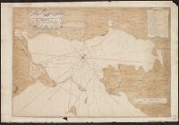
- Beinecke Rare Book and Manuscript Library > A Draft of the Bay of Fundy by John Wells.
- Published / Created:
- [1840?].
- Call Number:
- 764 B77 1740
- Container / Volume:
- BRBL_00710
- Image Count:
- 1
- Resource Type:
- Maps, Atlases & Globes
- Found in:
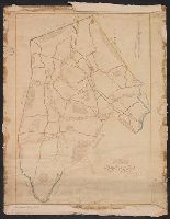
- Beinecke Rare Book and Manuscript Library > A Map of Brimfield as it was from its settlement 1720 till 1740. [Rev.] J[ason] Morse.
- Published / Created:
- 1774
- Call Number:
- 771 1774
- Container / Volume:
- BRBL_00713
- Image Count:
- 1
- Resource Type:
- Maps, Atlases & Globes
- Found in:
- Beinecke Rare Book and Manuscript Library > A Map of the Province of New York as divided into Counties together with the adjacent provinces. Compiled from the latest Maps and Actual Surveys. Will:Cockburn.
- Published / Created:
- 1828
- Call Number:
- 75 1828D
- Container / Volume:
- BRBL_00709
- Image Count:
- 1
- Resource Type:
- Maps, Atlases & Globes
- Found in:
- Beinecke Rare Book and Manuscript Library > A Map of the United States. Projected by Nancy Gibbs, Livermore, 1828.
- Published / Created:
- [175-?]
- Call Number:
- 732 1750
- Container / Volume:
- BRBL_00708
- Image Count:
- 1
- Resource Type:
- Maps, Atlases & Globes
- Found in:
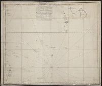
- Beinecke Rare Book and Manuscript Library > A Map of the surueyed parts of Noua Scotia.
- Published / Created:
- 1798
- Call Number:
- 27cea 1798
- Container / Volume:
- BRBL_00700
- Image Count:
- 1
- Resource Type:
- Maps, Atlases & Globes
- Found in:
- Beinecke Rare Book and Manuscript Library > A New Chart of the Eastern Straits or the Straits of the East of Java, with a part of the Banda Sea; corrected and improved chiefly from the observation of Captn. - Williams.
- Published / Created:
- [ca. 1789]
- Call Number:
- 6555cea 1789
- Container / Volume:
- BRBL_00708
- Image Count:
- 3
- Resource Type:
- Maps, Atlases & Globes
- Found in:
- Beinecke Rare Book and Manuscript Library > A New Survey of that part of the Coast of Africa comprised between Cape Verga and Cape Formoso, including chiefly the Windward and Gold Coasts in which the Latitudes of all the Principal Places are determined by Actual observations, the bearings and cours
- Published / Created:
- 1711
- Call Number:
- 764 B65 1711
- Container / Volume:
- BRBL_00710
- Image Count:
- 1
- Resource Type:
- Maps, Atlases & Globes
- Found in:
- Beinecke Rare Book and Manuscript Library > A New plan of the Harbour of Boston in New England. Lat. 42, 29 North. Long. 71 West. Surveyed by Order of the Commissioners of her Majesty's Navy.
- Published / Created:
- 1821
- Call Number:
- 764 W688 1821
- Container / Volume:
- BRBL_00710
- Image Count:
- 1
- Resource Type:
- Maps, Atlases & Globes
- Found in:
- Beinecke Rare Book and Manuscript Library > A Plan of Wilmington Taken October 1821 by Edmund Parker.
- Published / Created:
- 1745
- Call Number:
- 7325cea L93 1745
- Container / Volume:
- BRBL_00709
- Image Count:
- 1
- Resource Type:
- Maps, Atlases & Globes
- Found in:
- Beinecke Rare Book and Manuscript Library > A Plan of the Harbour and Fortifications of Louisburg. The Harbour Survey'd by Capt. Phil: Durell. The fortifications by Capt. Will: Henry Bastide. Anne. 1745.
- Published / Created:
- 1758
- Call Number:
- 7325 L93 1758A
- Container / Volume:
- BRBL_00709
- Image Count:
- 1
- Resource Type:
- Maps, Atlases & Globes
- Found in:
- Beinecke Rare Book and Manuscript Library > A Plan of the Town and Harbour of Louisburg ... 1758. By Lieut. Joseph Norwood.
- Published / Created:
- [1780]
- Call Number:
- 29cea 1780
- Container / Volume:
- BRBL_00701
- Image Count:
- 1
- Resource Type:
- Maps, Atlases & Globes
- Found in:
- Beinecke Rare Book and Manuscript Library > A Plane Chart of several Islands Bank Shoals & Soundings ...
- Published / Created:
- [1750?]
- Call Number:
- 763fb Su87 1750
- Container / Volume:
- BRBL_00710
- Image Count:
- 1
- Resource Type:
- Maps, Atlases & Globes
- Found in:
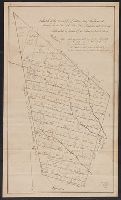
- Beinecke Rare Book and Manuscript Library > A Sketch of the Township of Sutton, lately Billymead, showing the number of the lot and to which propietor each lot is rett.
- Published / Created:
- 1785
- Call Number:
- 648cea Sa23 1785
- Container / Volume:
- BRBL_00708
- Image Count:
- 1
- Resource Type:
- Maps, Atlases & Globes
- Found in:
- Beinecke Rare Book and Manuscript Library > A chart of a bay [St. Francis Bay?] on the SE coast of Africa ... 1785 ... in Lat. 34°09'S, Long 26°10'E.
- Published / Created:
- [ca. 1758]
- Call Number:
- 732cea 1758
- Container / Volume:
- BRBL_00709
- Image Count:
- 1
- Resource Type:
- Maps, Atlases & Globes
- Found in:
- Beinecke Rare Book and Manuscript Library > A chart of the peninsula of Nova Scotia by Charles Morris.
- Published / Created:
- ca. 1705]
- Call Number:
- 732cea C413 1705
- Container / Volume:
- BRBL_00709
- Image Count:
- 1
- Resource Type:
- Maps, Atlases & Globes
- Found in:
- Beinecke Rare Book and Manuscript Library > A draught of Southacks Bay in America [cartographic material].
- Published / Created:
- [1715?]
- Call Number:
- 53 1700
- Container / Volume:
- BRBL_00707
- Image Count:
- 1
- Resource Type:
- Maps, Atlases & Globes
- Found in:
- Beinecke Rare Book and Manuscript Library > A large draught of the Red Sea from Mount Felix to Judda.
- Published / Created:
- April 1759.
- Call Number:
- 773 C884 1759
- Container / Volume:
- BRBL_00714
- Image Count:
- 1
- Resource Type:
- Maps, Atlases & Globes
- Found in:
- Beinecke Rare Book and Manuscript Library > A map of Isaac Cowgill's plantation : contain two hundred & seven acres and twenty perches / by Jno. Oliver.
- Published / Created:
- [1789]
- Call Number:
- BrSides 2017 121
- Image Count:
- 2
- Resource Type:
- Maps, Atlases & Globes
- Found in:
- Beinecke Rare Book and Manuscript Library > A map of lands purchased of the state of Georgia in 1789, by the South Carolina Yazou Company, by the Virginia Yazou Company, and by the Tennessee Company / sketched from a map of Zachariah Coxe's Esq., who made it from an actual survey of these counties; this draught, although coarsely done, is exact, and consonant the scale adopted by the said Coxe.
- Published / Created:
- [ca. 1746]
- Call Number:
- 7325 L93 1746
- Container / Volume:
- BRBL_00709
- Image Count:
- 1
- Resource Type:
- Maps, Atlases & Globes
- Found in:
- Beinecke Rare Book and Manuscript Library > A plan of Louisbourg intended only to shew by strong red the publick buildings lately erected, and by faint red such as have had a thorough repair. I.H. Bastide.