Search
You Searched For
Search Results
- Creator:
- Oliva, Joan, fl. 1580-1615
- Call Number:
- Art Storage 30cea 1555
- Image Count:
- 2
- Resource Type:
- Maps, Atlases & Globes
- Found in:
- Beinecke Rare Book and Manuscript Library > [Portolan chart of the Mediterranean Sea, the North Atlantic Ocean, the Baltic Sea, and the northwestern African coast].
- Call Number:
- BrSides Folio 2019 56
- Image Count:
- 1
- Resource Type:
- Maps, Atlases & Globes
- Found in:
- Beinecke Rare Book and Manuscript Library > Karta : opisi i promeru glubiny, chasti dnieprovskago Limana i reki Buga do Nikolaeva / sochinena flota gospodinom kapitanʺ leĭtnantomʺ Aleksandrom Savit︠s︡kimʺ 1793 goda.
- Call Number:
- BrSides Folio 2019 53
- Image Count:
- 1
- Resource Type:
- Maps, Atlases & Globes
- Found in:
- Beinecke Rare Book and Manuscript Library > Charte der Krieges operation am Donn und Dniper ihro Russisch Kayserl. Maist. glorieusen Armeen, 1736.
- Call Number:
- BrSides Double Folio 2017 26
- Image Count:
- 1
- Resource Type:
- Maps, Atlases & Globes
- Found in:
- Beinecke Rare Book and Manuscript Library > New Haven in 1641.
- Creator:
- De Lacy, W. W. (Walter Washington), 1819-1892
- Call Number:
- WA MSS 443
- Collection Title:
- Isaac Ingalls Stevens papers
- Container / Volume:
- Box 1 | Folder 29
- Image Count:
- 1
- Resource Type:
- Maps, Atlases & Globes
- Found in:
- Beinecke Rare Book and Manuscript Library > Plan of the battle of Grande Ronde fought Jul 17, 1856.
- Call Number:
- 32cea 1550
- Container / Volume:
- BRBL_00701
- Image Count:
- 2
- Resource Type:
- Maps, Atlases & Globes
- Found in:
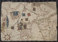
- Beinecke Rare Book and Manuscript Library > [Section of a portolan chart spanning Great Britain in the west to the Adriatic Sea in the east.]
- Creator:
- Roselli, Petrus, active 1446-1468, cartographer
- Published / Created:
- [approximately 1450-1475]
- Call Number:
- Art Storage 49cea 1425
- Image Count:
- 2
- Resource Type:
- cartographic image
- Found in:
- Beinecke Rare Book and Manuscript Library > Portolan chart of the Mediterranean Sea and the Black Sea
- Creator:
- Freducci, Conte di Ottomano, active 1497-1539, cartographer
- Published / Created:
- [1536?]
- Call Number:
- Covers 49 +1536
- Image Count:
- 6
- Resource Type:
- cartographic image
- Found in:
- Beinecke Rare Book and Manuscript Library > Composite atlas of portolan charts produced by Conte di Ottomano Freducci
- Published / Created:
- [1550?]
- Call Number:
- 488 1550
- Container / Volume:
- BRBL_00706
- Image Count:
- 1
- Resource Type:
- Maps, Atlases & Globes
- Found in:
- Beinecke Rare Book and Manuscript Library > [Portolan chart of the Aegean Sea].
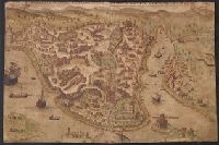
- Published / Created:
- [1576]
- Call Number:
- 491 Is7 1576
- Container / Volume:
- BRBL_00707
- Image Count:
- 1
- Resource Type:
- Maps, Atlases & Globes
- Found in:
- Beinecke Rare Book and Manuscript Library > Questa e la famosisima citta di Costantinopoli. [View of Constantinople]. .