Search
You Searched For
Search Results
- Creator:
- Erdoes, Richard, 1912-2008
- Published / Created:
- 1976-1983, undated
- Call Number:
- WA MSS S-2609
- Collection Title:
- Richard Erdoes papers
- Container / Volume:
- Box 46 | Plains Indian History II
- Image Count:
- 40
- Found in:
- Beinecke Rare Book and Manuscript Library > 18th Century Maps
- Published / Created:
- 1846
- Call Number:
- 1976 Folio 93
- Collection Title:
- A new universal atlas containing maps of the various empires, kingdoms, states and republics of the
- Image Count:
- 1
- Resource Type:
- Maps, Atlases & Globes
- Found in:
- Beinecke Rare Book and Manuscript Library > 9. Connecticut
- Published / Created:
- 1719
- Call Number:
- Defoe 50 719db 1
- Collection Title:
- The life and strange surprizing adventures of Robinson Crusoe, of York, mariner : who lived eight
- Image Count:
- 1
- Resource Type:
- Maps, Atlases & Globes
- Found in:
- Beinecke Rare Book and Manuscript Library > A Map of the world, on wch is delineated the voyages of Robinson Cruso
- Call Number:
- 1989 +19
- Collection Title:
- A collection of voyages and travels, some now first printed from original manuscripts, others now
- Image Count:
- 1
- Resource Type:
- Maps, Atlases & Globes
- Found in:
- Beinecke Rare Book and Manuscript Library > A chart and map of the Gold Coast of Guinea from Rio da Corsa to Ro da Volta. vol. V [5], pl. K
- Published / Created:
- 1739
- Call Number:
- WeInd Ehc 739
- Collection Title:
- A description of the Windward Passage, and Gulf of Florida, with the course of the British trading
- Image Count:
- 1
- Resource Type:
- Maps, Atlases & Globes
- Found in:
- Beinecke Rare Book and Manuscript Library > A chart of the Bahamas Islands with a description of the Gulf of Florida and Windward passage &c. referr'd from the figures here set down, to the general index annexed ... by J.C
- Creator:
- Pine, John, 1690-1756
Rocque, John, d. 1762
Tinney, John
- Published / Created:
- 1746
- Call Number:
- 2002 Folio 94
- Image Count:
- 1
- Resource Type:
- Maps, Atlases & Globes
- Found in:
- Beinecke Rare Book and Manuscript Library > A contracted scetch of the plan of London &c. : printed on 24 sheets of imperial paper, to shew the general appearance of the whole : for the use of those who bind it in a book, and for the better comprehension of the divisions mentioned in the index.
- Creator:
- Vaughan, Robert, 17th cent., engraver
- Published / Created:
- 1624
- Call Number:
- Pequot +Sm4
- Collection Title:
- The generall historie of Virginia, New-England, and the Summer Isles : with the names of the
- Image Count:
- 1
- Found in:
- Beinecke Rare Book and Manuscript Library > A description of part of the adventures of Cap. Smith in Virginia
- Creator:
- Vaughan, Robert, 17th cent., engraver
- Published / Created:
- 1624
- Call Number:
- 2003 +39
- Collection Title:
- The generall historie of Virginia, New-England, and the Summer Iles ...
- Image Count:
- 1
- Found in:
- Beinecke Rare Book and Manuscript Library > A description of part of the adventures of Cap. Smith in Virginia
- Creator:
- Dodsley, Robert, 1703-1764
Evans, Lewis, 1700?-1756.
Turner, James, d. 1759, engraver.
- Published / Created:
- 1755
- Call Number:
- 391 +1755h
- Collection Title:
- Geographical, historical, political, philosophical and mechanical essays : the first, containing an
- Image Count:
- 1
- Resource Type:
- Maps, Atlases & Globes
- Found in:
- Beinecke Rare Book and Manuscript Library > A general map of the middle British colonies in America
- Creator:
- Bowles, Carington, 1724-1793
Evans, Lewis, 1700?-1756.
- Published / Created:
- 1771
- Call Number:
- Franklin 391 1755e
- Collection Title:
- Geographical, historical, political, philosophical and mechanical essays : the first, containing an
- Image Count:
- 1
- Found in:
- Beinecke Rare Book and Manuscript Library > A general map of the middle British colonies in America
- Creator:
- Evans, Lewis, 1700?-1756
- Call Number:
- Egg +755E
- Collection Title:
- Geographical, historical, political, philosophical and mechanical essays : the first, containing an
- Image Count:
- 1
- Found in:
- Beinecke Rare Book and Manuscript Library > A general map of the middle British colonies in America
- Creator:
- Seller, John, fl. 1658-1698
- Call Number:
- 1976 Folio 139
- Collection Title:
- The English pilot: describing the sea-coasts, capes, head-lands, soundings, sands, shoals, rocks
- Image Count:
- 1
- Found in:
- Beinecke Rare Book and Manuscript Library > A large description of the two chanells in the River Dwina goeing up to the citty of Archangel by John Seller
- Creator:
- Clark, William, 1770-1838
Lewis, Samuel, 1753 or 4-1822
- Published / Created:
- [ca. 1814]
- Call Number:
- Zc10 814Le
- Collection Title:
- History of the expedition under the command of Captains Lewis and Clark, to the sources of the
- Image Count:
- 2
- Resource Type:
- Maps, Atlases & Globes
- Found in:
- Beinecke Rare Book and Manuscript Library > A map of Lewis and Clark's track, across the western portion of North America fom the Mississippi to the Pacific Ocean; by order of the Executive of the United States . In 1804, 5 & 6
- Call Number:
- 1977 +392
- Collection Title:
- A survey of the cities of London and Westminster : containing the original, antiquity, increase
- Image Count:
- 1
- Found in:
- Beinecke Rare Book and Manuscript Library > A map of St. Giles Cripple Gate without. With large additions and corrections
- Call Number:
- 1977 +392
- Collection Title:
- A survey of the cities of London and Westminster : containing the original, antiquity, increase
- Image Count:
- 1
- Resource Type:
- Maps, Atlases & Globes
- Found in:
- Beinecke Rare Book and Manuscript Library > A map of the parish if St. Katherines by the Tower
- Call Number:
- 1977 +392
- Collection Title:
- A survey of the cities of London and Westminster : containing the original, antiquity, increase
- Image Count:
- 1
- Resource Type:
- Maps, Atlases & Globes
- Found in:
- Beinecke Rare Book and Manuscript Library > A map of the parish of St. Dustans Stepney and Stebunheath divided into hamlets
- Call Number:
- 1977 +392
- Collection Title:
- A survey of the cities of London and Westminster : containing the original, antiquity, increase
- Image Count:
- 1
- Found in:
- Beinecke Rare Book and Manuscript Library > A mapp of the parish of St. Giles's in the Fields taken from the last servey, with corrections and additions
- Call Number:
- 1977 +392
- Collection Title:
- A survey of the cities of London and Westminster : containing the original, antiquity, increase
- Image Count:
- 1
- Resource Type:
- Maps, Atlases & Globes
- Found in:
- Beinecke Rare Book and Manuscript Library > A mapp of the parishes of St. Clements Danes, St. Mary Savoy; with the Rolls Liberty and Lincolns Inn, taken from the last survey with corrections and additions
- Call Number:
- 1977 +392
- Collection Title:
- A survey of the cities of London and Westminster : containing the original, antiquity, increase
- Image Count:
- 1
- Resource Type:
- Maps, Atlases & Globes
- Found in:
- Beinecke Rare Book and Manuscript Library > A mapp of the parishes of St. Saviours Southwark and St. Georges taken from the last survey with corrections
- Creator:
- Bennett, John
Sayer, Robert, 1725-1794
- Call Number:
- 1977 Folio 78
- Collection Title:
- A New and accurate chart of the West-India Islands and coast, with the gulf passage through the New
- Image Count:
- 1
- Resource Type:
- Maps, Atlases & Globes
- Found in:
- Beinecke Rare Book and Manuscript Library > A new general chart of the West Indies from the latest marine journals and surveys. Regulated and ascertained by astronomical observations
- Published / Created:
- 1846
- Call Number:
- 1976 Folio 93
- Collection Title:
- Mitchell’s universal atlas
- Image Count:
- 1
- Resource Type:
- Maps, Atlases & Globes
- Found in:
- Beinecke Rare Book and Manuscript Library > A new map of Maine
- Published / Created:
- 1850
- Call Number:
- 1975 Folio 26
- Collection Title:
- A new universal atlas containing maps of the various empires, kingdoms, states and republics of the
- Image Count:
- 1
- Resource Type:
- Maps, Atlases & Globes
- Found in:
- Beinecke Rare Book and Manuscript Library > A new map of Maine
- Call Number:
- 1977 +379
- Collection Title:
- Geografia; cioe, Descrittione vniversale della terra. Partita in due volumi, nel primo de' quali si
- Image Count:
- 1
- Found in:
- Beinecke Rare Book and Manuscript Library > A new map of that part of Africacalled the coast of Guinea ...
- Published / Created:
- 1657
- Call Number:
- Taylor 353
- Collection Title:
- Certaine errors in navigation / detected and corrected by Edw. Wright ; with many additions that
- Image Count:
- 1
- Found in:
- Beinecke Rare Book and Manuscript Library > A particular platt, for sailing to the Azores
- Call Number:
- 1977 Folio 78
- Collection Title:
- A New and accurate chart of the West-India Islands and coast, with the gulf passage through the New
- Image Count:
- 1
- Resource Type:
- Maps, Atlases & Globes
- Found in:
- Beinecke Rare Book and Manuscript Library > A plan of Fort St. Louis harbour on the south side of Hispaniola, pl. 31.
- Call Number:
- 1977 Folio 78
- Collection Title:
- A New and accurate chart of the West-India Islands and coast, with the gulf passage through the New
- Image Count:
- 1
- Resource Type:
- Maps, Atlases & Globes
- Found in:
- Beinecke Rare Book and Manuscript Library > A plan of Monte-Christe Bay with the Seven Brothers on the north coast of St. Domingo, pl. 38
- Call Number:
- 1977 Folio 78
- Collection Title:
- A New and accurate chart of the West-India Islands and coast, with the gulf passage through the New
- Image Count:
- 1
- Resource Type:
- Maps, Atlases & Globes
- Found in:
- Beinecke Rare Book and Manuscript Library > A plan of the road of Port Paix in the island of Hispaniola, pl. 35.
- Creator:
- Smith, John, 1580-1631
- Published / Created:
- 1631
- Call Number:
- Taylor 316
- Image Count:
- 2
- Found in:
- Beinecke Rare Book and Manuscript Library > Advertisements for the unexperienced planters of New-England, or anywhere, or, The path-way to experience to erect a plantation : With the yearely proceedings of this country in fishing and planting, since the yeare 1614. to the yeare 1630. and their present estate. Also how to prevent the greatest inconveniences, by their proceedings in Virginia, and other plantations, by approved examples. With the countries armes, a description of the coast, harbours, habitations, land-markes, latitude and longitude: with the map, allowed by our royall King Charles. By Captaine Iohn Smith, sometimes governour of Virginia, and admirall of Nevv-England.
- Call Number:
- 1977 +392
- Collection Title:
- A survey of the cities of London and Westminster : containing the original, antiquity, increase
- Image Count:
- 1
- Found in:
- Beinecke Rare Book and Manuscript Library > Alders Gate Ward and St. Martins le grand liberty taken from the last survey with corrections
- Call Number:
- 1977 +392
- Collection Title:
- A survey of the cities of London and Westminster : containing the original, antiquity, increase
- Image Count:
- 1
- Resource Type:
- Maps, Atlases & Globes
- Found in:
- Beinecke Rare Book and Manuscript Library > Aldgate Ward with its division into parishes. Taken from the last survey, with corrections & additions
- Call Number:
- Gfp94 gf525j
- Collection Title:
- Geographiae vniversae ... opvs ... habentur Cl. Ptolemaei ... Geographicae enarrationis libri octo
- Image Count:
- 1
- Resource Type:
- Books, Journals & Pamphlets
- Found in:
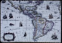
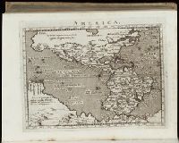
- Beinecke Rare Book and Manuscript Library > America
- Call Number:
- 1977 1341
- Collection Title:
- Geographiae vniversae opvs habentur Cl. Ptolemaei ... Geographicae enarationis libri octo [tr. by W
- Image Count:
- 1
- Resource Type:
- Books, Journals & Pamphlets
- Found in:
- Beinecke Rare Book and Manuscript Library > America
- Creator:
- Jefferys, Thomas, d. 1771
- Call Number:
- C6 033c
- Collection Title:
- The natural and civil history of the French dominions in North and South America : with an
- Image Count:
- 1
- Resource Type:
- Maps, Atlases & Globes
- Found in:
- Beinecke Rare Book and Manuscript Library > An authentic plan of the town and harbour of Cap Francois in the isle of St. Domingo. By Thomas Jefferys geographer to his Royal Highness the Prince of Wales
- Call Number:
- 1978 +73
- Collection Title:
- The ecclesiastical history of New-England from its first planting in the year 1620 unto the year of
- Image Count:
- 1
- Resource Type:
- Books, Journals & Pamphlets
- Found in:
- Beinecke Rare Book and Manuscript Library > An exact mapp of New England and New York
- Call Number:
- 1977 +392
- Collection Title:
- A survey of the cities of London and Westminster : containing the original, antiquity, increase
- Image Count:
- 1
- Found in:
- Beinecke Rare Book and Manuscript Library > Billings Gate Ward and Bridge Ward within with it's division into parishes, taken from the last survey
- Call Number:
- 1977 +392
- Collection Title:
- A survey of the cities of London and Westminster : containing the original, antiquity, increase
- Image Count:
- 1
- Resource Type:
- Maps, Atlases & Globes
- Found in:
- Beinecke Rare Book and Manuscript Library > Bishop Gate Street Ward taken from the last survey and corrected
- Published / Created:
- [1565?]
- Call Number:
- 1977 +251
- Collection Title:
- Terzo volume delle nauigationi et viaggi / raccolto gia da m. Gio. Battista Ramusio
- Container / Volume:
- v. 3
- Image Count:
- 1
- Found in:
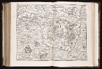
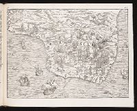
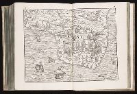
- Beinecke Rare Book and Manuscript Library > Brasil
- Published / Created:
- [1565?]
- Call Number:
- Taylor 115 3
- Collection Title:
- Terzo volume delle nauigationi et viaggi / raccolto gia da m. Gio. Battista Ramusio
- Container / Volume:
- v. 3
- Image Count:
- 1
- Found in:
- Beinecke Rare Book and Manuscript Library > Brasil
- Published / Created:
- [1565?]
- Call Number:
- 2001 +204 3
- Collection Title:
- Terzo volume delle nauigationi et viaggi / raccolto gia da m. Gio. Battista Ramusio
- Image Count:
- 1
- Found in:
- Beinecke Rare Book and Manuscript Library > Brasil
- Call Number:
- 1977 +392
- Collection Title:
- A survey of the cities of London and Westminster : containing the original, antiquity, increase
- Image Count:
- 1
- Resource Type:
- Maps, Atlases & Globes
- Found in:
- Beinecke Rare Book and Manuscript Library > Bread Street Ward and Cordwainer Ward with it's division into parishes taken from the last survey
- Published / Created:
- 1610
- Call Number:
- Ede +610C
- Collection Title:
- Britain, or, A chronographicall description of the most flourishing kingdomes, England, Scotland
- Image Count:
- 1
- Resource Type:
- Books, Journals & Pamphlets
- Found in:
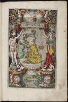
- Beinecke Rare Book and Manuscript Library > Britannia
- Call Number:
- 1977 +392
- Collection Title:
- A survey of the cities of London and Westminster : containing the original, antiquity, increase
- Image Count:
- 1
- Resource Type:
- Maps, Atlases & Globes
- Found in:
- Beinecke Rare Book and Manuscript Library > Candlewick Ward with its division into parishes. Corrected from the last survey
- Published / Created:
- 1661
- Call Number:
- 1976 Folio 152
- Collection Title:
- Arcano del mare di D. Rvberto Dvdleo dvca di Nortvmbria, e conte di VVarvich. Diviso in libri sei ...
- Container / Volume:
- Volume 2
- Image Count:
- 1
- Found in:
- Beinecke Rare Book and Manuscript Library > Carta particolare della nuova Belgia e parte della nuova Anglia
- Creator:
- Bouttats, Gaspard, b. ca. 1640, engraver
- Call Number:
- Pequot H41
- Collection Title:
- Aenmerckelycke historische reys-beschryvinge door verscheyde landen veel grooter als die van geheel
- Image Count:
- 1
- Found in:
- Beinecke Rare Book and Manuscript Library > Carte d'un nouueau monde, entre le nouueau Mexique et la mer glacialle
- Published / Created:
- 1755
- Call Number:
- ZZc90 755be
- Collection Title:
- Remarques sur la carte de lAmerique Septentrionale : comprise entre le 28e et le 72e degre de
- Image Count:
- 1
- Resource Type:
- Maps, Atlases & Globes
- Found in:
- Beinecke Rare Book and Manuscript Library > Carte de lAmerique septentrionale depuis le 28 degre de latitude jusqau 72
- Published / Created:
- 1632
- Call Number:
- Taylor 317
- Collection Title:
- Les voyages de la Novvelle France occidentale, dicte Canada / faits par le Sr. de Champlain
- Image Count:
- 1
- Found in:
- Beinecke Rare Book and Manuscript Library > Carte de la Nouuelle France, augmentee depuis la derniere, seruant a la navigation faicte en son vray meridien, par le sr. de Champlain, capitaine pour le Roy en la Marine; lequel depuis lan 1603 jusques en lannee 1629; a descouuert plusieurs costes, terr
- Published / Created:
- 1808
- Call Number:
- Folio Q115 H84 3A
- Collection Title:
- Atlas geographique et physique du royaume de la Nouvelle-Espagne, fonde sur des observations
- Image Count:
- 1
- Resource Type:
- Maps, Atlases & Globes
- Found in:
- Beinecke Rare Book and Manuscript Library > Carte de la Vallee de Mexico et des Montagnes Voisines esquissee sur les Lieux en 1804, par Don Louis Martin redigee et corrigee en 1807 d'apres les operations trigonometriques de Don Joaquin Velasquez et d'apres les observations astronomiques et les mesu
- Creator:
- Buache, Philippe, 1700-1773
Fuentes, Bartolome de, 17th cent
- Call Number:
- ZZc70 752L
- Collection Title:
- Explication de la carte des nouvelles decouvertes au nord de la mer du Sud; par m. de Lisle ...
- Image Count:
- 1
- Resource Type:
- Maps, Atlases & Globes
- Found in:
- Beinecke Rare Book and Manuscript Library > Carte de nouvelles decouvertes au nord de la mer du Sud, tant a lest de la Siberie et du Kamtchatka, qua louest de la Nouvelle France
- Published / Created:
- 1813
- Call Number:
- Folio Q115 H84 1B
- Collection Title:
- Atlas geographique et physique des regions equinoxiales du nouveau continent, fonde sur des
- Image Count:
- 1
- Resource Type:
- Maps, Atlases & Globes
- Found in:
- Beinecke Rare Book and Manuscript Library > Carte du Cours de Rio Apure et d'une Partie de la Chaine des Montaignes de la Nouvelle Grenade, dressee par Alexandre de Humboldt. pl. 17
- Published / Created:
- undated
- Call Number:
- Folio Q115 H84 1B
- Collection Title:
- Atlas geographique et physique des regions equinoxiales du nouveau continent, fonde sur des
- Image Count:
- 1
- Resource Type:
- Maps, Atlases & Globes
- Found in:
- Beinecke Rare Book and Manuscript Library > Carte du Rio Grande de la Magdalena depuis le 4 [degrees] Latitude jusqu'a son embouchure. No. 24