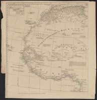
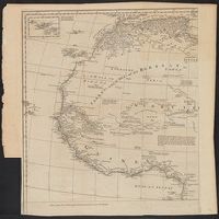
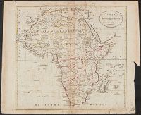
" R. Spoffort Sc.", Appears in "A new sett of maps both of ancient and present geography"., Relief shown pictorially., and Shows boundaries, rivers, deserts, caravan routes, and principal settlements, with unexplored areas.
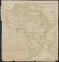
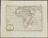
Africa, plate Ist. The northwest part / examined and revised by Mr. Bolton -- Africa, plate II. The northeast part -- Africa, plate IIId. The southwest part -- Africa, plate IV. The southeast part. and Appears in Postlethwayt's Universal dictionary of trade a
Publisher:
s.n.,
Subject (Geographic):
Africa--Maps--Earlyworksto1800
Subject (Name):
Bolton, Solomon, d. ca. 1768, Bowen, Emanuel, d. 1767, Orléans, Louis Philippe, duc d', 1725-1785, and Postlethwayt, Malachy, 1707?-1767. Universal dictionary of trade and commerce. 1766
Africa, plate Ist., The northwest part / examined and revised by Mr. Bolton -- Africa, plate II, The northeast part -- Africa, plate IIId., The southwest part -- Africa, plate IV, The southeast part. and Appears in Postlethwayt's Universal dictionary of trade
Publisher:
s.n.,
Subject (Geographic):
Africa--Maps--Earlyworksto1800
Subject (Name):
Bolton, Solomon, d. ca. 1768, Bowen, Emanuel, d. 1767, Orléans, Louis Philippe, duc d', 1725-1785, and Postlethwayt, Malachy, 1707?-1767. Universal dictionary of trade and commerce. 1774
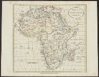
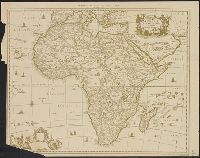
Africa distinguished into its principall parts viz. Barbary, Biledulgerid, Egypt, Zaara or the Desart, the Country of the Negroes, Guinea, Nubia, Abissinea, Zanguebar, Congo, Monomotapa, Caffrares, the Islands of the Canaries, Cape Verd, St. Thomas, Madagascar or St. Lawrence in which are observed the empires, monarchies, kingdomes, states and peoples, which at present inhabite Africa
Description:
Ferro meridian., No. 56 of 69 maps bound together in composite atlas., Relief shown pictorially., Scale [ca 1:34 000 000]., and To the most serene and most sacred majesty of Charles II, by the grace of God, king of Great Brittain, France, and Ireland, this map of Africa is humbly dedicated and presented by your majesties loyal subject and servant, William Berry.
Publisher:
Sold by William Berry at the sign of the globe between Charing Cross and White-Hall
"Engraved for Carey's American edition of Guthrie's Geography improved.", Has watermarks., Prime meridian: Philadelphia., and Relief shown pictorially.