Skip to search
Skip to main content
Skip to first result
Search
You Searched For
"Michigan"
Repository
Beinecke Rare Book and Manuscript Library
Genre
Maps
Language
English
New Search
Search Results
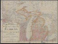
Creator:
Published / Created:
1879
Call Number:
811 1879
Container / Volume:
BRBL_00552
Image Count:
1
Resource Type:
Maps, Atlases & Globes
Alternative Title:
Michigan with a new and original index.
Description:
Also shows counties and railroads of adjacent parts of Wisconsin, Illinois, Indiana, Iowa, and Ontario. and Relief shown by hachures.
Publisher:
Rand, McNally & Co.,
Subject (Geographic):
Michigan --Administrative and political
Subject (Topic):
Railroads--Michigan --Maps
Found in:
Beinecke Rare Book and Manuscript Library > Rand, McNally & Co.'s township, county and railroad map of Michigan and the entire Upper Lake Region : showing the celebrated mining districts of the Upper Peninsula / compiled from the U.S. Land Office and Lake Surveys, County Surveys, etc.
Creator:
Published / Created:
[1900?]
Call Number:
811am D48 1900
Container / Volume:
BRBL_00554
Image Count:
2
Resource Type:
Maps, Atlases & Globes
Description:
interest in southeast Michigan ; chart for
Publisher:
Calvert Lith. Co.,
Subject (Geographic):
Detroit (Mich.)--Description and travel, Detroit (Mich.)--Maps, Detroit Metropolitan Area (Mich.)--Description and travel, and Detroit Metropolitan Area (Mich.)--Maps
Subject (Topic):
Street-railroads--Michigan --Detroit
Found in:
Beinecke Rare Book and Manuscript Library > Trolley rides in city and country [cartographic material] : to charming rural scenery, beautiful lakes and majestic rivers via Detroit United Railway.
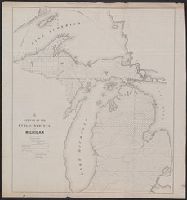
Creator:
Published / Created:
[1857].
Call Number:
753gme 1858
Container / Volume:
BRBL_00415
Image Count:
1
Resource Type:
Maps, Atlases & Globes
Description:
Mackinaw connecting Lake Michigan and Lake
Publisher:
Middleton, Strobridge & Co.,
Subject (Geographic):
Canada--Maps, Great Lakes (North America)--Maps, and Middle West--Maps
Subject (Name):
Canadian Pacific Railway Company--Maps and Northern Pacific Railroad Company--Maps
Subject (Topic):
Counties--Michigan --Maps
Found in:
Beinecke Rare Book and Manuscript Library > Map illustrating the Canada Pacific and Northern Pacific and other proposed Railroads, connecting at Straits of Mackinaw : Also showing the position of Mackinaw City.
Published / Created:
1844
Call Number:
755 1844
Container / Volume:
BRBL_00441
Image Count:
1
Resource Type:
Maps, Atlases & Globes
Description:
the printed maps of Michigan , 1804-1880
Publisher:
J.H. Colton,
Subject (Geographic):
East (U.S.)--Maps
Found in:
Beinecke Rare Book and Manuscript Library > Guide through Ohio, Michigan, Indiana, Illinois, Missouri, Wisconsin & Iowa by J. Calvin Smith ...
Creator:
Published / Created:
1841]
Call Number:
811fcm 1840
Container / Volume:
BRBL_00554
Image Count:
1
Resource Type:
Maps, Atlases & Globes
Description:
Shows all of Michigan north of Grand
Publisher:
U.S. Congress,
Subject (Geographic):
Michigan --Maps
Subject (Name):
De La Vergne, Earl W. pro
Found in:
Beinecke Rare Book and Manuscript Library > Sketch of the public surveys in the north part of Michigan / lith. of P. Haas.
Creator:
Published / Created:
1850
Call Number:
811fcm 1850
Container / Volume:
BRBL_00554
Image Count:
1
Resource Type:
Maps, Atlases & Globes
Description:
At head of title: G.
Publisher:
U.S. Congress],
Subject (Geographic):
Michigan --Maps
Found in:
Beinecke Rare Book and Manuscript Library > Sketch of the public surveys in Michigan / Surveyor General's Office, Detroit, November 12th, 1850, Charles Noble, Surveyor General.
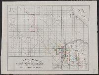
Creator:
Published / Created:
[ca. 1870]
Call Number:
811gfc P831 1870
Container / Volume:
BRBL_00554
Image Count:
1
Resource Type:
Maps, Atlases & Globes
Description:
Oriented with north to the right.
Publisher:
J.O. Seymour & Co.,
Subject (Geographic):
Houghton County (Mich.)--Maps
Subject (Name):
Globe Copper Company and Globe Copper Company--Maps
Subject (Topic):
Copper mines and mining--Michigan
Found in:
Beinecke Rare Book and Manuscript Library > Map of property of the Globe Copper Company and mines in the Portage Lake District.
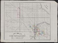
Published / Created:
1855
Call Number:
811ca 1855
Container / Volume:
BRBL_00554
Image Count:
1
Resource Type:
Maps, Atlases & Globes
Description:
United States for the State of Michigan ".
Publisher:
s.n.,]
Subject (Geographic):
Michigan --Maps
Found in:
Beinecke Rare Book and Manuscript Library > [Western part of upper peninsula, Michigan].
Creator:
Published / Created:
1892
Call Number:
811 H867 1892
Container / Volume:
BRBL_00553
Image Count:
1
Resource Type:
Maps, Atlases & Globes
Description:
Lenawee County, Michigan . [Adrian, Mich
Publisher:
George B. Cadwell & Co.],
Subject (Geographic):
Hudson (Mich.)--Maps
Subject (Name):
Lenawee County, Michigan
Subject (Topic):
Real property--Michigan --Hudson--Maps
Found in:
Beinecke Rare Book and Manuscript Library > Map of Hudson : compiled expressly for the Lenawee Co. atlas.
Branch:v1.61.8 ,Deployed:2024-06-20T11:14:48-04:00