Skip to search
Skip to main content
Skip to first result
Search
You Searched For
Genre
Maps
Language
English
New Search
Search Results
Published / Created:
1821
Call Number:
51 1821
Container / Volume:
BRBL_00279
Image Count:
1
Resource Type:
Maps, Atlases & Globes
Description:
The routes of 9 travelers or explorers are shown.
Subject (Geographic):
Palestine--Maps
Found in:
Beinecke Rare Book and Manuscript Library > A new map of Palestine and the adjacent countries ... Drawn & Engraved by Richard Palmer, Somerstown.
Creator:
Published / Created:
1856?]
Call Number:
51 1856
Container / Volume:
BRBL_00279
Image Count:
1
Resource Type:
Maps, Atlases & Globes
Description:
From: Handbook for travellers in Syria and Palestine, London, 1858, by John Murray. and Two insets: Sketch Map of Jerusalem reduced from the Plan of Symmonds & Tobler and Environs of Jerusalem.
Publisher:
John Murray,
Subject (Geographic):
Palestine--Maps
Subject (Name):
Murray, John. Handbook for travellers in Syria and Palestine, Robinson, Edward, 1794-1863, and Smith, Eli, 1801-1857
Found in:
Beinecke Rare Book and Manuscript Library > A new map of Palestine including also Phoenicia and Coelesyria / Constructed principally from unpublished materials furnished by Ed. Robinson and Eli Smith and J.L. Porter, by Henry Kiepert, 1856.
Published / Created:
1811
Call Number:
534 1811A
Container / Volume:
BRBL_00289
Image Count:
1
Resource Type:
Maps, Atlases & Globes
Publisher:
J. Cary,
Subject (Geographic):
Persia--Maps
Found in:
Beinecke Rare Book and Manuscript Library > A new map of Persia ... By John Cary, Engraver.
Creator:
Call Number:
401 1811
Container / Volume:
BRBL_00233
Image Count:
1
Resource Type:
Maps, Atlases & Globes
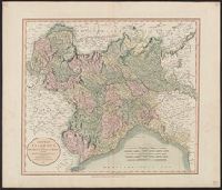
Description:
Hand colored. Stamp: Karpinski-von Wieser Map Collection. Label: 17., Meridian: Greenwich., and Relief shown by hachures.
Subject (Geographic):
Genoa (Italy : Province)--Maps, Milan (Italy : Province)--Maps, Piedmont (Italy)--Maps, and Savoy (France and Italy)--Maps
Found in:
Beinecke Rare Book and Manuscript Library > A new map of Piedmont, the duchies of Savoy and Milan, and the republic of Genoa, with their subdivisions : from the latest authorities / by John Cary.
Creator:
Published / Created:
Augst. 1. 1799.
Call Number:
401 1799
Container / Volume:
BRBL_00233
Image Count:
1
Resource Type:
Maps, Atlases & Globes
Description:
Greenwich meridian., Hand colored. Stamp: Karpinski-von Wieser Map Collection. Label: 17., and Relief shown by hachures.
Publisher:
Printed for J. Cary ...,
Subject (Geographic):
Genoa (Italy : Province)--Maps--Early works to 1800, Milan (Italy : Province)--Maps--Early works to 1800, Piedmont (Italy)--Maps--Early works to 1800, and Savoy (France and Italy)--Maps--Early works to 1800
Found in:
Beinecke Rare Book and Manuscript Library > A new map of Piedmont, the duchies of Savoy and Milan, and the republic of Genoa, with their subdivisions : from the latest authorities / by John Cary.
Published / Created:
1811
Call Number:
356 1772-1811
Container / Volume:
BRBL_00113
Image Count:
1
Resource Type:
Maps, Atlases & Globes
Publisher:
J. Cary,
Subject (Geographic):
Poland--Maps
Found in:
Beinecke Rare Book and Manuscript Library > A new map of Poland and the Grand Duchy of Lithuania ... between Austria, Russia, and Prussia in 1772, 1793, & 1795 ... By John Cary, Engraver. 1811.
Published / Created:
1811
Call Number:
326 1811
Container / Volume:
BRBL_00070
Image Count:
2
Resource Type:
Maps, Atlases & Globes
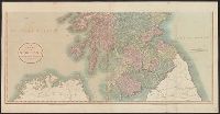
Description:
Preliminary record.
Publisher:
J. Cary,
Subject (Geographic):
Scotland--Maps
Found in:
Beinecke Rare Book and Manuscript Library > A new map of Scotland ... by John Cary, Engraver.
Published / Created:
1793
Call Number:
407 1793
Container / Volume:
BRBL_00237
Image Count:
1
Resource Type:
Maps, Atlases & Globes
Publisher:
Printed for Robert Sayer ... ,
Subject (Geographic):
Naples (Kingdom)--Maps--Early works to 1800
Found in:
Beinecke Rare Book and Manuscript Library > A new map of Sicily the First, or the kingdom of Naples : drawn with several additions, from Zannoni's map published by order of the King of the Two Sicilies.
Published / Created:
1799
Call Number:
407 1799
Container / Volume:
BRBL_00237
Image Count:
1
Resource Type:
Maps, Atlases & Globes
Publisher:
Published ... by Laurie & Whittle ... ,
Subject (Geographic):
Naples (Kingdom)--Maps--Early works to 1800
Found in:
Beinecke Rare Book and Manuscript Library > A new map of Sicily the First, or the kingdom of Naples : drawn with several additions, from Zannoni's map published by order of the King of the Two Sicilies.
Published / Created:
1794
Call Number:
90 1794A
Container / Volume:
BRBL_00731
Image Count:
2
Resource Type:
Maps, Atlases & Globes
Description:
Originally printed in 4 sections.
Publisher:
Laurie & Whittle,
Subject (Geographic):
South America--Maps--Early works to 1800
Found in:
Beinecke Rare Book and Manuscript Library > A new map of South America ... from Mr. d'Anville ...
Branch:v1.61.6 ,Deployed:2024-06-12T09:55:37-04:00