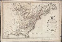
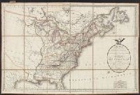
Veue et perspective de la ville de Londre, Westminster et Parc St. Jacques and View of London and Westminster by John Kip, circa 1710-1720
Description:
"To Her Royal Highness Wilhelmina Carolina, the most illustrious Princess of Wales, this prospect of London, Westminster & St. James's Park is most humbly dedicated by John Kip.", In lower margin: Key to selected buildings or places of interest,, and Panorama.
Publisher:
London Topographical Society,
Subject (Geographic):
London (England)--Pictorial works--Early works to 1800--Facsimiles
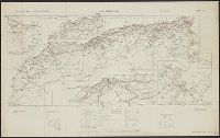
Great Britain. War Office. General Staff. Geographical Section
Published / Created:
1942
Call Number:
66gmb 1942
Container / Volume:
BRBL_00348
Image Count:
1
Resource Type:
Maps, Atlases & Globes
Alternative Title:
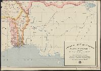
[G.S.G.S.] 4256 and GSGS (Series) ; 4256.
Description:
"Copied from a French (Michelin) map [sheet 151] dated 1939.", Includes index map and 3 insets: Région Meknès-Fes -- Région d'Oran -- Ré, Legend in French and English., and Shows roads, railroads, administrative boundaries, distances, and service facilities.
Publisher:
GSGS,
Subject (Geographic):
Africa, North--Maps
Subject (Name):
Pneu Michelin (Firm)
Subject (Topic):
Roads--Africa, North--Maps, Roads--Algeria--Maps, Roads--Morocco--Maps, and Roads--Tunisia--Maps
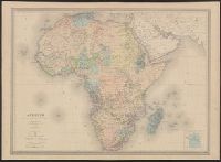
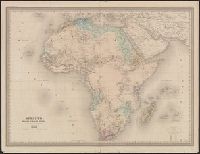
Atlas national, illustré, des 86 départments et des possessions de la France.
Description:
"Ancien continent.", Appears in the author's Atlas national, illustré, des 86 départments et des possessions de la France, 1852., In upper left: Atlas universel illustré., and Includes ill., views of Alexandria, Cairo, and Algiers, population list, and text.
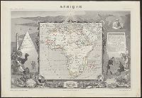
"11-98" at bottom below neat line., [Ancillary map 1], [Ancillary map 2], [Ancillary map 3], [Ancillary map 4], [Ancillary map 5], Bottom of verso: "M. Chesneau.", From Franz Schrader's Atlas de Géographie Moderne., Grands lacs comparés au lac de Genéve --, Hachure and spot-heigh relief., Le Cap [showing water depths] --, Legend., Principaux itinéraires [Africa South of Equator] --, Races [Inset map: [Madagascar]], Réseau navigable du bassin du Congo --, Shows possessions and protectorates by colonial powers, railroads, land routes, water ways, region names, islands, towns., and Verso includes various statistical, trade, communications, and historical information on various African countries, with 5 ancillary maps.
Publisher:
La Librairie Hachette et Cie.,
Subject (Geographic):
Africa--Maps
Subject (Name):
Schrader, Franz, 1844-1924. Atlas de Géographie Moderne.