Search
You Searched For
Search Results
- Creator:
- Homann Erben (Firm)
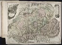
Mayer, Tobias, 1723-1762
- Published / Created:
- ca. 1751
- Call Number:
- 1983 Folio 23
- Collection Title:
- [Atlas factice of 50 maps, primarily by Johann Baptist Homann and/or issued by the Homann Erben
- Image Count:
- 1
- Found in:
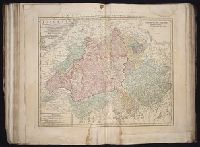
- Beinecke Rare Book and Manuscript Library > Helvetia tredecim statibvs liberis, quos cantones vocant composita: una cum foederatis & subjectis provinciis, ex probatissimis subsidiis
- Creator:
- Dorn, Sebastian
Hase, Johann Matthias, 1684-1742
Homann Erben (Firm)
- Published / Created:
- 1744
- Call Number:
- 1983 Folio 23
- Collection Title:
- [Atlas factice of 50 maps, primarily by Johann Baptist Homann and/or issued by the Homann Erben
- Image Count:
- 1
- Found in:
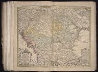
- Beinecke Rare Book and Manuscript Library > Hvngariae ampliori significatu et veteris vel methodicae, complexae regna: Hvngariae Propriae, Croatiae, Dalmatiae, Bosniae, Serviae, Bvlgariae, Cvmaniae, principatvm: Transylvaniae, despotatvs: Walachiae, Moldaviae (exclusis ab eadem alienatis Galitia et
- Creator:
- Gussefeld, F. L. (Franz Ludwig), 1744-1807
Homann Erben (Firm)
- Published / Created:
- 1786
- Call Number:
- 1983 Folio 23
- Collection Title:
- [Atlas factice of 50 maps, primarily by Johann Baptist Homann and/or issued by the Homann Erben
- Image Count:
- 1
- Found in:
- Beinecke Rare Book and Manuscript Library > Charte das Russische Reich, und die von den Tatarn bewohnte Laender in Europa und Asien enthaltend [cartographic material] / entworfen von F.L. Guessefeld = Carte de l'Empire de Russie et de la Grande Tatarie / dressee avec soin par F.L. Guessefeld
- Creator:
- Boehm, August Gottlieb
Homann Erben (Firm)
- Published / Created:
- 1766
- Call Number:
- 1983 Folio 23
- Collection Title:
- [Atlas factice of 50 maps, primarily by Johann Baptist Homann and/or issued by the Homann Erben
- Image Count:
- 1
- Found in:
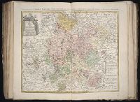
- Beinecke Rare Book and Manuscript Library > Totius Danubii cum adjacentibus regnis nec non totius Graeciae et archipelagi [cartographic material] : novissima tabula ex recentissimis subsidiis concinnata et ad leges projectionis stereographicae legitimae / reducta ab Augusto Gottlob Boehmio ...
- Creator:
- Dorn, Sebastian
Homann Erben (Firm)
Rizzi-Zannoni, Giovanni Antonio, 1736-1814
- Published / Created:
- 1764
- Call Number:
- 1983 Folio 23
- Collection Title:
- [Atlas factice of 50 maps, primarily by Johann Baptist Homann and/or issued by the Homann Erben
- Image Count:
- 1
- Found in:
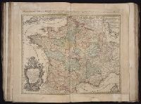
- Beinecke Rare Book and Manuscript Library > Tres nouvelle Carte du Royaume de France [cartographic material] : divise en toutes les Provinces et Gouvernements dressee sur une nouvelle observation astronomique faite aux environ du Globe, assujetie aux memoires du feu M. Cassini de Thury, dans toute
- Creator:
- Guessefeld, F. L. (Franz Ludwig), 1744-1807
Homann Erben (Firm)
Schmidt, I. M.
- Published / Created:
- 1782
- Call Number:
- 1983 Folio 23
- Collection Title:
- [Atlas factice of 50 maps, primarily by Johann Baptist Homann and/or issued by the Homann Erben
- Image Count:
- 1
- Found in:
- Beinecke Rare Book and Manuscript Library > Der Fraenkische Kreis / [cartographic material] / von F.L. Guessefeld = Charte geographique du Cercle de Franconie / dressee nouvellement par F.L. Guessefeld
- Creator:
- Guessefeld, Franz Ludwig, 1744-1808
Homanniorum Heredum
- Published / Created:
- MDCCLXXXIV [1784]
- Call Number:
- 1983 Folio 23
- Collection Title:
- [Atlas factice of 50 maps, primarily by Johann Baptist Homann and/or issued by the Homann Erben
- Image Count:
- 1
- Found in:
- Beinecke Rare Book and Manuscript Library > Repraesentationem hancce Circuli Saxonici Inferioris [cartographic material] : ad mentem domini D. Buesching, et ex novissimis ac praestantissimis observationibus delineavit F. L. Guessefeld
- Creator:
- Harenberg, Johann Christoph, 1696-1774
Homann Erben (Firm)
- Published / Created:
- ca. 1750
- Call Number:
- 1983 Folio 23
- Collection Title:
- [Atlas factice of 50 maps, primarily by Johann Baptist Homann and/or issued by the Homann Erben
- Image Count:
- 1
- Found in:
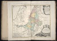
- Beinecke Rare Book and Manuscript Library > Palaestina in XII tribus divisa cum terris adiacentibus / [cartographic material] / denuo revisa & copiosior reddita studio Iohannis Christoph Harenbergh, Praep. S. Laur. Schening
- Creator:
- Homann Erben (Firm)
Ovalle, Alonso de, 1601-1651
Techo, Nicolas del, 1611-1685
- Published / Created:
- A. MDCCXXXIII [1733]
- Call Number:
- 1975 Folio 31
- Collection Title:
- [Atlas factice of 42 maps, produced by the Homann Erben firm]
- Image Count:
- 1
- Found in:
- Beinecke Rare Book and Manuscript Library > Typus geographicus [cartographic material] : Chili a Paraguay freti Magellanici &c., ex. PPbg. Alfonso d'Ovalle & Nicol. Techo nec non de Brouwer, Narbouroug, de Beauchesne &c., a Guiliel de l'Islio descripta, insuperque secundum recentiores du Frezier re
- Creator:
- Hase, Johann Matthias, 1684-1742
Homann Erben (Firm)
Reinsberger, Johann Christoph
- Published / Created:
- A. MDCCXXXXIII [1743]
- Call Number:
- 1975 Folio 31
- Collection Title:
- [Atlas factice of 42 maps, produced by the Homann Erben firm]
- Image Count:
- 1
- Found in:
- Beinecke Rare Book and Manuscript Library > Europa, secundum legitimas projectionis stereographicae regulas : et juxta recentissimas observationes aeque ac relationes adhibitis quoq[ue] veterum monumentorum subsidiis / descripta et in partes suas methodicas X divisa a Ioh. Matth. Hasio, Math. P.P.O
- Creator:
- Homann Erben (Firm)
L'Isle, Guillaume de, 1675-1726
- Published / Created:
- 1741
- Call Number:
- 1975 Folio 31
- Collection Title:
- [Atlas factice of 42 maps, produced by the Homann Erben firm]
- Image Count:
- 1
- Found in:
- Beinecke Rare Book and Manuscript Library > Regni Galliae seu Franciae et Navarrae [cartographic material] : tabula geographica in usum elementorum geographiae schazianorum accom[m]odata / per Homannianos Heredes
- Creator:
- Homann, Johann Baptist, 1663-1724
- Published / Created:
- 1742?
- Call Number:
- 1975 Folio 31
- Collection Title:
- [Atlas factice of 42 maps, produced by the Homann Erben firm]
- Image Count:
- 1
- Found in:
- Beinecke Rare Book and Manuscript Library > Praefectura Generalis & Comitatus Provinciae una cum Terris adjacentibus in suas Dioeceses & Praeturas subdivisus ad prototypum del Islianum / [cartographic material] / excusus studion Homannianorum Heredum
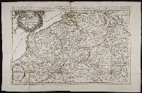
- Creator:
- Homann Erben (Firm)
Mayer, Tobias, 1723-1762
Schneider, R. A.
- Published / Created:
- 1747 [i.e. 1748?]
- Call Number:
- 1975 Folio 31
- Collection Title:
- [Atlas factice of 42 maps, produced by the Homann Erben firm]
- Image Count:
- 1
- Found in:
- Beinecke Rare Book and Manuscript Library > Belgii universi seu inferioris Germaniae quam XVII provinciae Austriaco Gallico et Batavo sceptro parentes constituunt nova tabula geographica / [cartographic material] / a Tobia Majero, Math. Cult. ad leges legitimae delineationis revocata
- Creator:
- Cassini, Cesar-Francois, 1714-1784
Mayer, Tobias, 1723-1762
Snellius, Willebrord, 1580-1626
- Published / Created:
- 1747
- Call Number:
- 1975 Folio 31
- Collection Title:
- [Atlas factice of 42 maps, produced by the Homann Erben firm]
- Image Count:
- 1
- Resource Type:
- Maps, Atlases & Globes
- Found in:
- Beinecke Rare Book and Manuscript Library > Belgivm Catholicvm seu decem provinciae Germaniae inferioris : cum confiniis Germaniae svp. et Franciae legitime omnia delineata et ad ductum observationum astronomicarum, nec non geometricarum operationum a Cassinio Snellio Muschenbrokio aliisqve rite ha
- Creator:
- Homann Erben (Firm)
Mayer, Tobias, 1723-1762
- Published / Created:
- 1748
- Call Number:
- 1975 Folio 31
- Collection Title:
- [Atlas factice of 42 maps, produced by the Homann Erben firm]
- Image Count:
- 1
- Found in:
- Beinecke Rare Book and Manuscript Library > Statvs Ecclesiastici nec non Magni Ducatvs Toscanae nova tabula geographica [cartographic material] / secundum prinicipia legitimae delineationis descripta a Tob. Majero, Societ. Geogr. Sodali
- Creator:
- Homann Erben (Firm)
Homann, Johann Baptist, 1663-1724
- Published / Created:
- ca. 1741
- Call Number:
- 1975 Folio 31
- Collection Title:
- [Atlas factice of 42 maps, produced by the Homann Erben firm]
- Image Count:
- 2
- Found in:
- Beinecke Rare Book and Manuscript Library > Imperii Romano Germanici in svos statvs et circvlos divisi tabvla generalis in ufus iuventutis erundiendae accommodata / a Ioh Bapt Homanno, S.C.M. Geographo, Reg. Boruss. Societ. Scient. Sodali
- Creator:
- Homann Erben (Firm)
Muller, J. C. (Johann Christoph), 1673-1721
- Published / Created:
- ca. 1730?
- Call Number:
- 1975 Folio 31
- Collection Title:
- [Atlas factice of 42 maps, produced by the Homann Erben firm]
- Image Count:
- 2
- Found in:
- Beinecke Rare Book and Manuscript Library > Bohemiae Regnum in XII Circulos divisum [cartographic material] : cum Com. Glac. et Distr. Egerano ceterisq[ue] circumjacentibiis terris / ex Muellerianis aliisq[ue] chorographicis subsidys delineatum nunc noviter revisum et emendatius per Homannianos Her
- Creator:
- Hase, Johann Matthias, 1684-1742
Homann Erben (Firm)
Mayer, Tobias, 1723-1762
- Published / Created:
- 1745
- Call Number:
- 1975 Folio 31
- Collection Title:
- [Atlas factice of 42 maps, produced by the Homann Erben firm]
- Image Count:
- 1
- Found in:
- Beinecke Rare Book and Manuscript Library > Dvcatvs Silesiae tabvla geographica prima inferiorem eivs partem, seu novem principatvs, quorum insignia hic adjecta sunt, secundum statum recentissimium complectens / [cartographic material] / ad mentem Hasiani avtographi majoris legitime delineata et ed
- Creator:
- Hase, Johann Matthias, 1684-1742
Homann Erben (Firm)
Lowitz, G. M. (George Moritz), 1722-1774
- Published / Created:
- 1746
- Call Number:
- 1975 Folio 31
- Collection Title:
- [Atlas factice of 42 maps, produced by the Homann Erben firm]
- Image Count:
- 1
- Found in:
- Beinecke Rare Book and Manuscript Library > Planiglobii terrestris mappa universalis utrumq[ue] hemisphaerium orient. et occidentale repraesentans, ex IV. mappis generalibus, Hasianis composita et adjectis ceteris hemisphaeriis / [cartographic material] / designata a G.M. Lowizio ; excudentibus Hom
- Creator:
- Hase, Johann Matthias, 1684-1742
Homann Erben (Firm)
- Published / Created:
- 1746
- Call Number:
- 1975 Folio 31
- Collection Title:
- [Atlas factice of 42 maps, produced by the Homann Erben firm]
- Image Count:
- 1
- Found in:
- Beinecke Rare Book and Manuscript Library > Dvcatvs Silesiae tabvla altera svperiorem Silesiam exhibens / [cartographic material] / ex mappa Hasiana majore desumta & excusa per Homan[n]ianos Heredes
- Creator:
- Homann Erben (Firm)
Mayer, Tobias, 1723-1762
- Published / Created:
- 1747
- Call Number:
- 1975 Folio 31
- Collection Title:
- [Atlas factice of 42 maps, produced by the Homann Erben firm]
- Image Count:
- 1
- Found in:
- Beinecke Rare Book and Manuscript Library > S.R.I. circulus Austriacus [cartographic material] : quem componunt archid. Austriae, ducatus Stiriae, Carinthiae, Carnioliae, comit. Tyrolensis, ditionesque Sueviae austriacae, cum suis confiniis / a Tobia Majero ; curantibus Homannianis Heridibus, C.P.S
- Creator:
- Boehm, Augustus Gottlieb
Hase, Johann Matthias, 1684-1742
Homann Erben (Firm)
- Published / Created:
- 1744
- Call Number:
- 1975 Folio 31
- Collection Title:
- [Atlas factice of 42 maps, produced by the Homann Erben firm]
- Image Count:
- 1
- Found in:
- Beinecke Rare Book and Manuscript Library > Asia secundvm legitimas projectionis stereographicae regvlas et jvxta recentissimas observationes [cartographic material] : et relationes explosis aliorum fabulosis designationibus et narrationibus, adhibitis quoque veterum monumentis et recentiorum itine
- Creator:
- Harenberg, Johann Christoph, 1696-1774
Homann Erben (Firm)
- Published / Created:
- 1744
- Call Number:
- 1975 Folio 31
- Collection Title:
- [Atlas factice of 42 maps, produced by the Homann Erben firm]
- Image Count:
- 1
- Found in:
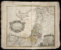
- Beinecke Rare Book and Manuscript Library > Palaestina seu terra olim sancta tum duodecim tribubus distributa tum a Davide et Salomone ... / [cartographic material] / delineavit I.C. Harenberg
- Creator:
- Jaillot, Alexis Hubert, 1632-1712
Mortier, Pierre
Sanson, Guillaume
- Published / Created:
- [1692?]
- Call Number:
- Folio 469
- Collection Title:
- [Atlas factice of 13 maps by Nicolaes Visscher I, Nicolaes Visscher II, Guillaume Sanson, and
- Image Count:
- 1
- Found in:
- Beinecke Rare Book and Manuscript Library > Le Royaume de France distingue suivant l’estenduee de toutes ses provinces et ses acquisitions [cartographic material] : dans l’Espagne, dans l’Italie, dans l’Allemagne, et dans la Flandre, l’Artois, le Haynaut, le Namur, et le Luxembourg, Provinces des P
- Creator:
- Jaillot, Alexis Hubert, 1632-1712
Mortier, Pierre
Sanson, Guillaume
- Published / Created:
- 1691
- Call Number:
- Folio 469
- Collection Title:
- [Atlas factice of 13 maps by Nicolaes Visscher I, Nicolaes Visscher II, Guillaume Sanson, and
- Image Count:
- 1
- Found in:
- Beinecke Rare Book and Manuscript Library > Les Provinces des Pays-Bas catholiques [cartographic material] : distinguees suivant qu’elles sont presentement partagees entre le Roy de France, le Roy d’Espagne et les Estats Generaux des Provinces-Unies / presentees au Roy par ... Guillaume Sanson Geog
- Creator:
- Hase, Johann Matthias, 1684-1742
Homann Erben (Firm)
- Published / Created:
- A. MDCCXXXXIII [1743]
- Call Number:
- 1973 Folio 30
- Collection Title:
- [Atlas factice of 32 maps and 1 distance table, produced by the Homann Erben firm]
- Image Count:
- 1
- Found in:
- Beinecke Rare Book and Manuscript Library > Europa, secundum legitimas projectionis stereographicae regulas [cartographic material] : et juxta recentissimas observationes aeque ac relationes adhibitis quoq[ue] veterum monumentorum subsidiis / descripta et in partes suas methodicas X divisa a Ioh. M
- Creator:
- Boehm, Augustus Gottlieb
Hase, Johann Matthias, 1684-1742
Homann Erben (Firm)
- Published / Created:
- 1744
- Call Number:
- 1973 Folio 30
- Collection Title:
- [Atlas factice of 32 maps and 1 distance table, produced by the Homann Erben firm]
- Image Count:
- 2
- Found in:
- Beinecke Rare Book and Manuscript Library > Asia secundum legitimas projectionis stereographicae regulas et juxta recentissimas observation [cartographic material] : et relationes explosis aliorum fabulosis designationibus et narrationibus, adhibitis quoque veterum monumentis et recentiorum itinera
- Creator:
- Homann Erben (Firm)
Mayer, Tobias, 1723-1762
- Published / Created:
- a. 1751
- Call Number:
- 1973 Folio 30
- Collection Title:
- [Atlas factice of 32 maps and 1 distance table, produced by the Homann Erben firm]
- Image Count:
- 2
- Found in:
- Beinecke Rare Book and Manuscript Library > Helvetia tredecim statibvs liberis, qvos cantones vocant composita [cartographic material] : una cum foederatis & subjectis provinciis, ex probatissimis subsidiis / geographice delineata per Dm. Tobiam Mayerum, Professorem Matth., Goettingensem
- Creator:
- Homann Erben (Firm)
Mayer, Tobias, 1723-1762
- Published / Created:
- 1750
- Call Number:
- 1973 Folio 30
- Collection Title:
- [Atlas factice of 32 maps and 1 distance table, produced by the Homann Erben firm]
- Image Count:
- 2
- Found in:
- Beinecke Rare Book and Manuscript Library > Mappa geographica Regni Poloniae [cartographic material] : ex novissimis quotquot sunt mappis specialibus composita et ad L.L. stereographicae projectionis / revocata a Tob. Mayero, S.C.S.
- Creator:
- Dorn, Sebastian
Hase, Johann Matthias, 1684-1742
Homann Erben (Firm)
- Published / Created:
- 1744
- Call Number:
- 1973 Folio 30
- Collection Title:
- [Atlas factice of 32 maps and 1 distance table, produced by the Homann Erben firm]
- Image Count:
- 2
- Found in:
- Beinecke Rare Book and Manuscript Library > Hvngariae ampliori significatu et veteris vel methodicae, complexae regna: Hvngariae Propriae, Croatiae, Dalmatiae, Bosniae, Serviae, Bvlgariae, Cvmaniae, principatvm: Transylvaniae, despotatvs: Walachiae, Moldaviae (exclusis ab eadem alienatis Galitia et
- Creator:
- Hase, Johann Matthias, 1684-1742
Homann Erben (Firm)
Lowitz, G. M. (George Moritz), 1722-1774
- Published / Created:
- 1746
- Call Number:
- 1973 Folio 30
- Collection Title:
- [Atlas factice of 32 maps and 1 distance table, produced by the Homann Erben firm]
- Image Count:
- 1
- Found in:
- Beinecke Rare Book and Manuscript Library > Planiglobii terrestris mappa universalis utrumq[ue] hemisphaerium orient. et occidentale repraesentans, ex IV. mappis generalibus, Hasianis composita et adjectis ceteris hemisphaeriis / [cartographic material] / designata a G.M. Lowizio ; excudentibus Hom
- Creator:
- Homann Erben (Firm)
L’Isle, Guillaume de, 1675-1726
- Published / Created:
- 1741
- Call Number:
- 1973 Folio 30
- Collection Title:
- [Atlas factice of 32 maps and 1 distance table, produced by the Homann Erben firm]
- Image Count:
- 2
- Found in:
- Beinecke Rare Book and Manuscript Library > Regni Galliae seu Franciae et Navarrae [cartographic material] : tabula geographica in usum elementorum geographiae schazianorum accom[m]odata / per Homannianos Heredes
- Creator:
- Homann Erben (Firm)
Mayer, Tobias, 1723-1762
- Published / Created:
- 1748
- Call Number:
- 1973 Folio 30
- Collection Title:
- [Atlas factice of 32 maps and 1 distance table, produced by the Homann Erben firm]
- Image Count:
- 2
- Found in:
- Beinecke Rare Book and Manuscript Library > Belgii universi seu inferioris Germaniae quam XVII provinciae Austriaco Gallico et Batavo sceptro parentes constituunt nova tabula geographica / [cartographic material] / a Tobia Majero, Math. Cult. ad leges legitimae delineationis revocata
- Creator:
- Cassini, Cesar-Francois, 1714-1784
Homann Erben (Firm)
Mayer, Tobias, 1723-1762
Snellius, Willebrord, 1580-1626
- Call Number:
- 1973 Folio 30
- Collection Title:
- [Atlas factice of 32 maps and 1 distance table, produced by the Homann Erben firm]
- Image Count:
- 2
- Found in:
- Beinecke Rare Book and Manuscript Library > Belgivm Catholicvm seu decem provinciae Germaniae inferioris : cum confiniis Germaniae svp. et Franciae legitime omnia delineata et ad ductum observationum astronomicarum, nec non geometricarum operationum a Cassinio Snellio Muschenbrokio aliisqve rite ha
- Creator:
- Homann Erben (Firm)
Homann, Johann Baptist, 1663-1724
- Published / Created:
- [1746?]
- Call Number:
- 1973 Folio 30
- Collection Title:
- [Atlas factice of 32 maps and 1 distance table, produced by the Homann Erben firm]
- Image Count:
- 2
- Found in:
- Beinecke Rare Book and Manuscript Library > Imperii Romano Germanici in svos statvs et circvlos divisi tabvla generalis in ufus iuventutis erundiendae accommodata / [cartographic material] / a Ioh Bapt Homanno, S.C.M. Geographo, Reg. Boruss. Societ. Scient. Sodali
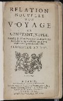
- Creator:
- Grelot, Guillaume-Joseph, b. ca. 1630
- Published / Created:
- 1681
- Call Number:
- 2007 1436
- Image Count:
- 221
- Found in:
- Beinecke Rare Book and Manuscript Library > Relation nouvelle d’un voyage de Constantinople. Enrichie de plans levez par l’auteur sur les lieux, et des figures de tout ce qu’il y a de plus remarquable dans cette ville. Presentee au roy
- Creator:
- Melling, Antoine Ignace, 1763-1831
- Published / Created:
- [1819]
- Call Number:
- 1995 Folio 11
- Image Count:
- 40
- Resource Type:
- Books, Journals & Pamphlets
- Found in:
- Beinecke Rare Book and Manuscript Library > Voyage pittoresque de Constantinople et des rives du Bosphore / d'apr es les dessins de M. Melling, architecte de l'Empereur Seå«lim III et dessinateur de la Sultane Hadidge sa soeur ; publie par MM Treuttel et Wurtz
- Published / Created:
- Undated
- Call Number:
- Taylor 232
- Collection Title:
- Mecometrie de leymant, cest a dire La maniere de mesvrer les longitudes par le moyen de l’eymant
- Image Count:
- 1
- Found in:
- Beinecke Rare Book and Manuscript Library > Orbis terrae compendiosa descriptio ex peritis simorum totius orbis gaeographorum tabulis et novissimis observationibus desumpta
- Creator:
- M. Marc Lescarbot
- Call Number:
- Z6 12
- Collection Title:
- Histoire de la Novvelle France
- Image Count:
- 1
- Found in:
- Beinecke Rare Book and Manuscript Library > Figure et descrition de la terre reconue et habitee par les Francois en la Floride et audeca, gisante par los 30-31- et 32- degrez
- Published / Created:
- 1609
- Call Number:
- Z6 12
- Collection Title:
- Histoire de la Novvelle France
- Image Count:
- 1
- Found in:
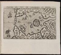
- Beinecke Rare Book and Manuscript Library > Figure du port de Ganabara au Brisil / I. Millot excudit. Auec priuilege du Roy
- Published / Created:
- [1609]
- Call Number:
- Z6 12
- Collection Title:
- Histoire de la Novvelle France
- Image Count:
- 1
- Found in:
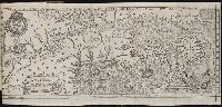
- Beinecke Rare Book and Manuscript Library > Figure de la terre neuue, grande riuiere de Canada, et cotes de l’ocean en la Nouuelle France / Ian Swelinc fecit ; I. Millot excudit ; Marcus Lescarbot nunc primum delineauit, publicauit, donauit. Auec priuilege du Roy
- Creator:
- Marc Lescarbot
- Published / Created:
- 1609
- Call Number:
- Z6 12
- Collection Title:
- Histoire de la Novvelle France
- Image Count:
- 1
- Found in:
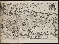
- Beinecke Rare Book and Manuscript Library > Figure du Port Royal en la Nouuelle France / par Marc Lescarbot ; Jan Swelinck sculp. ; I. Millot excudit
- Published / Created:
- [1609]
- Call Number:
- Taylor 245
- Collection Title:
- Histoire de la Novvelle France
- Image Count:
- 1
- Found in:
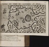
- Beinecke Rare Book and Manuscript Library > Figure du port de Ganabara au Brisil / I. Millot excudit. Auec priuilege du Roy
- Published / Created:
- [1609]
- Call Number:
- Pequot L56
- Collection Title:
- Histoire de la Nouvelle-France : contenant les navigations, decouvertes, & habitations faites par
- Image Count:
- 1
- Found in:
- Beinecke Rare Book and Manuscript Library > Figure du port de Ganabara au Brisil / I. Millot excudit. Auec priuilege du Roy
- Creator:
- Lescarbot, Marc
- Published / Created:
- [1609]
- Call Number:
- Pequot L56
- Collection Title:
- Histoire de la Nouvelle France : contenant les navigations, decouvertes, & habitations faites par
- Image Count:
- 1
- Found in:
- Beinecke Rare Book and Manuscript Library > Figure de la terre neuue, grande riuiere de Canada, et cotes de l’ocean en la Nouuelle France / Ian Swelinc fecit ; I. Millot excudit ; Marcus Lescarbot nunc primum delineauit, publicauit, donauit. Auec priuilege du Roy
- Creator:
- Lescarbot, Marc
- Published / Created:
- 1609
- Call Number:
- Pequot L56
- Collection Title:
- Histoire de la Nouvelle-France : contenant les navigations, decouvertes, & habitations faites par
- Image Count:
- 1
- Found in:
- Beinecke Rare Book and Manuscript Library > Figure du Port Royal en la Nouuelle France / par Marc Lescarbot ; Jan Swelinck sculp. ; I. Millot excudit
- Published / Created:
- 1618?
- Call Number:
- Taylor 278
- Collection Title:
- Jovrnal ou Description dv merveillevx voyage de Gvillavme Schovten, hollandois natif de Hoorn
- Image Count:
- 1
- Found in:
- Beinecke Rare Book and Manuscript Library > [Map of the world in two hemispheres]
- Published / Created:
- 1618?
- Call Number:
- Taylor 278
- Collection Title:
- Jovrnal ou Description dv merveillevx voyage de Gvillavme Schovten, hollandois natif de Hoorn
- Image Count:
- 1
- Found in:
- Beinecke Rare Book and Manuscript Library > Description de nouveau passage vers le zud du destroict de Magellan ...
- Published / Created:
- 1618?
- Call Number:
- Taylor 278
- Collection Title:
- Jovrnal ou Description dv merveillevx voyage de Gvillavme Schovten, hollandois natif de Hoorn
- Image Count:
- 1
- Found in:
- Beinecke Rare Book and Manuscript Library > Description de la grande Mer de Sud ...
- Published / Created:
- 1618?
- Call Number:
- Taylor 278
- Collection Title:
- Jovrnal ou Description dv merveillevx voyage de Gvillavme Schovten, hollandois natif de Hoorn
- Image Count:
- 1
- Found in:
- Beinecke Rare Book and Manuscript Library > [Map of Nova Guinea]
- Published / Created:
- 1612
- Call Number:
- Pequot G325
- Collection Title:
- Descriptio ac delineatio geographica detectionis freti, sive, transitus ad occasum supra terras
- Image Count:
- 1
- Found in:
- Beinecke Rare Book and Manuscript Library > Tabula nautica ...
- Published / Created:
- 1612
- Call Number:
- Taylor 258
- Collection Title:
- Descriptio ac delineatio geographica detectionis freti, sive, transitus ad occasum supra terras
- Image Count:
- 1
- Found in:
- Beinecke Rare Book and Manuscript Library > Tabula nautica, qua repraesentantur orae maritimae, meatus, ac freta, noviter a H. Hudsono Anglo ad Caurum supra Novam Franciam
- Published / Created:
- 1632
- Call Number:
- BrSides Folio 2008 15
- Collection Title:
- Les voyages de la Novvelle France occidentale, dicte Canada / faits par le Sr. de Champlain
- Image Count:
- 1
- Found in:
- Beinecke Rare Book and Manuscript Library > Carte de la Nouuelle France, augmentee depuis la derniere, seruant a la nauigation faicte en son vray Meridien, par le Sr. de Champlain pour le Roy en la Marine; lequel depuis l'an 1603 jusques en l'année 1629; a descouuert plusieurs costes, terres, lacs, ruineres, et Nations de Sauuages, par cy deuant incognuës, comme il se voit en ses relations quil a faict Imprimer en 1632, ou il se uoit cette marque [image of a flag] ce sont habitations qu'ont faict les françois. Faicte l'an 1632 par le sieur de Champlain. Scale [ca. 1:1,000,000].
- Published / Created:
- Undated
- Call Number:
- CF2221 F74
- Collection Title:
- Relation du voyage de la Mer du Sud aux cotes du Chily et du Perou : fait pendant les annees 1712
- Image Count:
- 1
- Resource Type:
- Books, Journals & Pamphlets
- Found in:
- Beinecke Rare Book and Manuscript Library > Carte redvite, pour l'intelligence du Voyage de la Mer du Sud ...
- Creator:
- Fer, Nicolas de, 1646-1720
- Published / Created:
- 1718.
- Call Number:
- 71 1718
- Image Count:
- 2
- Found in:
- Beinecke Rare Book and Manuscript Library > La France Occidentale dans l'Amérique Septentrionale : ou le cours de la Rivière de St. Laurens, aux environs de la quelle se trouvent Le Canada, L'Acadie, et la Gaspasie, Les Esquimaux, Les Hurons, Les Iroquois, Les Illinois & La Virginie, La Marie-Lande, La Pensilvanie, Le Nouveau-Jersay, La Nouvelle Yorck, La Nouvelle Angleterre et l'Isle de Terre-Neuve
- Creator:
- Labat, Jean Baptiste, 1663-1738
- Published / Created:
- 1728
- Call Number:
- Efd 728L
- Image Count:
- 1
- Found in:
- Beinecke Rare Book and Manuscript Library > Nouvelle relation de l'Afrique occidentale: contenant une description exacte du Senegal & des païs situés entre le Cap-Blanc & la riviere de Serrelionne, jusqu'à plus de 300. lieuës en avant dans les terres. L'histoire naturelle de ces païs, les differentes nations qui y sont répanduës, leurs religions & leurs mœurs. Avec l'etat ancien et present des compagnies qui y font le commerce. Ouvrage enrichi de quantite' de cartes, de plans, & de figures en taille-douce. Par le pere Jean-Baptiste Labat ...
- Published / Created:
- 1802
- Call Number:
- Zc20 805peb
- Collection Title:
- Voyage dans les deux Lousiianes, et chez les nations sauvages du Missouri, par les Etats-Unis, l
- Image Count:
- 1
- Found in:
- Beinecke Rare Book and Manuscript Library > Carte du Missouri levee ou rectifiee dans toute son etendue. Par F.ois Perrin du Lac
- Creator:
- Guerard, Nicholas
- Call Number:
- Cn 105
- Collection Title:
- Map: Carte de la Nouuelle France et de la Louisiane, nouuellement decouuerte, dediée au roy, l'an
- Image Count:
- 1
- Found in:
- Beinecke Rare Book and Manuscript Library > Carte de la nouvelle France et de la Louisiane nouvellement decouverte dediee au Roy l'An 1683. Par le Reverend Pere Louis Hennepin missionaire recollect et notaire apostolique
- Call Number:
- Zc20 720so
- Collection Title:
- Some considerations on the consequences of the French settling colonies on the Mississippi, with
- Image Count:
- 1
- Found in:
- Beinecke Rare Book and Manuscript Library > A new map of Louisiana and the River Mississipi
- Creator:
- Lescarbot, Marc
- Published / Created:
- [1609]
- Call Number:
- Taylor 245
- Collection Title:
- Histoire de la Novvelle France
- Image Count:
- 1
- Found in:
- Beinecke Rare Book and Manuscript Library > Figure de la terre neuue, grande riuiere de Canada, et cotes de l�ocean en la Nouuelle France
- Creator:
- Lescarbot, Marc
- Published / Created:
- 1609
- Call Number:
- Taylor 245
- Collection Title:
- Histoire de la Novvelle France
- Image Count:
- 1
- Found in:
- Beinecke Rare Book and Manuscript Library > Figure du Port Royal en la Nouuelle France
- Call Number:
- Cm87 48th
- Collection Title:
- Histoire de Kentucke : nouvelle colonie a l'ouest de al Virginie: contenant, 1o, La decouverte
- Image Count:
- 1
- Found in:
- Beinecke Rare Book and Manuscript Library > Carte de Kentucke, d'apres les observations actuelles: dediee a L'Honorable Congres des Etats-Unis de l'Amerique et a Son Excellence George Washington, Commandant en chef de ses armees par leur tres humble serviteur, John Filson
- Creator:
- Sotzmann, D. F
- Call Number:
- Zm Sp79
- Collection Title:
- Allgemeines historisches Taschenbuch, oder, Abriss der merkwurdigsten neuen Welt-Begebenheiten
- Image Count:
- 1
- Found in:
- Beinecke Rare Book and Manuscript Library > Die Vereinigten Staaten von Nord America. nach der von Wm Faden 1783
- Call Number:
- Zc20 758Le
- Collection Title:
- Histoire de la Louisiane : contenant la decouverte de ce vaste pays ; sa description geographique
- Image Count:
- 1
- Found in:
- Beinecke Rare Book and Manuscript Library > Carte de la Louisiane colonie francaise avec le cours du fleuve St. Louis, les rivieres adjacentes, les nations de naturels, las etablissems francais, et les mines. Par l'Auteur de l'Histoire de cette Province 1757
- Call Number:
- Zc20 758Le
- Collection Title:
- Histoire de la Louisiane : contenant la decouverte de ce vaste pays ; sa description geographique
- Image Count:
- 1
- Found in:
- Beinecke Rare Book and Manuscript Library > [Map of Louisiana]
- Call Number:
- Taylor 257
- Collection Title:
- Les voyages dv sievr de Champlain Xaintongeois, capitaine ordinaire pour le Roy, en la marine
- Image Count:
- 1
- Found in:
- Beinecke Rare Book and Manuscript Library > Port Royal
- Call Number:
- Taylor 257
- Collection Title:
- Les voyages dv sievr de Champlain Xaintongeois, capitaine ordinaire pour le Roy, en la marine
- Image Count:
- 1
- Found in:
- Beinecke Rare Book and Manuscript Library > Carte geographique de la nouelle Franse en son vray mondia
- Call Number:
- Taylor 257
- Collection Title:
- Les voyages dv sievr de Champlain Xaintongeois, capitaine ordinaire pour le Roy, en la marine
- Image Count:
- 1
- Found in:
- Beinecke Rare Book and Manuscript Library > Champlain Saint Tongois Cappitaine Ordinaire povr le Roy en la Marine
- Call Number:
- Taylor 257
- Collection Title:
- Les voyages dv sievr de Champlain Xaintongeois, capitaine ordinaire pour le Roy, en la marine
- Image Count:
- 1
- Found in:
- Beinecke Rare Book and Manuscript Library > Carte Geographiqve de la Novvelle Franse Faictte Par Le Sievr de [Champlain]
- Creator:
- Society for the Propagation of the Faith
T. Ireland
- Published / Created:
- 1851 March
- Call Number:
- Zc13 M6 So3d
- Collection Title:
- Rapport sur les missions du diocese de Quebec [microform]
- Image Count:
- 1
- Found in:
- Beinecke Rare Book and Manuscript Library > Trace de la route de Westport, Etat de Missouri, a Walla Walla, Oregon
- Creator:
- Bailleul, François, approximately 1690-
Labat, Jean Baptiste, 1663-1738
- Published / Created:
- 1728
- Call Number:
- Efd 728L
- Image Count:
- 6
- Found in:
- Beinecke Rare Book and Manuscript Library > Nouvelle relation de l'Afrique occidentale: contenant une description exacte du Senegal & des païs situés entre le Cap-Blanc & la riviere de Serrelionne, jusqu'à plus de 300. lieuës en avant dans les terres. L'histoire naturelle de ces païs, les differentes nations qui y sont répanduës, leurs religions & leurs mœurs. Avec l'etat ancien et present des compagnies qui y font le commerce. Ouvrage enrichi de quantite' de cartes, de plans, & de figures en taille-douce. Par le pere Jean-Baptiste Labat ...
- Creator:
- Crublier d'Opterre, Henri, 1739-1799
- Published / Created:
- 1783
- Call Number:
- GEN MSS 499
- Collection Title:
- Henri Crublier d'Opterre journal and maps, [1776]-1783.
- Container / Volume:
- Bsd folder 10
- Image Count:
- 3
- Found in:
- Beinecke Rare Book and Manuscript Library > Unidentified. 'Amérique Septentrionale, 1783. Plan de la Ville et du Port de Ports-mouth, dans le newhampshire.'
- Creator:
- Seale, Richard William
- Published / Created:
- [1783?]
- Call Number:
- 1977 Folio 177
- Image Count:
- 4
- Resource Type:
- Maps, Atlases & Globes
- Found in:
- Beinecke Rare Book and Manuscript Library > England and Ireland : containing all the cities, boroughs, markettowns & principal villages : with the coast of France from Calais to Brest delineated and engraved from actual surveys / by Richard William Seale.
- Creator:
- Anville, Jean Baptiste Bourguignon d', 1697-1782
Aveline, J. A.
Coypel, Charles-Antoine, 1694-1752
- Published / Created:
- 1743
- Call Number:
- 1982 Folio 10
- Image Count:
- 2
- Found in:
- Beinecke Rare Book and Manuscript Library > L'Italie : publiee sous les auspices de Monseigneur le Duc d'Orleans, Premier Prince du Sang
- Creator:
- Faden, William, 1749-1836, creator
- Published / Created:
- 1783 February 24
- Call Number:
- 1982 Folio 10
- Image Count:
- 1
- Found in:
- Beinecke Rare Book and Manuscript Library > Carte generale des etats du roi de Sardaigne
- Creator:
- Faden, William, 1749-1836, creator
- Published / Created:
- 1778
- Call Number:
- 1982 Folio 10
- Image Count:
- 1
- Found in:
- Beinecke Rare Book and Manuscript Library > Nouvelle carte de la Suisse : dans laquelle sont exactement distingues les treize cantons, leurs allies, et leurs sujets : dressee sur les memoires les plus corrects et assujettie aux observations astronomiques
- Creator:
- La Feuille, Jacques de., creator
- Published / Created:
- [168-?]
- Call Number:
- 1973 Folio 10
- Image Count:
- 1
- Resource Type:
- Maps, Atlases & Globes
- Found in:
- Beinecke Rare Book and Manuscript Library > Lutetiae Parisiorum universae Galliae metropolis novissima [et] accuratissima
- Creator:
- Wit, Frederik de., creator
- Published / Created:
- [ca. 1700]
- Call Number:
- 1973 Folio 10
- Image Count:
- 1
- Resource Type:
- Maps, Atlases & Globes
- Found in:
- Beinecke Rare Book and Manuscript Library > Gouvernement General de Languedoc: divise en ses vint deux Diocesez
- Creator:
- Jaillot, Alexis Hubert, 1632?-1712
Sanson, Nicolas, 1600-1667, creator
- Published / Created:
- 1693
- Call Number:
- 1973 Folio 10
- Image Count:
- 1
- Resource Type:
- Maps, Atlases & Globes
- Found in:
- Beinecke Rare Book and Manuscript Library > La Suisse divisee en ses treze cantons, ses alliez [et] ses sujets
- Creator:
- Jaillot, Alexis Hubert, 1632?-1712
Sanson, Nicolas, 1600-1667, creator
- Published / Created:
- 1696
- Call Number:
- 1973 Folio 10
- Image Count:
- 1
- Resource Type:
- Maps, Atlases & Globes
- Found in:
- Beinecke Rare Book and Manuscript Library > Le cercle de Franconie : subdivise en tous les estats qui le composent
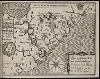
- Creator:
- Mortier, David
Mortier, Pierre
Sanson, Nicolas, 1600-1667, creator
- Published / Created:
- [1710]
- Call Number:
- 1973 Folio 10
- Image Count:
- 1
- Resource Type:
- Maps, Atlases & Globes
- Found in:
- Beinecke Rare Book and Manuscript Library > Teatre de la guerre en Flandre [et] Brabant, les pays conquis et le Bas-Rhein etc
- Call Number:
- 1973 Folio 67
- Collection Title:
- The West-India pilot: containing piloting directions for Port Royal and Kingston harbours in
- Image Count:
- 1
- Found in:
- Beinecke Rare Book and Manuscript Library > Plan de la Rade du Port Paix
- Call Number:
- 1973 Folio 67
- Collection Title:
- The West-India pilot: containing piloting directions for Port Royal and Kingston harbours in
- Image Count:
- 1
- Found in:
- Beinecke Rare Book and Manuscript Library > Plan du Cap Francois
- Call Number:
- 1973 Folio 67
- Collection Title:
- The West-India pilot: containing piloting directions for Port Royal and Kingston harbours in
- Image Count:
- 1
- Found in:
- Beinecke Rare Book and Manuscript Library > Plan du cul de sac de Leogane ou le Port au Prince