Skip to search
Skip to main content
Skip to first result
Search
You Searched For
"Switzerland"
Access
Public
Genre
Maps
Resource Type
Maps, Atlases & Globes
Language
German
New Search
Search Results
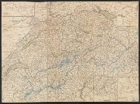
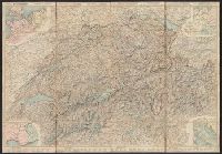
Published / Created:
1820?]
Call Number:
37 1820A
Image Count:
2
Resource Type:
Maps, Atlases & Globes
Description:
5 insets in border.
Publisher:
Heinrich Keller,
Subject (Geographic):
Switzerland --Maps
Found in:
Beinecke Rare Book and Manuscript Library > [Switzerland]
Creator:
Switzerland . Generaldirektion der Post-, Telegraphen- und Telephonverwaltung
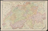
Published / Created:
1951
Call Number:
37 Sa5 1951
Container / Volume:
BRBL_00150
Image Count:
2
Resource Type:
Maps, Atlases & Globes
Alternative Title:
Thusis - Splügen
Publisher:
Generaldirektion der Post-, Telegraphen- und Telephonverwaltung,
Subject (Geographic):
Alps, Swiss (Switzerland )--Maps
Subject (Name):
Kümmerly + Frey
Subject (Topic):
Mountain passes--Switzerland --Maps
Found in:
Beinecke Rare Book and Manuscript Library > Schweizerische Alpenposten San Bernardino, Splügen - Mesocco / [cartographic material] / Kümmerly & Frey, Bern.
Creator:
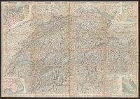
Published / Created:
1860
Call Number:
37 1860A
Image Count:
2
Resource Type:
Maps, Atlases & Globes
Alternative Title:
Road map of Switzerland
Description:
In French. Legend and scales in French, English, German, and Italian., Includes insets of northwestern Europe, north-central Europe, northern Italy, and the French-Italian coastal, and Mounted on verso: Luzern -- Bâle -- Genève -- Zuric -- Berne -- Lausanne.
Publisher:
H.F. Leuthold,
Subject (Geographic):
Switzerland --Maps
Subject (Name):
Bressanini and Mullhaupt
Subject (Topic):
Roads--Switzerland --Maps
Found in:
Beinecke Rare Book and Manuscript Library > Roadmap of Switzerland = Reisekarte der Schweiz = Carta stradale della Svizzera = Carte routière de la Suisse : en partie tirée de l'atlas topographique de la confederation / dresée et gravée par Mullhaupt ; publiée par H.F. Leuthold editeur ; ecrit
Creator:
Published / Created:
1861
Call Number:
37 1861A
Image Count:
2
Resource Type:
Maps, Atlases & Globes
Alternative Title:
Road map of Switzerland
Description:
In French. Legend and scales in French, English, German, and Italian., Includes insets of northwestern Europe, north-central Europe, northern Italy, and the French-Italian coastal region., Mounted on verso: Luzern, and Relief shown by hachures and spot heights.
Publisher:
H.F. Leuthold,
Subject (Geographic):
Switzerland --Maps
Subject (Name):
Bressanini and Mullhaupt
Subject (Topic):
Roads--Switzerland --Maps
Found in:
Beinecke Rare Book and Manuscript Library > Roadmap of Switzerland = Reisekarte der Schweiz = Carta stradale della Svizzera = Carte routière de la Suisse : en partie tirée de l'atlas topographique de la confederation / dresée et gravée par Mullhaupt ; publiée par H.F. Leuthold editeur ; ecrit
Creator:
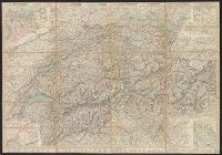
Published / Created:
1858
Call Number:
37 1858
Image Count:
2
Resource Type:
Maps, Atlases & Globes
Alternative Title:
Road map of Switzerland
Description:
In French. Legend and scales in French, English, German, and Italian., Includes insets of northwestern Europe, north-central Europe, northern Italy, and the French-Italian coastal region., Mounted on verso: Luzern, and Relief shown by hachures and spot heights.
Publisher:
H.F. Leuthold,
Subject (Geographic):
Switzerland --Maps
Subject (Name):
Bressanini and Mullhaupt
Subject (Topic):
Roads--Switzerland --Maps
Found in:
Beinecke Rare Book and Manuscript Library > Roadmap of Switzerland = Reisekarte der Schweiz = Carta stradale della Svizzera = Carte routière de la Suisse : en partie tirée de l'atlas topographique de la confederation / dresée et gravée par Mullhaupt ; publiée par H.F. Leuthold editeur ; ecrit
Creator:
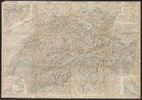
Published / Created:
1867
Call Number:
37 1867
Image Count:
2
Resource Type:
Maps, Atlases & Globes
Alternative Title:
Road map of Switzerland
Description:
In French. Legend and scales in French, English, German, and Italian., Includes insets of northwestern Europe, north-central Europe, northern Italy, and the French-Italian coastal region., Library copy annotated in, and Relief shown by hachures and spot heights.
Publisher:
H.F. Leuthold,
Subject (Geographic):
Switzerland --Maps
Subject (Name):
Bressanini and Mullhaupt
Subject (Topic):
Roads--Switzerland --Maps
Found in:
Beinecke Rare Book and Manuscript Library > Roadmap of Switzerland = Reisekarte der Schweiz = Carta stradale della Svizzera = Carte routière de la Suisse : en partie tirée de l'atlas topographique de la confederation / dresée et gravée par Mullhaupt ; publiée par H.F. Leuthold editeur ; ecrit
Creator:
Published / Created:
1856
Call Number:
37 1856
Image Count:
2
Resource Type:
Maps, Atlases & Globes
Alternative Title:
Road map of Switzerland
Description:
In French. Legend and scales in French, English, German, and Italian., Includes insets of northwestern Europe, north-central Europe, northern Italy, and the French-Italian coastal region., and Mounted on verso: Luzern -- Bâle -- Genève -- Zuric -- Berne -- La
Publisher:
H.F. Leuthold,
Subject (Geographic):
Switzerland --Maps
Subject (Name):
Bressanini and Mullhaupt
Subject (Topic):
Roads--Switzerland --Maps
Found in:
Beinecke Rare Book and Manuscript Library > Roadmap of Switzerland = Reisekarte der Schweiz = Carta stradale della Svizzera = Carte routière de la Suisse : en partie tirée de l'atlas topographique de la confederation / dresée et gravée par Mullhaupt ; publiée par H.F. Leuthold editeur ; ecrit
Creator:
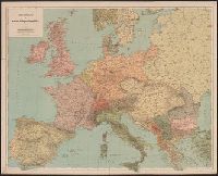
Published / Created:
[1914?]
Call Number:
30 1914A
Container / Volume:
BRBL_00032
Image Count:
1
Resource Type:
Maps, Atlases & Globes
Publisher:
Kartographia Winterthur,
Subject (Geographic):
Europe--Maps
Found in:
Beinecke Rare Book and Manuscript Library > Uebersichtskarte der europ. Kriegsschauplätze.
Creator:
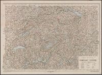
Published / Created:
1907
Call Number:
37 1907C
Container / Volume:
BRBL_00149
Image Count:
2
Resource Type:
Maps, Atlases & Globes
Alternative Title:
Distance map of Switzerland
Description:
On verso: "Profile der wichtigsten routen der Schweiz ...". and Relief shown by shading.
Publisher:
H. Kummerly & Frey,
Subject (Geographic):
Switzerland --Maps
Found in:
Beinecke Rare Book and Manuscript Library > Distanzenkarte der Schweiz in Marschstunden = Carte des distances de la Suisse en heures de marche / Calculation des distances de A. Ringier, topographe au bureau topogr. federal.
Creator:
Call Number:
37 1835
Container / Volume:
BRBL_00148
Image Count:
19
Resource Type:
Maps, Atlases & Globes
Description:
"Lithographie von B. Herder in Freiburg im Breisgau.", "Mitglied der königl. Academie der Kriegswissenschaften in Schweden der königl. geographischen Societaeten zu London und Paris der historischen Gesellschaft zu Freiburg i. B. & . &.", and [Title sheet] --
Subject (Geographic):
Switzerland --Maps
Subject (Name):
Herder, Bartholomä, 1774-1839, lithographer and K.K. Universitäts-Bibliothek Innsbruck Stamp
Found in:
Beinecke Rare Book and Manuscript Library > Karte der Schweiz / von Dr. I. Woerl.
Branch:v1.61.6 ,Deployed:2024-06-12T09:55:36-04:00