Skip to search
Skip to main content
Skip to first result
Search
You Searched For
Genre
Maps
Language
Italian
Search Results
Creator:
Published / Created:
1646 or 1647]
Call Number:
64 1646
Container / Volume:
BRBL_00338
Image Count:
1
Resource Type:
Maps, Atlases & Globes
Alternative Title:
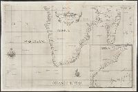
Carta seconda generale d'Africa
Description:
Appears in Dudley's Dell'arcano del mare., Has watermarks., Includes ill. and inset of the eastern coast of Africa from the Gulf of Aden to Zanzibar., and Library copy annotated in brown ink: Fig. 18.
Publisher:
R. Dudley,
Subject (Geographic):
Africa, Southern--Maps--Early works to 1800
Subject (Name):
Dudley, Robert, Sir, 1574-1649. Dell'arcano del mare and Lucini, Antonio Francesco, b. 1605
Subject (Topic):
Coasts--Africa, Eastern--Maps--Early works to 1800 and Coasts--Africa, Southern--Maps--Early works to 1800
Found in:
Beinecke Rare Book and Manuscript Library > Carta seconda generale d'Affrica / AF: Lucini fece.
Published / Created:
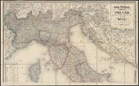
1857
Call Number:
40 1857
Container / Volume:
BRBL_00200
Image Count:
1
Resource Type:
Maps, Atlases & Globes
Publisher:
Presso Ferd. Artaria e Figlio, editori,
Subject (Geographic):
Italy--Maps
Found in:
Beinecke Rare Book and Manuscript Library > Carta stradale dell' Italia : disegnata ed incisa dietro le carte piu recenti ed accreditate / da Pietro Allodi ; Giberto Morandotti impr.
Published / Created:
1859
Call Number:
40 1859A
Container / Volume:
BRBL_00201
Image Count:
1
Resource Type:
Maps, Atlases & Globes
Publisher:
Artaria,
Subject (Geographic):
Italy--Maps
Found in:
Beinecke Rare Book and Manuscript Library > Carta stradale e postale dell'Italia / Carlo Cerri.
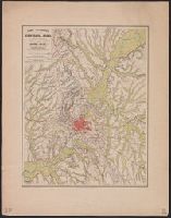
Published / Created:
1859
Call Number:
406 R66 1859
Container / Volume:
BRBL_00236
Image Count:
1
Resource Type:
Maps, Atlases & Globes
Publisher:
Simone Schropp (Luigi Beringuier),
Subject (Geographic):
Rome (Italy : Province)--Maps
Found in:
Beinecke Rare Book and Manuscript Library > Carta topografica dei Contorni di Roma, ridotta alla mezza scala dalla pianta levata in 1845 e 1846 per il Barone di Moltke, Ajutante in campo di S.A. Reale il Principe Enrico di Prussia / G. Steffens disegnò sotto direzione di H. Kiepert ; C. Birk Litog
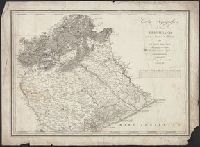
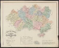
Call Number:
402cbf 1814
Container / Volume:
BRBL_00233A
Image Count:
4
Resource Type:
Maps, Atlases & Globes
Description:
"Stampato oggi 22 Febbo. 1815"., Imperfect: Sheets wanting., and Relief shown by hachures.
Subject (Geographic):
Lombardo-Venetian Kingdom--Maps
Found in:
Beinecke Rare Book and Manuscript Library > Carta topografica del Regno Lombardo-Veneto, con paesi limitrofi ...
Creator:
Call Number:
40 T276 1840A
Image Count:
1
Resource Type:
Maps, Atlases & Globes
Description:
Imperfect: Small hole with loss of imagery. and Relief shown by hachures.
Subject (Geographic):
Veneto (Italy)--Maps
Subject (Name):
Remondini, Giuseppe Antonio, 1747-1811
Found in:
Beinecke Rare Book and Manuscript Library > Carta topografica del paese Trevigiano : posto tra la Brenta e la Livenza / di Giuseppe Malvolti.
Published / Created:
1880
Call Number:
40 R66 1880
Image Count:
6
Resource Type:
Maps, Atlases & Globes
Description:
[Title sheet] -- Roma -- Civita-Vecchia -- Nettuno -- Palo -- Civita-Castellana., Map of Nettuno includes inset map of Velletri., Map of Palo has an inset table and graph showing the growth of the agro romano., and This map is a reproduction of the map published
Publisher:
Lit. Virano e Teano,
Subject (Geographic):
Civita Castellana (Italy)--Maps, Civitavecchia (Italy)--Maps, Nettuno (Italy)--Maps, Palo (Italy)--Maps, Rome (Italy)--Maps, Rome Region (Italy)--Maps, and Velletri (Italy)--Maps
Subject (Name):
Canevari, Raffaello and Lit. Virano e Teano
Found in:
Beinecke Rare Book and Manuscript Library > Carta topografica dell'agro romano e territori limitrofi in scala di 1 a 80.000 [cartographic material].
Published / Created:
1848
Call Number:
40hc 1848
Container / Volume:
BRBL_00231
Image Count:
1
Resource Type:
Maps, Atlases & Globes
Publisher:
Presso la libreria d'Istruzione da Andrea Ubicini,
Subject (Geographic):
Italy--Maps
Found in:
Beinecke Rare Book and Manuscript Library > Carta topografica della guerra dell'Anno 1848.
Published / Created:
[ca. 1864]
Call Number:
40hc 1864
Container / Volume:
BRBL_00231
Image Count:
1
Resource Type:
Maps, Atlases & Globes
Description:
4 inset maps: [1.] Legnago -- [2.] Peschiera -- [3.] Verona -- [4.] Mantova.
Publisher:
Presso la libreria d'Educazione e d'Istruzione da Andrea Ubicini,
Subject (Geographic):
Italy, Northern--Maps
Found in:
Beinecke Rare Book and Manuscript Library > Carta topografica della guerra.
Published / Created:
[1860?]
Call Number:
40FB G914 1860
Container / Volume:
BRBL_00229
Image Count:
1
Resource Type:
Maps, Atlases & Globes
Publisher:
Lit. di Ach. Paris,
Subject (Geographic):
Grosseto (Italy : Province)--Maps
Found in:
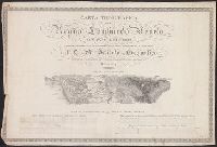
Beinecke Rare Book and Manuscript Library > Carta topografica della provincia di Grosseto / redatta a cura dell'Ingegnere Capo Gaetano Niccoli.
Branch:v1.68.2 ,Deployed:2025-06-12T06:59:37-04:00