Skip to search
Skip to main content
Skip to first result
Search
You Searched For
Access
Public
Repository
Beinecke Rare Book and Manuscript Library
Genre
Maps
Subject (Name)
Arnold, Robert M.--Ownership
New Search
Search Results
Creator:
Published / Created:
1798
Call Number:
845 1798A
Container / Volume:
BRBL_00619
Image Count:
1
Resource Type:
Maps, Atlases & Globes
Found in:
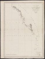
Beinecke Rare Book and Manuscript Library > A chart shewing part of the coast of N.W. America : with the tracks of His Majesty's sloop Discovery and armed tender Chatham / commanded by George Vancouver, esqr. and prepared under his immediate inspection by Lieut. Joseph Baker, in which the continent
Creator:
Published / Created:
1798
Call Number:
845 1798H
Container / Volume:
BRBL_00619
Image Count:
1
Resource Type:
Maps, Atlases & Globes
Found in:
Beinecke Rare Book and Manuscript Library > A chart shewing part of the coast of N.W. America, with the tracks of His Majesty's sloop Discovery and armed tender Chatham / commanded by George Vancouver, esq. and prepared under his immediate inspection by Lieut. Joseph Baker, in which the continental
Creator:
Published / Created:
1798
Call Number:
845 1798C
Container / Volume:
BRBL_00619
Image Count:
1
Resource Type:
Maps, Atlases & Globes
Found in:
Beinecke Rare Book and Manuscript Library > A chart shewing part of the coast of N.W. America, with the tracks of His Majesty's sloop Discovery and armed tender Chatham / commanded by George Vancouver, esq. and prepared under his immediate inspection by Lieut. Joseph Baker, in which the continental
Creator:
Published / Created:
1798
Call Number:
845 1798B
Container / Volume:
BRBL_00619
Image Count:
1
Resource Type:
Maps, Atlases & Globes
Found in:
Beinecke Rare Book and Manuscript Library > A chart shewing part of the coast of N.W. America, with the tracks of His Majesty's sloop Discovery and armed tender Chatham / commanded by George Vancouver, esqr. and prepared from the foregoing surveys under his immediate inspection by Lieut. Edwd. Robe
Creator:
Published / Created:
1798
Call Number:
845 1798G
Container / Volume:
BRBL_00619
Image Count:
1
Resource Type:
Maps, Atlases & Globes
Found in:
Beinecke Rare Book and Manuscript Library > A chart shewing part of the coast of N.W. America, with the tracks of His Majesty's sloop Discovery and armed tender Chatham / commanded by George Vancouver, esqr. and prepared under his immediate inspection by Lieut. Joseph Baker, in which the continenta
Creator:
Published / Created:
1798
Call Number:
845 1798F
Container / Volume:
BRBL_00619
Image Count:
1
Resource Type:
Maps, Atlases & Globes
Found in:
Beinecke Rare Book and Manuscript Library > A chart shewing part of the coast of N.W. America, with the tracks of His Majesty's sloop Discovery and armed tender Chatham / commanded by George Vancouver, esqr. and prepared under his immediate inspection by Lieut. Joseph Baker, in which the continenta
Creator:
Published / Created:
1798
Call Number:
845 1798D
Container / Volume:
BRBL_00619
Image Count:
1
Resource Type:
Maps, Atlases & Globes
Found in:
Beinecke Rare Book and Manuscript Library > A chart shewing part of the coast of N.W. America, with the tracks of His Majesty's sloop Discovery and armed tender Chatham / commanded by George Vancouver, esqr. and prepared under his immediate inspection by Lieut. Joseph Baker, in which the continenta
Creator:
Published / Created:
1798
Call Number:
845 1798E
Container / Volume:
BRBL_00619
Image Count:
1
Resource Type:
Maps, Atlases & Globes
Found in:
Beinecke Rare Book and Manuscript Library > A chart shewing part of the coast of N.W. America, with the tracks of His Majesty's sloop Discovery and armed tender Chatham / commanded by George Vancouver, esqu. and prepared under his immediate inspection by Lieut. Joseph Baker, in which the continenta
Creator:
Published / Created:
1798?]
Call Number:
739 1795
Container / Volume:
BRBL_00388
Image Count:
1
Resource Type:
Maps, Atlases & Globes
Found in:
Beinecke Rare Book and Manuscript Library > Carta esferica de los reconocimientos hechos en 1792 en la costa N.O. de America para examinar la entrada de Juan de Fuca, y la internacion de sus canales navegables / levantada de orden del Rey Nuestro Señor abordo de las Goletas Sutil y Mexicana, por D
Published / Created:
between 1795 and 1814]
Call Number:
739 1795A
Container / Volume:
BRBL_00388
Image Count:
1
Resource Type:
Maps, Atlases & Globes
Found in:
Beinecke Rare Book and Manuscript Library > Carta esferica de los reconocimientos hechos en la costa N.O. de America desde la parte en que empiezan á angostar los canales de la entrada de Juan de Fuca hasta la salida de las Goletas Sutil y Mexicana, año de 1795 / Joaquin Ballester la grabó ; [Di
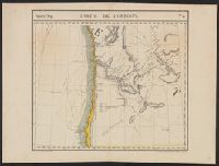
Creator:
Published / Created:
1646-1647]
Call Number:
845 1647
Container / Volume:
BRBL_00619
Image Count:
1
Resource Type:
Maps, Atlases & Globes
Found in:
Beinecke Rare Book and Manuscript Library > Carta particolare dello stretto di Iezo fra l'America è l'isola Iezo / AF: Lucini fece.
Creator:
Published / Created:
[1752]
Call Number:
18 1750C
Container / Volume:
BRBL_00732
Image Count:
1
Resource Type:
Maps, Atlases & Globes
Found in:
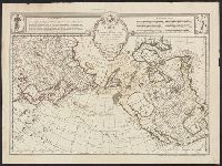
Beinecke Rare Book and Manuscript Library > Carte des nouvelles découvertes au nord de la Mer du Sud : tant à l'est de la Siberie et du Kamtchatka, qu'à l'ouest de la Nouvelle France / dressée sur le mémoires de Mr. Del'Isle, professeur royal et de l'Académie des sciences par Philippe Buache
Creator:
Published / Created:
[1752]
Call Number:
23 1750
Container / Volume:
BRBL_00682
Image Count:
1
Resource Type:
Maps, Atlases & Globes
Found in:
Beinecke Rare Book and Manuscript Library > Carte des nouvelles découvertes au nord de la Mer du Sud : tant à l'est de la Siberie et du Kamtchatka, qu'à l'ouest de la Nouvelle France / dressée sur le mémoires de Mr. Del'Isle, professeur royal et de l'Académie des sciences par Philippe Buache
Creator:
Published / Created:
[1752]
Call Number:
23 1750A
Container / Volume:
BRBL_00018
Image Count:
1
Resource Type:
Maps, Atlases & Globes
Found in:
Beinecke Rare Book and Manuscript Library > Carte des nouvelles découvertes au nord de la Mer du Sud : tant à l'est de la Siberie et du Kamtchatka, qu'à l'ouest de la Nouvelle France / dressée sur le mémoires de Mr. Del'Isle, professeur royal et de l'Académie des sciences par Philippe Buache
Creator:
Published / Created:
[1752]
Call Number:
18 1750B
Container / Volume:
BRBL_00012
Image Count:
1
Resource Type:
Maps, Atlases & Globes
Found in:
Beinecke Rare Book and Manuscript Library > Carte des nouvelles découvertes au nord de la Mer du Sud : tant à l'est de la Siberie et du Kamtchatka, qu'à l'ouest de la Nouvelle France / dressée sur le mémoires de Mr. Del'Isle, professeur royal et de l'Académie des sciences par Philippe Buache
Creator:
Published / Created:
{1797]
Call Number:
845 1797
Container / Volume:
BRBL_00619
Image Count:
1
Resource Type:
Maps, Atlases & Globes
Found in:
Beinecke Rare Book and Manuscript Library > Carte générale d'une partie de la côte du nord-ouest de l'Amérique : reconnue par les frégates françaises la Boussole et l'Astrolabe / assujettie au point journalier de la Frégate la Boussole determiné astronomiquement par M. Dagelet ; Bouclet scu
Published / Created:
[1889?]
Call Number:
847 Se18 1889A
Container / Volume:
BRBL_00626
Image Count:
2
Resource Type:
Maps, Atlases & Globes
Found in:
Beinecke Rare Book and Manuscript Library > Guide map of Seattle, the metropolis of Washington Ter. / compliments of Wood & Osborne ; Benedict & Co., eng.
Creator:
Published / Created:
1875
Call Number:
73 1875A
Container / Volume:
BRBL_00375
Image Count:
1
Resource Type:
Maps, Atlases & Globes
Found in:
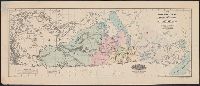
Beinecke Rare Book and Manuscript Library > Map of part of the North West Territory including the province of Manitoba : exhibiting the several tracts of country ceded by the Indian Treaties 1, 2, 3 and 4 : to accompany report of the Honble. the Minister of the Interior, dated 20th January, 1875 /
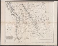
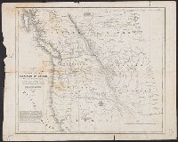
Creator:
Published / Created:
1838]
Call Number:
80 1838B
Container / Volume:
BRBL_00532
Image Count:
1
Resource Type:
Maps, Atlases & Globes
Found in:
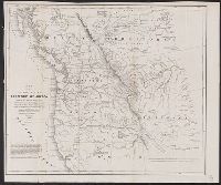
Beinecke Rare Book and Manuscript Library > Map of the United States, Territory of Oregon, west of the Rocky Mountains : exhibiting the various trading depots or forts occupied by the British Hudson Bay Company, connected with the western and northwestern fur trade / compiled in the Bureau of Topog
Creator:
Published / Created:
1838]
Call Number:
80 1838B
Container / Volume:
BRBL_00532
Image Count:
1
Resource Type:
Maps, Atlases & Globes
Found in:
Beinecke Rare Book and Manuscript Library > Map of the United States, Territory of Oregon, west of the Rocky Mountains : exhibiting the various trading depots or forts occupied by the British Hudson Bay Company, connected with the western and northwestern fur trade / compiled in the Bureau of Topog
Creator:
Published / Created:
[between 1635 and 1650]
Call Number:
11 1635
Container / Volume:
BRBL_00003
Image Count:
2
Resource Type:
Maps, Atlases & Globes
Found in:
Beinecke Rare Book and Manuscript Library > Nova totius terrarum orbis geographica ac hydrographica tabula / auct. Guiljelmo Blaeuw ; Ja. van den Ende sculpsit.
Creator:
Published / Created:
[1836]
Call Number:
845 1833
Container / Volume:
BRBL_00620
Image Count:
1
Resource Type:
Maps, Atlases & Globes
Found in:
Beinecke Rare Book and Manuscript Library > Oregon Territory / Illman & Pilbrow sc.
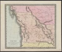
Creator:
Published / Created:
1827]
Call Number:
846 1827
Container / Volume:
BRBL_00620
Image Count:
1
Resource Type:
Maps, Atlases & Globes
Found in:
Beinecke Rare Book and Manuscript Library > Partie de l'Oregon / dressée et dessinée par Ph. Vandermaelen ; des[sin]ée sur pierre et lith[ographi]e par H. Ode et Ph. Lippens.
Creator:
Published / Created:
[Brussels : and 1827]
Call Number:
739 1827
Container / Volume:
BRBL_00388
Image Count:
1
Resource Type:
Maps, Atlases & Globes
Found in:
Beinecke Rare Book and Manuscript Library > Partie de la Nouvelle Hanovre.
Creator:
Published / Created:
1827]
Call Number:
846 1827A
Container / Volume:
BRBL_00620
Image Count:
1
Resource Type:
Maps, Atlases & Globes
Found in:
Beinecke Rare Book and Manuscript Library > Partie des États Unis.
Creator:
Published / Created:
[1871]
Call Number:
7391 1871
Container / Volume:
BRBL_00394
Image Count:
1
Resource Type:
Maps, Atlases & Globes
Found in:
Beinecke Rare Book and Manuscript Library > Vancouver Island and adjacent shores of British Columbia / surveyed by G.H. Richards, assisted by R.C. Mayne ... [et al.], 1859-65 ; compiled and drawn for engraving by E.J. Powell ; engraved by Davies & Powell.
Branch:v1.60.98 ,Deployed:2024-04-24T10:14:36-04:00