Search
You Searched For
Search Results
- Published / Created:
- 191-.
- Call Number:
- 11hc 1915R
- Container / Volume:
- BRBL_00010C
- Image Count:
- 2
- Resource Type:
- Maps, Atlases & Globes
- Found in:
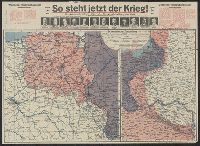
- Beinecke Rare Book and Manuscript Library > [So steht jetzt der Krieg!] : Kriegsoperationskarte über alle Kriegsschauplätze der welt.
- Published / Created:
- [1915?]
- Call Number:
- 11hcf 1919A-32
- Container / Volume:
- BRBL_00010N
- Image Count:
- 1
- Resource Type:
- Maps, Atlases & Globes
- Found in:
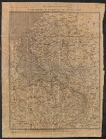
- Beinecke Rare Book and Manuscript Library > [Regional map of the area around the Adriatic Sea : showing the cities of Pola, Zara, Comacchio] / K.u.K. Militärgeographisches Institut.
- Published / Created:
- 191-.
- Call Number:
- 11hcf 1919A-31
- Container / Volume:
- BRBL_00010N
- Image Count:
- 2
- Resource Type:
- Maps, Atlases & Globes
- Found in:
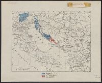
- Beinecke Rare Book and Manuscript Library > [Italian claims along the Adriatic Sea.]
- Published / Created:
- 1940
- Call Number:
- 11hc 1915C
- Container / Volume:
- BRBL_00010B
- Image Count:
- 2
- Resource Type:
- Maps, Atlases & Globes
- Found in:
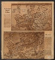
- Beinecke Rare Book and Manuscript Library > [A soldier saved a map.]
- Creator:
- United States. Committee on Public Information
- Published / Created:
- [1918]
- Call Number:
- 11hc 1917A
- Container / Volume:
- BRBL_00010D
- Image Count:
- 1
- Resource Type:
- Maps, Atlases & Globes
- Found in:
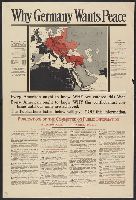
- Beinecke Rare Book and Manuscript Library > Why Germany wants peace : every American ought to know why we entered this War; every American ought to know why this conflict must continue until our aims are achieved; the publications listed below will give you this information.
- Published / Created:
- [1916?]
- Call Number:
- 11hc 1914R
- Container / Volume:
- BRBL_00010B
- Image Count:
- 1
- Resource Type:
- Maps, Atlases & Globes
- Found in:
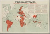
- Beinecke Rare Book and Manuscript Library > What Germany wants : her claims as set forth by leaders of German thought.
- Published / Created:
- 191-.
- Call Number:
- 11hcf 1919-10
- Image Count:
- 1
- Resource Type:
- Maps, Atlases & Globes
- Found in:
- Beinecke Rare Book and Manuscript Library > Voies ferrees a la disposition des forces Américaines.
- Published / Created:
- 1918
- Call Number:
- 38hc 1918 Sep. folder
- Container / Volume:
- BRBL_00172
- Image Count:
- 1
- Resource Type:
- Maps, Atlases & Globes
- Found in:
- Beinecke Rare Book and Manuscript Library > Verdun-Point-à-Mousson.
- Creator:
- Ordnance Survey of Great Britain and Ireland
Royal Geographical Society (Great Britain). Geographical Section
- Published / Created:
- 1915
- Call Number:
- 11hcf 1919E-11
- Image Count:
- 1
- Resource Type:
- Maps, Atlases & Globes
- Found in:
- Beinecke Rare Book and Manuscript Library > Triest : North L 33. / compiled at the Royal Geographical Society under the direction of the Geographical Section; drawn and printed by Ordnance Survey.
- Creator:
- Ordnance Survey of Great Britain and Ireland
Royal Geographical Society (Great Britain). Geographical Section
- Published / Created:
- 1915
- Call Number:
- 11hcf 1919E-10
- Container / Volume:
- BRBL_00010Z
- Image Count:
- 1
- Resource Type:
- Maps, Atlases & Globes
- Found in:
- Beinecke Rare Book and Manuscript Library > Triest : North L 33. / compiled at the Royal Geographical Society under the direction of the Geographical Section; drawn and printed by Ordnance Survey.
- Creator:
- Ordnance Survey of Great Britain and Ireland
Royal Geographical Society (Great Britain). Geographical Section
- Published / Created:
- 1915
- Call Number:
- 11hcf 1919E-10
- Image Count:
- 1
- Resource Type:
- Maps, Atlases & Globes
- Found in:
- Beinecke Rare Book and Manuscript Library > Triest : North L 33. / compiled at the Royal Geographical Society under the direction of the Geographical Section; drawn and printed by Ordnance Survey.
- Published / Created:
- 1918
- Call Number:
- 11hc 1918D
- Container / Volume:
- BRBL_00010E
- Image Count:
- 2
- Resource Type:
- Maps, Atlases & Globes
- Found in:
- Beinecke Rare Book and Manuscript Library > Three Months of Victory on the Western Front.
- Creator:
- Stanford's Geographical Estabt
- Published / Created:
- [1917?]
- Call Number:
- 11hc 1919W
- Image Count:
- 1
- Resource Type:
- Maps, Atlases & Globes
- Found in:
- Beinecke Rare Book and Manuscript Library > The downfall of Germany's world-empire / Stanford's Geogl. Estabt., London.
- Published / Created:
- [1918?]
- Call Number:
- 11hc 1915L
- Container / Volume:
- BRBL_00010C
- Image Count:
- 7
- Resource Type:
- Maps, Atlases & Globes
- Found in:
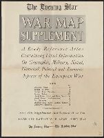
- Beinecke Rare Book and Manuscript Library > The Evening Star (with Sunday morning edition) war map supplement : a ready-reference atlas containing vital information on geographic, military, naval, historical, political, and economic aspects of the European war / compiled by members of the Star Staf
- Creator:
- Istituto geografico De Agostini
- Published / Created:
- [1916]
- Call Number:
- BrSides Elephant Folio 2019 2
- Image Count:
- 1
- Resource Type:
- Maps, Atlases & Globes
- Found in:
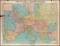
- Beinecke Rare Book and Manuscript Library > Teatro della guerra europea [cartographic material] / carta dimostrativa pubblicata dall'Istituto Geografico de Agostini.
- Creator:
- A. K.
- Published / Created:
- 1915
- Call Number:
- 30 1915G
- Container / Volume:
- BRBL_00032A
- Image Count:
- 2
- Resource Type:
- Maps, Atlases & Globes
- Found in:
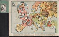
- Beinecke Rare Book and Manuscript Library > Sommerschau über Europa 1915 : erweiterte Massstab, 3 gegen 8 / A.K. gez. u. lith.
- Creator:
- Johnson, Riddle & Co
- Published / Created:
- [191-]
- Call Number:
- 30 191X
- Container / Volume:
- BRBL_00032
- Image Count:
- 2
- Resource Type:
- Maps, Atlases & Globes
- Found in:
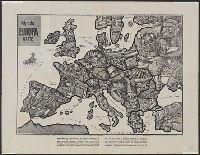
- Beinecke Rare Book and Manuscript Library > Serio-comique map of Europe at war : hark! hark! the dogs do bark! / designed and printed by Johnson & Riddle Co. ; with a note by Walter Emanuel.
- Creator:
- Zimmermann, E
- Published / Created:
- [1914]
- Call Number:
- 30an 1914C
- Container / Volume:
- BRBL_00037A
- Image Count:
- 1
- Resource Type:
- Maps, Atlases & Globes
- Found in:
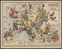
- Beinecke Rare Book and Manuscript Library > Satyrische Europa Karte, Weltkrieg 1914 / Zeichnung u. Entwurf, E. Zimmermann.
- Creator:
- Ordnance Survey of Great Britain and Ireland
Royal Geographical Society (Great Britain). Geographical Section
- Published / Created:
- 1916
- Call Number:
- 11hcf 1919E-16
- Image Count:
- 1
- Resource Type:
- Maps, Atlases & Globes
- Found in:
- Beinecke Rare Book and Manuscript Library > Roma : North K 33. / compiled at the Royal Geographical Society under the direction of the Geographical Section; drawn and printed by Ordnance Survey.
- Creator:
- Rand McNally and Company
- Published / Created:
- [n.d.]
- Call Number:
- 30 1920E
- Container / Volume:
- BRBL_00032A
- Image Count:
- 2
- Resource Type:
- Maps, Atlases & Globes
- Found in:
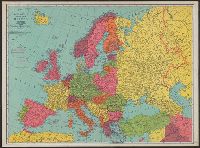
- Beinecke Rare Book and Manuscript Library > Rand McNally standard map of Europe.