Search
You Searched For
Search Results
- Creator:
- U.S. Lake Survey
- Published / Created:
- 1885
- Call Number:
- 8075cea 1885
- Container / Volume:
- BRBL_00551
- Image Count:
- 1
- Resource Type:
- Maps, Atlases & Globes
- Subject (Geographic):
- Great Lakes (North America)--Maps.
- Found in:
- Beinecke Rare Book and Manuscript Library > Index chart of the northern and northwestern lakes : compiled from the data of the U.S. Survey and showing the names and limits of the published charts / compiled and drawn by Edward Molitor.
- Published / Created:
- 1852
- Call Number:
- 8075gme 1852
- Container / Volume:
- BRBL_00551
- Image Count:
- 1
- Resource Type:
- Maps, Atlases & Globes
- Subject (Geographic):
- Great Lakes (North America)--Maps
- Found in:
- Beinecke Rare Book and Manuscript Library > Map showing the several lines of R.R. : leading from the Lakes to the MIssissippi River together with the route surveyed by the St. C. & L.S. R.R. Co.
- Creator:
- Brué, Adrien Hubert, 1786-1832
- Published / Created:
- 1835
- Call Number:
- 71 1835B
- Container / Volume:
- BRBL_00370
- Image Count:
- 4
- Resource Type:
- Maps, Atlases & Globes
- Subject (Geographic):
- North America--Maps
- Found in:
- Beinecke Rare Book and Manuscript Library > Nouvelle carte de l'Amérique septentrionale, du Groënland et des îles qui en dépendent / par A.H. Brué, géographe du Roi ... ; Artus et Massuet, sculpt.
- Creator:
- Rand McNally and Company
- Published / Created:
- c1914.
- Call Number:
- 88hc 1914
- Container / Volume:
- BRBL_00649
- Image Count:
- 2
- Resource Type:
- Maps, Atlases & Globes
- Alternative Title:
- New commercial atlas map of North
- Description:
- North America" (scale [1:20,592,000]) on
- Subject (Geographic):
- North America--Maps
- Found in:
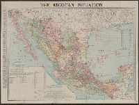
- Beinecke Rare Book and Manuscript Library > The Rand McNally new commercial atlas map of Mexico.
- Published / Created:
- 1849
- Call Number:
- 844cea 1849
- Container / Volume:
- BRBL_00613
- Image Count:
- 1
- Resource Type:
- Maps, Atlases & Globes
- Subject (Geographic):
- Pacific Coast (North America)--Maps
- Found in:
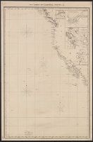
- Beinecke Rare Book and Manuscript Library > The coasts of California, Oregon, &c.
- Published / Created:
- 1850
- Call Number:
- 754gme 1850
- Container / Volume:
- BRBL_00419
- Image Count:
- 1
- Resource Type:
- Maps, Atlases & Globes
- Subject (Geographic):
- Great Lakes (North America)--Maps
- Found in:
- Beinecke Rare Book and Manuscript Library > [Railroads of the Lake States, from Great Lakes to Ohio River]
- Creator:
- Rider, Sidney S. (Sidney Smith), 1833-1917
- Published / Created:
- 1903
- Call Number:
- 765 1904
- Container / Volume:
- BRBL_00463
- Image Count:
- 1
- Resource Type:
- Maps, Atlases & Globes
- Subject (Topic):
- Names, Indian--North America--Maps
- Found in:
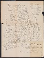
- Beinecke Rare Book and Manuscript Library > Map of the Colony of Rhode Island : giving the Indian names of locations and the locations of great events in Indian history with present political divisions indicated / by Sidney S. Rider.
- Creator:
- United States. Bureau of Indian Affairs
- Published / Created:
- 1907
- Call Number:
- 75ea 1907A
- Container / Volume:
- BRBL_00409
- Image Count:
- 1
- Resource Type:
- Maps, Atlases & Globes
- Subject (Topic):
- Indian reservations--North America
- Found in:
- Beinecke Rare Book and Manuscript Library > Map showing Indian reservations within the limits of the United States / compiled under the direction of the Hon. F.E. Leupp, Commissioner of Indian Affairs.
- Creator:
- United States. Bureau of Indian Affairs
- Published / Created:
- 1904
- Call Number:
- 75ed 1904
- Container / Volume:
- BRBL_00410
- Image Count:
- 1
- Resource Type:
- Maps, Atlases & Globes
- Subject (Topic):
- Indian reservations--North America
- Found in:
- Beinecke Rare Book and Manuscript Library > Map showing Indian reservations within the limits of the United States / compiled under the direction of the Hon. W.A. Jones, Commissioner of Indian Affairs.
- Creator:
- Tanner, Henry Schenck, 1786-1858
- Published / Created:
- [1822 or 1823]
- Call Number:
- 71 1822
- Container / Volume:
- BRBL_00369
- Image Count:
- 4
- Resource Type:
- Maps, Atlases & Globes
- Subject (Geographic):
- North America--Maps
- Found in:
- Beinecke Rare Book and Manuscript Library > A map of North America : constructed according to the latest information / engraved & published by H.S. Tanner, Philadelphia 1822.