Search
You Searched For
Search Results
- Published / Created:
- 1816
- Call Number:
- 56 1816
- Container / Volume:
- BRBL_00295
- Image Count:
- 1
- Resource Type:
- Maps, Atlases & Globes
- Found in:
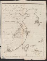
- Beinecke Rare Book and Manuscript Library > A map of the Route of the British Embassy, from the mouth of the Peiho River, to Pekin and from thence to Canton, in the year 1816.
- Creator:
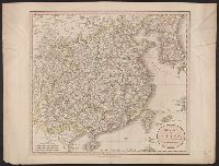
- Cary, John, ca. 1754-1835
- Published / Created:
- Apr. 28, 1811.
- Call Number:
- 56 1811
- Container / Volume:
- BRBL_00685
- Image Count:
- 1
- Resource Type:
- Maps, Atlases & Globes
- Found in:
- Beinecke Rare Book and Manuscript Library > A new map of China, from the latest authorities / by John Cary, engraver.
- Creator:
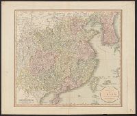
- Cary, John, ca. 1754-1835
- Published / Created:
- Apr. 28, 1811.
- Call Number:
- 56 1811
- Container / Volume:
- BRBL_00295
- Image Count:
- 1
- Resource Type:
- Maps, Atlases & Globes
- Found in:
- Beinecke Rare Book and Manuscript Library > A new map of China, from the latest authorities / by John Cary, engraver.
- Creator:
- Rand McNally and Company
- Published / Created:
- c1901.
- Call Number:
- 56 1901A
- Container / Volume:
- BRBL_00296
- Image Count:
- 2
- Resource Type:
- Maps, Atlases & Globes
- Found in:
- Beinecke Rare Book and Manuscript Library > A new map of the Chinese Empire with Japan and Korea. Map of Asia. / by Rand, McNally & Co.
- Creator:
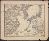
- Petermann, A. (August), 1822-1878
- Published / Created:
- 1877
- Call Number:
- 56 1877
- Container / Volume:
- BRBL_00296
- Image Count:
- 1
- Resource Type:
- Maps, Atlases & Globes
- Found in:
- Beinecke Rare Book and Manuscript Library > China (östl. Theil), Korea und Japan im Massstab 1:7.500.000 / von A. Petermann ; bearbeitet von Ernst Debes ; gestochen v. H. Eberhardt ; Terrain v. C. Jungmann.
- Creator:
- National Geographic Society (U.S.). Cartographic Section
- Published / Created:
- 1945
- Call Number:
- 56 1945
- Container / Volume:
- BRBL_00296
- Image Count:
- 1
- Resource Type:
- Maps, Atlases & Globes
- Found in:
- Beinecke Rare Book and Manuscript Library > China [cartographic material] / compiled and drawn in the Cartographic Section of the National Geographic Society for the National Geographic Magazine ; James M. Darley, chief cartographer.
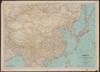
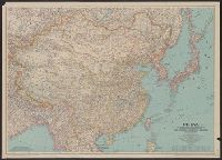
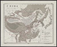
- Creator:
- United States. Office of Strategic Services. Research and Analysis Branch
- Published / Created:
- 1944
- Call Number:
- 56cb 1944
- Container / Volume:
- BRBL_00297
- Image Count:
- 1
- Resource Type:
- Maps, Atlases & Globes
- Found in:
- Beinecke Rare Book and Manuscript Library > China [cartographic material] / drawn in the Branch of Research and Analysis, OSS.
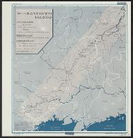
- Creator:
- United States. Office of Strategic Services. Research and Analysis Branch
- Published / Created:
- 1945
- Call Number:
- 56gme H89 1945
- Container / Volume:
- BRBL_00299
- Image Count:
- 1
- Resource Type:
- Maps, Atlases & Globes
- Found in:
- Beinecke Rare Book and Manuscript Library > China [cartographic material] : the Hunan-Kwangsi Railroad / R & A, OSS.