Search
You Searched For
Search Results
- Creator:
- United States. Office of Strategic Services
- Published / Created:
- 1943
- Call Number:
- 36gma 1943
- Container / Volume:
- BRBL_00130
- Image Count:
- 1
- Resource Type:
- Maps, Atlases & Globes
- Description:
- "Map no. 1994, 25 August 1943." and 1. Northwestern waterways -- 2. Berlin -- 3. Magdeburg.
- Publisher:
- Lithographed in the Reproduction Branch, OSS,
- Subject (Geographic):
- Europe, Central--Maps and Germany--Maps
- Subject (Topic):
- Inland navigation--Europe, Central--Maps and Inland navigation--Germany--Maps
- Found in:
- Beinecke Rare Book and Manuscript Library > "Greater Germany" inland waterways.
- Creator:
- United States. Office of Strategic Services
- Published / Created:
- 1945
- Call Number:
- 36cb 1945
- Container / Volume:
- BRBL_00127
- Image Count:
- 1
- Resource Type:
- Maps, Atlases & Globes
- Description:
- "No. 6339." and Shows cave regions within the "Greater" German boundary of 1944.
- Publisher:
- OSS,
- Subject (Geographic):
- Europe, Central--Maps
- Subject (Topic):
- Caves--Europe, Central--Maps
- Found in:
- Beinecke Rare Book and Manuscript Library > "Greater" Germany caves and cave regions.
- Published / Created:
- [1920?]
- Call Number:
- 304gme 1920
- Container / Volume:
- BRBL_00035
- Image Count:
- 2
- Resource Type:
- Maps, Atlases & Globes
- Description:
- Verso: France, Algeria, Italy, Suez Canal, Spain & Portugal, Russia, Denmark, Sweden, Norway, Belgium.
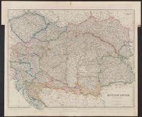
- Subject (Geographic):
- Europe, Central--Maps
- Found in:
- Beinecke Rare Book and Manuscript Library > Carte des chemins de fer L'Europe Centrale pour le Livret-chaix Continental.
- Creator:
- Allied Forces
Great Britain. War Office. General Staff. Geographical Section
- Published / Created:
- 1943-
- Call Number:
- 11hd 1942D-44
- Image Count:
- 14
- Resource Type:
- Maps, Atlases & Globes
- Alternative Title:
- [Series] M641, G.S.G.S ; no. 4416, and GSGS (Series) ; 4416.
- Description:
- Marginal maps: Index to adjoining sheets and incidence of grid letters [and] G.S.G.S. 4346, Germany 1:250,000.--Compilation diagram., Relief shown by contours and spot heights., and Sheet P-3. Detmold -- Sheet P-4. Hildesheim -- Sheet Q-3. Paderborn -- Sheet Q-
- Publisher:
- War Office,
- Subject (Geographic):
- Europe, Central--Maps and Germany--Maps
- Found in:
- Beinecke Rare Book and Manuscript Library > Central Europe 1:100,000.