Search
You Searched For
Search Results
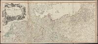
- Creator:
- Moll, Herman, -1732
- Call Number:
- 304 1712
- Container / Volume:
- BRBL_00033
- Image Count:
- 1
- Resource Type:
- Maps, Atlases & Globes
- Found in:
- Beinecke Rare Book and Manuscript Library > A new map of Germany, Hungary, Transilvania & the Suisse cantons : with many remarks not extant in any map : according to ye newest and most exact observations / by Herman Moll, geographer.
- Creator:
- Delamarche, Charles François, 1740-1817
Groux, Charles Jacques
Robert de Vaugondy, Didier, 1723-1786
- Call Number:
- 36 1792
- Container / Volume:
- BRBL_00118
- Image Count:
- 1
- Resource Type:
- Maps, Atlases & Globes
- Found in:
- Beinecke Rare Book and Manuscript Library > Carte de l'empire d'Allemagne : dessinée d'après les cartes nationales et assujetties aux observations astronomiques par Robert de Vaugondy ; corrigée et divisée en IX cercles, suivant les divisions politiques actuelles, avec les parties adjacentes et
- Creator:
- Delarochette, L. (Louis), 1731-1802
Kitchin, Thomas, 1718-1784. New universal atlas. 1804
Laurie & Whittle
- Call Number:
- 36 1794B
- Container / Volume:
- BRBL_00119
- Image Count:
- 2
- Resource Type:
- Maps, Atlases & Globes
- Found in:
- Beinecke Rare Book and Manuscript Library > Map of the Empire of Germany : including all the states comprehended under that name: with the Kingdom of Prussia, &c. / by L. Delarochette ; T. Kitchin sculpt.