Search
You Searched For
Search Results
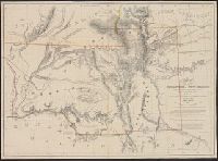
- Creator:
- Pike, Zebulon Montgomery, 1779-1813
- Published / Created:
- 1810
- Call Number:
- GA405 +W44 (LC)
- Collection Title:
- Mapping the transmississippi West, 1540-1861
- Image Count:
- 1
- Description:
- Bound in between p. 24-25.
- Publisher:
- C. & A. Conrad, & Co
- Subject (Geographic):
- Louisiana--Maps, New Mexico--Maps, North America--Maps, and West (U.S.)--Maps
- Collection Created:
- San Francisco, Institute of Historical Cartography, 1957-63
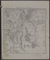
- Found in:
- Beinecke Rare Book and Manuscript Library > A Chart of the Internal Part of Louisiana, Including all the hitherto unexplored Countries, lying between the River La Platte of the Missouri on the N: and the Red River on the S: the Mississippi East and the Mountains of Mexico West; with a Part of New M
- Creator:
- Karl, Anton
- Published / Created:
- 1875
- Call Number:
- 841 1875
- Container / Volume:
- BRBL_00596
- Image Count:
- 1
- Resource Type:
- Maps, Atlases & Globes
- Description:
- In lower margin: "Official copy, William J. Volkmar, 1st. Lieut. 5th Cav."
- Publisher:
- s.n.],
- Subject (Geographic):
- New Mexico--Administrative and political divisions--Maps, New Mexico--Historical geography--Maps, and New Mexico--Maps
- Subject (Name):
- Lichtenberg, G. A and Morrison, C. C. (Charles Clifford), 1848 or 1849-1894
- Subject (Topic):
- Land grants--New Mexico--Maps and Railroads--New Mexico--Maps
- Found in:
- Beinecke Rare Book and Manuscript Library > District of New Mexico / Lt. C.C. Morrison, 6th Cav. U.S.A., acting eng.r officer ; drawn by Anton Karl ; copied by G.A. Lichtenberg, sergt. engrs.
- Published / Created:
- between 1869 and 1884]
- Call Number:
- 841 18XX
- Container / Volume:
- BRBL_00596
- Image Count:
- 1
- Resource Type:
- Maps, Atlases & Globes
- Alternative Title:
- Map of New Mexico and New Mexico
- Description:
- Copyright: Geo. F. Cram.
- Publisher:
- s.n.,
- Subject (Geographic):
- New Mexico--Administrative and political divisions--Maps and New Mexico--Maps
- Subject (Name):
- Cram, George Franklin, 1841-1928 and Kingman, E., Jr
- Subject (Topic):
- Indian reservations--New Mexico--Maps, Land grants--New Mexico--Maps, and Railroads--New Mexico--Maps
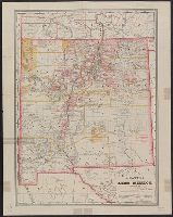
- Found in:
- Beinecke Rare Book and Manuscript Library > Hayt's map of New Mexico / compiled by E. Kingman, Jr., deputy U.S. surveyor.
- Call Number:
- Zc56 859so
- Collection Title:
- Charter and by-laws of the Sopori Land and Mining Company, incorporated by the state of Rhode
- Image Count:
- 1
- Resource Type:
- Maps, Atlases & Globes
- Subject (Geographic):
- Arizona--Maps, California--Maps, Mexico--Maps, and New Mexico--Maps
- Subject (Topic):
- Mineral industries--United States--History--Sources
- Collection Created:
- Providence : Knowles, Anthony & Co., 1859
- Found in:
- Beinecke Rare Book and Manuscript Library > Map of Arizona or the Gadsen Purchase with the position of its silver mines as now worked 1859
- Creator:
- Orleman, L. H
- Published / Created:
- 1874
- Call Number:
- 796 1874B
- Container / Volume:
- BRBL_00526
- Image Count:
- 1
- Resource Type:
- Maps, Atlases & Globes
- Description:
- "From the Streeter collection."
- Publisher:
- Askevold & Roy?],
- Subject (Geographic):
- Indian Territory--Maps, New Mexico--Maps, and Texas--Maps
- Subject (Name):
- Askevold & Roy, Davidson, John W., 1825-1881, and Streeter, Thomas W.--(Thomas Winthrop),--1883-1965--Ownership
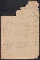
- Found in:
- Beinecke Rare Book and Manuscript Library > Map of parts of Indian Territory, Texas, and New Mexico / compiled by order of Bvt. Maj. Genl. J.W. Davidson, U.S.A., commanding Fort Sill Ind. Ter. ; by Lieut. L.H. Orleman, 10th Cavalry ; lithographed at head quarters mil. div. of the mo., by Askevold &
- Creator:
- Ehrenberg, Herman, 1816-1866
- Published / Created:
- 1858
- Call Number:
- 88191 1858
- Container / Volume:
- BRBL_00653
- Image Count:
- 1
- Resource Type:
- Maps, Atlases & Globes
- Description:
- "The Yaqui, Mayo, and Fuerte Valleys are by A. Fleury, millitary [sic] eng. of Sonora."
- Publisher:
- Middleton, Strobridge & Co., lithographers,
- Subject (Geographic):
- Baja California (Mexico : Peninsula)--Maps, New Mexico--Maps, and Sonora (Mexico : State)--Maps
- Subject (Name):
- Fleury, A and Strobridge & Co. Lith
- Subject (Topic):
- Gadsden Purchase--Maps
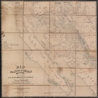
- Found in:
- Beinecke Rare Book and Manuscript Library > Map of the Gadsden Purchase, Sonora, and portions of New Mexico, Chihuaua & California / by Herman Ehrenberg, C.E., from his private notes and those of Colonel Gray, Maj. Heintzelman, Lieut. Parks, and others.
- Creator:
- Parke, John G
- Published / Created:
- 1851
- Call Number:
- 841 1851
- Container / Volume:
- BRBL_00596
- Image Count:
- 1
- Resource Type:
- Maps, Atlases & Globes
- Description:
- Cloth-mounted.
- Publisher:
- [Corps of Topographical Engineers]
- Subject (Geographic):
- New Mexico--Maps and Southwestern States--Maps
- Subject (Name):
- Abert, John James, 1788-1863, J & D Major, Kern, Richard H., 1821-1853, Munroe, John, and United States. Corps of Topographical Engineers
- Found in:
- Beinecke Rare Book and Manuscript Library > Map of the Territory of New Mexico / compiled by Jno. G. Parke ; assisted by Mr. Richard H. Kern ; by order of Jno. Munroe ; constructed under general orders from J.J. Abert.
- Creator:
- Parke, John G
- Published / Created:
- 1851
- Call Number:
- 841 1851
- Container / Volume:
- BRBL_00596
- Image Count:
- 1
- Resource Type:
- Maps, Atlases & Globes
- Description:
- Includes list of sources.
- Publisher:
- [Corps of Topographical Engineers]
- Subject (Geographic):
- New Mexico--Maps and Southwestern States--Maps
- Subject (Name):
- Abert, John James, 1788-1863, J & D Major, Kern, Richard H., 1821-1853, Munroe, John, and United States. Corps of Topographical Engineers
- Found in:
- Beinecke Rare Book and Manuscript Library > Map of the Territory of New Mexico / compiled by Jno. G. Parke ; assisted by Mr. Richard H. Kern ; by order of Jno. Munroe ; constructed under general orders from J.J. Abert.
- Creator:
- Gray, Ormando Willis
- Published / Created:
- 1874]
- Call Number:
- 841 1874
- Container / Volume:
- BRBL_00596
- Image Count:
- 1
- Resource Type:
- Maps, Atlases & Globes
- Description:
- "138."
- Publisher:
- Stedman, Brown & Lyon?,
- Subject (Geographic):
- Arizona--Maps and New Mexico--Maps
- Subject (Name):
- Gray, Ormando Willis. Gray's atlas of the United States
- Found in:
- Beinecke Rare Book and Manuscript Library > New Mexico and Arizona / [Ormando Willis Gray].
- Creator:
- Gray, Ormando Willis
- Published / Created:
- 1878?]
- Call Number:
- 841 1878A
- Container / Volume:
- BRBL_00596
- Image Count:
- 2
- Resource Type:
- Maps, Atlases & Globes
- Alternative Title:
- Mexico.
- Description:
- From Gray's Atlas of the United States. Philadelphia, [1878?]
- Publisher:
- s.n.?,
- Subject (Geographic):
- Arizona--Maps, Mexico--Maps, and New Mexico--Maps
- Subject (Name):
- Gray, Ormando Willis. Gray's atlas of the United States
- Found in:
- Beinecke Rare Book and Manuscript Library > New Mexico and Arizona.