Skip to search
Skip to main content
Skip to first result
Search
You Searched For
Genre
Maps
Subject (Name)
Arnold, Robert M.--Ownership
New Search
Search Results
Creator:
Published / Created:
1838]
Call Number:
80 1838B
Container / Volume:
BRBL_00532
Image Count:
1
Resource Type:
Maps, Atlases & Globes
Found in:
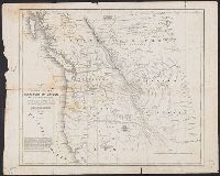
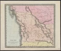
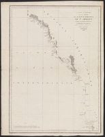
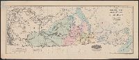
Beinecke Rare Book and Manuscript Library > Map of the United States, Territory of Oregon, west of the Rocky Mountains : exhibiting the various trading depots or forts occupied by the British Hudson Bay Company, connected with the western and northwestern fur trade / compiled in the Bureau of Topog
Creator:
Published / Created:
1838]
Call Number:
80 1838B
Container / Volume:
BRBL_00532
Image Count:
1
Resource Type:
Maps, Atlases & Globes
Found in:
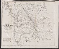
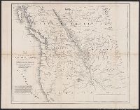
Beinecke Rare Book and Manuscript Library > Map of the United States, Territory of Oregon, west of the Rocky Mountains : exhibiting the various trading depots or forts occupied by the British Hudson Bay Company, connected with the western and northwestern fur trade / compiled in the Bureau of Topog
Creator:
Published / Created:
[1752]
Call Number:
23 1750
Container / Volume:
BRBL_00682
Image Count:
1
Resource Type:
Maps, Atlases & Globes
Found in:
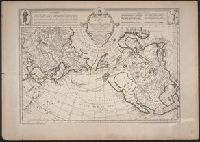
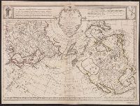
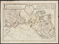
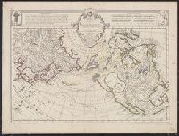
Beinecke Rare Book and Manuscript Library > Carte des nouvelles découvertes au nord de la Mer du Sud : tant à l'est de la Siberie et du Kamtchatka, qu'à l'ouest de la Nouvelle France / dressée sur le mémoires de Mr. Del'Isle, professeur royal et de l'Académie des sciences par Philippe Buache
Creator:
Published / Created:
[between 1635 and 1650]
Call Number:
11 1635
Container / Volume:
BRBL_00003
Image Count:
2
Resource Type:
Maps, Atlases & Globes
Found in:
Beinecke Rare Book and Manuscript Library > Nova totius terrarum orbis geographica ac hydrographica tabula / auct. Guiljelmo Blaeuw ; Ja. van den Ende sculpsit.
Creator:
Published / Created:
1798
Call Number:
845 1798E
Container / Volume:
BRBL_00619
Image Count:
1
Resource Type:
Maps, Atlases & Globes
Found in:
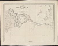
Beinecke Rare Book and Manuscript Library > A chart shewing part of the coast of N.W. America, with the tracks of His Majesty's sloop Discovery and armed tender Chatham / commanded by George Vancouver, esqu. and prepared under his immediate inspection by Lieut. Joseph Baker, in which the continenta
Creator:
Published / Created:
1798
Call Number:
845 1798B
Container / Volume:
BRBL_00619
Image Count:
1
Resource Type:
Maps, Atlases & Globes
Found in:
Beinecke Rare Book and Manuscript Library > A chart shewing part of the coast of N.W. America, with the tracks of His Majesty's sloop Discovery and armed tender Chatham / commanded by George Vancouver, esqr. and prepared from the foregoing surveys under his immediate inspection by Lieut. Edwd. Robe
Creator:
Published / Created:
1798
Call Number:
845 1798C
Container / Volume:
BRBL_00619
Image Count:
1
Resource Type:
Maps, Atlases & Globes
Found in:
Beinecke Rare Book and Manuscript Library > A chart shewing part of the coast of N.W. America, with the tracks of His Majesty's sloop Discovery and armed tender Chatham / commanded by George Vancouver, esq. and prepared under his immediate inspection by Lieut. Joseph Baker, in which the continental
Creator:
Published / Created:
1798
Call Number:
845 1798G
Container / Volume:
BRBL_00619
Image Count:
1
Resource Type:
Maps, Atlases & Globes
Found in:
Beinecke Rare Book and Manuscript Library > A chart shewing part of the coast of N.W. America, with the tracks of His Majesty's sloop Discovery and armed tender Chatham / commanded by George Vancouver, esqr. and prepared under his immediate inspection by Lieut. Joseph Baker, in which the continenta
Creator:
Published / Created:
1798
Call Number:
845 1798A
Container / Volume:
BRBL_00619
Image Count:
1
Resource Type:
Maps, Atlases & Globes
Found in:
Beinecke Rare Book and Manuscript Library > A chart shewing part of the coast of N.W. America : with the tracks of His Majesty's sloop Discovery and armed tender Chatham / commanded by George Vancouver, esqr. and prepared under his immediate inspection by Lieut. Joseph Baker, in which the continent
Creator:
Published / Created:
1646-1647]
Call Number:
845 1647
Container / Volume:
BRBL_00619
Image Count:
1
Resource Type:
Maps, Atlases & Globes
Found in:
Beinecke Rare Book and Manuscript Library > Carta particolare dello stretto di Iezo fra l'America è l'isola Iezo / AF: Lucini fece.
Creator:
Published / Created:
1798
Call Number:
845 1798H
Container / Volume:
BRBL_00619
Image Count:
1
Resource Type:
Maps, Atlases & Globes
Found in:
Beinecke Rare Book and Manuscript Library > A chart shewing part of the coast of N.W. America, with the tracks of His Majesty's sloop Discovery and armed tender Chatham / commanded by George Vancouver, esq. and prepared under his immediate inspection by Lieut. Joseph Baker, in which the continental
Creator:
Published / Created:
1827]
Call Number:
846 1827
Container / Volume:
BRBL_00620
Image Count:
1
Resource Type:
Maps, Atlases & Globes
Found in:
Beinecke Rare Book and Manuscript Library > Partie de l'Oregon / dressée et dessinée par Ph. Vandermaelen ; des[sin]ée sur pierre et lith[ographi]e par H. Ode et Ph. Lippens.
Creator:
Published / Created:
[1836]
Call Number:
845 1833
Container / Volume:
BRBL_00620
Image Count:
1
Resource Type:
Maps, Atlases & Globes
Found in:
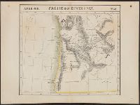
Beinecke Rare Book and Manuscript Library > Oregon Territory / Illman & Pilbrow sc.
Creator:
Published / Created:
1827]
Call Number:
846 1827A
Container / Volume:
BRBL_00620
Image Count:
1
Resource Type:
Maps, Atlases & Globes
Found in:
Beinecke Rare Book and Manuscript Library > Partie des États Unis.
Creator:
Published / Created:
1798
Call Number:
845 1798F
Container / Volume:
BRBL_00619
Image Count:
1
Resource Type:
Maps, Atlases & Globes
Found in:
Beinecke Rare Book and Manuscript Library > A chart shewing part of the coast of N.W. America, with the tracks of His Majesty's sloop Discovery and armed tender Chatham / commanded by George Vancouver, esqr. and prepared under his immediate inspection by Lieut. Joseph Baker, in which the continenta
Creator:
Published / Created:
1798
Call Number:
845 1798D
Container / Volume:
BRBL_00619
Image Count:
1
Resource Type:
Maps, Atlases & Globes
Found in:
Beinecke Rare Book and Manuscript Library > A chart shewing part of the coast of N.W. America, with the tracks of His Majesty's sloop Discovery and armed tender Chatham / commanded by George Vancouver, esqr. and prepared under his immediate inspection by Lieut. Joseph Baker, in which the continenta
Creator:
Published / Created:
{1797]
Call Number:
845 1797
Container / Volume:
BRBL_00619
Image Count:
1
Resource Type:
Maps, Atlases & Globes
Found in:
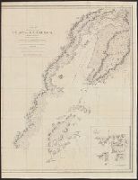
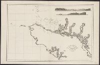
Beinecke Rare Book and Manuscript Library > Carte générale d'une partie de la côte du nord-ouest de l'Amérique : reconnue par les frégates françaises la Boussole et l'Astrolabe / assujettie au point journalier de la Frégate la Boussole determiné astronomiquement par M. Dagelet ; Bouclet scu
Creator:
Published / Created:
[1752]
Call Number:
18 1750C
Container / Volume:
BRBL_00732
Image Count:
1
Resource Type:
Maps, Atlases & Globes
Found in:
Beinecke Rare Book and Manuscript Library > Carte des nouvelles découvertes au nord de la Mer du Sud : tant à l'est de la Siberie et du Kamtchatka, qu'à l'ouest de la Nouvelle France / dressée sur le mémoires de Mr. Del'Isle, professeur royal et de l'Académie des sciences par Philippe Buache
Published / Created:
[1889?]
Call Number:
847 Se18 1889A
Container / Volume:
BRBL_00626
Image Count:
2
Resource Type:
Maps, Atlases & Globes
Found in:
Beinecke Rare Book and Manuscript Library > Guide map of Seattle, the metropolis of Washington Ter. / compliments of Wood & Osborne ; Benedict & Co., eng.
Creator:
Published / Created:
[1752]
Call Number:
18 1750B
Container / Volume:
BRBL_00012
Image Count:
1
Resource Type:
Maps, Atlases & Globes
Found in:
Beinecke Rare Book and Manuscript Library > Carte des nouvelles découvertes au nord de la Mer du Sud : tant à l'est de la Siberie et du Kamtchatka, qu'à l'ouest de la Nouvelle France / dressée sur le mémoires de Mr. Del'Isle, professeur royal et de l'Académie des sciences par Philippe Buache
Creator:
Published / Created:
[1752]
Call Number:
23 1750A
Container / Volume:
BRBL_00018
Image Count:
1
Resource Type:
Maps, Atlases & Globes
Found in:
Beinecke Rare Book and Manuscript Library > Carte des nouvelles découvertes au nord de la Mer du Sud : tant à l'est de la Siberie et du Kamtchatka, qu'à l'ouest de la Nouvelle France / dressée sur le mémoires de Mr. Del'Isle, professeur royal et de l'Académie des sciences par Philippe Buache
Creator:
Published / Created:
1875
Call Number:
73 1875A
Container / Volume:
BRBL_00375
Image Count:
1
Resource Type:
Maps, Atlases & Globes
Found in:
Beinecke Rare Book and Manuscript Library > Map of part of the North West Territory including the province of Manitoba : exhibiting the several tracts of country ceded by the Indian Treaties 1, 2, 3 and 4 : to accompany report of the Honble. the Minister of the Interior, dated 20th January, 1875 /
Creator:
Published / Created:
1798?]
Call Number:
739 1795
Container / Volume:
BRBL_00388
Image Count:
1
Resource Type:
Maps, Atlases & Globes
Found in:
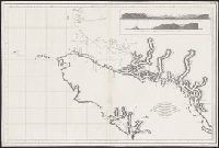
Beinecke Rare Book and Manuscript Library > Carta esferica de los reconocimientos hechos en 1792 en la costa N.O. de America para examinar la entrada de Juan de Fuca, y la internacion de sus canales navegables / levantada de orden del Rey Nuestro Señor abordo de las Goletas Sutil y Mexicana, por D
Published / Created:
between 1795 and 1814]
Call Number:
739 1795A
Container / Volume:
BRBL_00388
Image Count:
1
Resource Type:
Maps, Atlases & Globes
Found in:
Beinecke Rare Book and Manuscript Library > Carta esferica de los reconocimientos hechos en la costa N.O. de America desde la parte en que empiezan á angostar los canales de la entrada de Juan de Fuca hasta la salida de las Goletas Sutil y Mexicana, año de 1795 / Joaquin Ballester la grabó ; [Di
Creator:
Published / Created:
[Brussels : and 1827]
Call Number:
739 1827
Container / Volume:
BRBL_00388
Image Count:
1
Resource Type:
Maps, Atlases & Globes
Found in:
Beinecke Rare Book and Manuscript Library > Partie de la Nouvelle Hanovre.
Creator:
Published / Created:
1798?]
Call Number:
739 1795
Container / Volume:
BRBL_00388
Image Count:
1
Resource Type:
Maps, Atlases & Globes
Found in:
Beinecke Rare Book and Manuscript Library > Carta esferica de los reconocimientos hechos en 1792 en la costa N.O. de America para examinar la entrada de Juan de Fuca, y la internacion de sus canales navegables / levantada de orden del Rey Nuestro Señor abordo de las Goletas Sutil y Mexicana, por D
Creator:
Published / Created:
[1871]
Call Number:
7391 1871
Container / Volume:
BRBL_00394
Image Count:
1
Resource Type:
Maps, Atlases & Globes
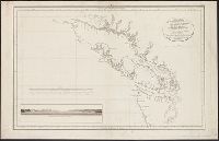
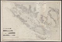
Found in:
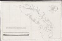
Beinecke Rare Book and Manuscript Library > Vancouver Island and adjacent shores of British Columbia / surveyed by G.H. Richards, assisted by R.C. Mayne ... [et al.], 1859-65 ; compiled and drawn for engraving by E.J. Powell ; engraved by Davies & Powell.
Branch:v1.60.98 ,Deployed:2024-04-17T09:54:31-04:00