Search
You Searched For
Search Results
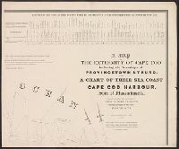
- Creator:
- Graham, J. D. (James Duncan), 1799-1865
- Published / Created:
- 1836
- Call Number:
- 764 C172 1836
- Container / Volume:
- BRBL_00456A
- Image Count:
- 4
- Resource Type:
- Maps, Atlases & Globes
- Found in:
- Beinecke Rare Book and Manuscript Library > A map of the extremity of Cape Cod : including the townships of Provincetown & Truro, with a chart of their sea coast and of Cape Cod Harbour, State of Massachusetts / executed under the direction of Major J.D. Graham ... 1833, '34, & '35.
- Creator:
- Abbot, Henry L
- Published / Created:
- 1862]
- Call Number:
- 783hc 1862F
- Container / Volume:
- BRBL_00511
- Image Count:
- 3
- Resource Type:
- Maps, Atlases & Globes
- Found in:
- Beinecke Rare Book and Manuscript Library > Campaign maps, Army of the Potomac / prepared by command of Maj. Gen. George B. McClellan [under direction of] A.A. Humphreys, Brig. Gen. and chief of Top. Engrs. ; compiled by Capt. H.L. Abbot, Top. Engrs., September 1862 ; photographic reduction by L.E.
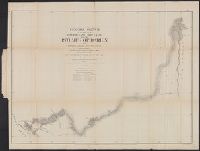
- Creator:
- Michler, N. (Nathaniel), 1827-1881
- Published / Created:
- 1859?]
- Call Number:
- 89 1866G
- Container / Volume:
- BRBL_00658
- Image Count:
- 1
- Resource Type:
- Maps, Atlases & Globes
- Found in:
- Beinecke Rare Book and Manuscript Library > General sketch of the survey for an interoceanic ship canal near the Isthmus of Darien via the Rivers Atrato and Truandó / made in accordance with the Act of Congress of March 3rd, 1857, under the direction of the Hon. Secretaries of War and of the Navy
- Creator:
- Emory, William H. (William Hemsley), 1811-1887
- Published / Created:
- 1844
- Call Number:
- 796 1844A
- Container / Volume:
- BRBL_00524
- Image Count:
- 1
- Resource Type:
- Maps, Atlases & Globes
- Found in:
- Beinecke Rare Book and Manuscript Library > Map of Texas and the country adjacent / compiled in the Bureau of the Corps of Topographical Engeneers [sic], from the best authorities, for the State Department, under the direction of Col. J.J. Abert, Chief of the Corps, by W.H. Emory, 1st Lieut. T.E.
- Published / Created:
- 1863
- Call Number:
- 783hc 1863S
- Container / Volume:
- BRBL_00512
- Image Count:
- 3
- Resource Type:
- Maps, Atlases & Globes
- Found in:
- Beinecke Rare Book and Manuscript Library > Map of a part of Eastern Virginia : including portions of Spotsylvania Co. and adjoining counties / compiled by Capt. W.H. Paine, A.D.C.
- Creator:
- Simpson, J. H. (James Hervey), 1813-1883
- Published / Created:
- 1850?]
- Call Number:
- 80 1849B
- Container / Volume:
- BRBL_00533
- Image Count:
- 1
- Resource Type:
- Maps, Atlases & Globes
- Found in:
- Beinecke Rare Book and Manuscript Library > Map of route pursued by U.S. troops from Fort Smith, Arkansas, to Santa Fé, New Mexico, via south side of Canadian River in the year 1849 whilst serving as an escort to a party of California emigrants : escort commanded ... by Capt. R.B. Marcy ... Explor
- Creator:
- Atkinson, W. G
- Published / Created:
- [New Orleans? : Corps of Topographical Engineers?, and 1862?]
- Call Number:
- 783hc 1862J
- Container / Volume:
- BRBL_00511
- Image Count:
- 1
- Resource Type:
- Maps, Atlases & Globes
- Found in:
- Beinecke Rare Book and Manuscript Library > Map of the battle fields of Manassas and the surrounding region showing the various actions of the 21st July, 1861, between the armies of the Confederate States and the United States / surveyed and drawn by W.G. Atkinson, acting 1st Lieut. Engineers. ; ph
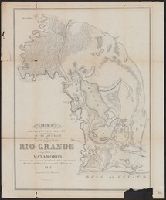
- Creator:
- Webster, J. D. (Joseph Dana), 1811-1876
- Published / Created:
- 1847
- Call Number:
- 796 R477 1847
- Container / Volume:
- BRBL_00528
- Image Count:
- 1
- Resource Type:
- Maps, Atlases & Globes
- Found in:
- Beinecke Rare Book and Manuscript Library > Map of the country adjacent to the left bank of the Rio Grande below Matamoros / surveyed under instructions from Col. J.J. Abert, Corps Top. Eng.rs. ; made by Lieut. J.D. Webster, J.E. ; assisted by T.E. Mullorony, Esq.r. ; Ackerman's Lith.
- Creator:
- Abbot, Henry L
- Published / Created:
- 1862?]
- Call Number:
- 783hc 1862K
- Container / Volume:
- BRBL_00511
- Image Count:
- 1
- Resource Type:
- Maps, Atlases & Globes
- Found in:
- Beinecke Rare Book and Manuscript Library > Official plan of the siege of Yorktown, Va. conducted by the Army of the Potomac under command of Maj. Gen. George B. McClellan U.S.A., April 5th to May 3rd 1862 / prepared under the direction of Brig. Gen. J.G. Barnard, Chief Engr. by Lieut. Henry L. Abb
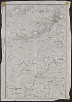
- Creator:
- Merrill, W. E. (William Emery), 1837-1891
- Published / Created:
- 1864]
- Call Number:
- 787hc 1864C
- Container / Volume:
- BRBL_00517A
- Image Count:
- 2
- Resource Type:
- Maps, Atlases & Globes
- Found in:
- Beinecke Rare Book and Manuscript Library > Part of northern Georgia : / compiled under the direction of Capt. Wm. E. Merrill, Chief Top'l Eng'r, D.C.