Search
You Searched For
Search Results
- Published / Created:
- 1780?]
- Call Number:
- 786 C38 1780
- Container / Volume:
- BRBL_00516
- Image Count:
- 1
- Resource Type:
- Maps, Atlases & Globes
- Found in:
- Beinecke Rare Book and Manuscript Library > [Proof copy of a map of Charleston, South Carolina].
- Published / Created:
- [1890?].
- Call Number:
- 38gmb P21 1870
- Container / Volume:
- BRBL_00171
- Image Count:
- 1
- Resource Type:
- Maps, Atlases & Globes
- Found in:
- Beinecke Rare Book and Manuscript Library > [Principales opérations de voirie exécutées à Paris].
- Creator:
- Pownall, Thomas, 1722-1805
- Published / Created:
- between 1783 and 1799?]
- Call Number:
- 71 1785C
- Container / Volume:
- BRBL_00366
- Image Count:
- 2
- Resource Type:
- Maps, Atlases & Globes
- Found in:
- Beinecke Rare Book and Manuscript Library > [Pownall's map of North America and the West Indies].
- Creator:
- Volčić, Vicko Dimitrije, 1563-1607, cartographer
- Published / Created:
- [1601]
- Call Number:
- Manuscript 49cea 1601
- Image Count:
- 2
- Resource Type:
- cartographic image
- Found in:
- Beinecke Rare Book and Manuscript Library > [Portolan chart of the Mediterranean Sea].
- Published / Created:
- [approximately 1960]
- Call Number:
- Art Storage 1019
- Image Count:
- 2
- Resource Type:
- cartographic image
- Found in:
- Beinecke Rare Book and Manuscript Library > [Portolan chart of the Mediterranean Sea, the North Atlantic Ocean, the Black Sea, and the northwestern African coast].
- Published / Created:
- 1919?]
- Call Number:
- 11hcf 1919B-11
- Image Count:
- 2
- Resource Type:
- Maps, Atlases & Globes
- Found in:
- Beinecke Rare Book and Manuscript Library > [Portion of map of France and Germany].
- Creator:
- Jansson, Jan, 1588-1664
- Published / Created:
- 1652?]
- Call Number:
- 19 1657
- Container / Volume:
- BRBL_00682
- Image Count:
- 1
- Resource Type:
- Maps, Atlases & Globes
- Found in:
- Beinecke Rare Book and Manuscript Library > [Polus Antarcticus].
- Published / Created:
- [approximately 1679]
- Call Number:
- Globe 41
- Image Count:
- 11
- Resource Type:
- cartographic three dimensional form
- Found in:
- Beinecke Rare Book and Manuscript Library > [Pocket terrestrial globe] [cartographic material].
- Published / Created:
- 1820?]
- Call Number:
- 11 1820
- Container / Volume:
- BRBL_00007
- Image Count:
- 1
- Resource Type:
- Maps, Atlases & Globes
- Found in:
- Beinecke Rare Book and Manuscript Library > [Playing card maps of of Europe and Asia and their countries].
- Creator:
- Bradshaw (Publisher)
- Published / Created:
- 1891]
- Call Number:
- 38 M35 1898
- Container / Volume:
- BRBL_00158
- Image Count:
- 1
- Resource Type:
- Maps, Atlases & Globes
- Found in:
- Beinecke Rare Book and Manuscript Library > [Plans of the major cities and towns of continental Europe] [cartographic material].
- Creator:
- Bradshaw (Publisher)
- Published / Created:
- 1891]
- Call Number:
- 38 P21 1898
- Container / Volume:
- BRBL_00164
- Image Count:
- 1
- Resource Type:
- Maps, Atlases & Globes
- Found in:
- Beinecke Rare Book and Manuscript Library > [Plans of the major cities and towns of continental Europe] [cartographic material].
- Creator:
- Trudeau, Charles Laveau, ca. 1750-1816
- Published / Created:
- 1808]
- Call Number:
- BrSide4o Zc22 808thha
- Image Count:
- 4
- Resource Type:
- Maps, Atlases & Globes
- Found in:
- Beinecke Rare Book and Manuscript Library > [Plans of New Orleans to accompany J.B.S. Thierry's Examen des droits des Etats Unis et des pretentions de Mr. Edouard Livingston sur la batture de Mr. Edouard Livingston sur la batture en face du faubourg Ste. Marie].
- Published / Created:
- 1918
- Call Number:
- 11hc 1918-Z1
- Container / Volume:
- BRBL_00010F
- Image Count:
- 1
- Resource Type:
- Maps, Atlases & Globes
- Found in:
- Beinecke Rare Book and Manuscript Library > [Planmaterial der 7. Armee. 22. Montcornet.]
- Published / Created:
- [1749]
- Call Number:
- BrSides Box 2019 18
- Image Count:
- 1
- Resource Type:
- Maps, Atlases & Globes
- Found in:
- Beinecke Rare Book and Manuscript Library > [Plan of the island of St. Louis, Senegal] ; Egnen fra fortet St. Joseph til Galam ; Grundridsning of fortet St. Joseph.
- Published / Created:
- [1652?]
- Call Number:
- 38AM P21 1652A
- Container / Volume:
- BRBL_00167
- Image Count:
- 1
- Resource Type:
- Maps, Atlases & Globes
- Found in:
- Beinecke Rare Book and Manuscript Library > [Pictorial map of Paris, 1652] Apres tant de faux Plans et de Mauvaises representationes de cette grande Ville ... [Plan de/Gomboust].
- Published / Created:
- [1652?]
- Call Number:
- 38AM P21 1652B
- Container / Volume:
- BRBL_00167
- Image Count:
- 1
- Resource Type:
- Maps, Atlases & Globes
- Found in:
- Beinecke Rare Book and Manuscript Library > [Pictorial map of Paris, 1652, Plan de/Gomboust.]
- Published / Created:
- 1915
- Call Number:
- 11ba 1915A
- Container / Volume:
- BRBL_00010A
- Image Count:
- 1
- Resource Type:
- Maps, Atlases & Globes
- Found in:
- Beinecke Rare Book and Manuscript Library > [Philips' 4 inch graphic globe.]
- Call Number:
- 11ba 1915
- Container / Volume:
- BRBL_00010A
- Image Count:
- 1
- Resource Type:
- Maps, Atlases & Globes
- Found in:
- Beinecke Rare Book and Manuscript Library > [Philips' 12 inch terrestrial globe.]
- Published / Created:
- [1665?]
- Call Number:
- 28 1665
- Container / Volume:
- BRBL_00023E
- Image Count:
- 1
- Resource Type:
- Maps, Atlases & Globes
- Found in:
- Beinecke Rare Book and Manuscript Library > [Philippine Islands. By Johannes Vingboons. ca. 1665]
- Published / Created:
- [ca. 1685?]
- Call Number:
- 73 1685A
- Container / Volume:
- BRBL_00373
- Image Count:
- 1
- Resource Type:
- Maps, Atlases & Globes
- Found in:
- Beinecke Rare Book and Manuscript Library > [Partie de Terre Neuve].
- Published / Created:
- [1800?]
- Call Number:
- 755cea 1800
- Container / Volume:
- BRBL_00441
- Image Count:
- 1
- Resource Type:
- Maps, Atlases & Globes
- Found in:
- Beinecke Rare Book and Manuscript Library > [Part of the shore line of Florida, Georgia, & South Carolina and a portion of the Bahama Bank].
- Published / Created:
- 1864
- Call Number:
- 787hc 1864B
- Container / Volume:
- BRBL_00517A
- Image Count:
- 1
- Resource Type:
- Maps, Atlases & Globes
- Found in:
- Beinecke Rare Book and Manuscript Library > [Part of eastern Georgia].
- Published / Created:
- 1864
- Call Number:
- 787hc 1864B
- Container / Volume:
- BRBL_00517A
- Image Count:
- 1
- Resource Type:
- Maps, Atlases & Globes
- Found in:
- Beinecke Rare Book and Manuscript Library > [Part of eastern Georgia].
- Published / Created:
- [1200?]
- Call Number:
- 38 P21 1200
- Container / Volume:
- BRBL_00159
- Image Count:
- 1
- Resource Type:
- Maps, Atlases & Globes
- Found in:
- Beinecke Rare Book and Manuscript Library > [Paris].
- Published / Created:
- 1911
- Call Number:
- 38 P21 1911
- Container / Volume:
- BRBL_00164A
- Image Count:
- 1
- Resource Type:
- Maps, Atlases & Globes
- Found in:
- Beinecke Rare Book and Manuscript Library > [Paris, central part] / Gravé chez L. Wuhrer.
- Published / Created:
- 1911?]
- Call Number:
- 38 P21 1911A
- Container / Volume:
- BRBL_00164A
- Image Count:
- 1
- Resource Type:
- Maps, Atlases & Globes
- Found in:
- Beinecke Rare Book and Manuscript Library > [Paris and environs] / Gravé chez L. Wuhrer.
- Published / Created:
- [1740?]
- Call Number:
- 38 P21 1740
- Container / Volume:
- BRBL_00160
- Image Count:
- 1
- Resource Type:
- Maps, Atlases & Globes
- Found in:
- Beinecke Rare Book and Manuscript Library > [Paris and Environs].
- Published / Created:
- [19--].
- Call Number:
- 58166 C714 1850
- Container / Volume:
- BRBL_00314
- Image Count:
- 1
- Resource Type:
- Maps, Atlases & Globes
- Found in:
- Beinecke Rare Book and Manuscript Library > [Outline map of the capital Co-loa, North Vietnam]
- Published / Created:
- 191-.
- Call Number:
- 11hcf 1919E-4
- Container / Volume:
- BRBL_00010ZA
- Image Count:
- 1
- Resource Type:
- Maps, Atlases & Globes
- Found in:
- Beinecke Rare Book and Manuscript Library > [Outline map of the Adriatic Sea and environs.]
- Published / Created:
- 191-.
- Call Number:
- 11hcf 1919-3
- Container / Volume:
- BRBL_00010K
- Image Count:
- 1
- Resource Type:
- Maps, Atlases & Globes
- Found in:
- Beinecke Rare Book and Manuscript Library > [Outline map of Eastern Europe showing exisiting and proposed frontiers.]
- Published / Created:
- 191-.
- Call Number:
- 11hcf 1919E-2
- Container / Volume:
- BRBL_00010ZA
- Image Count:
- 1
- Resource Type:
- Maps, Atlases & Globes
- Found in:
- Beinecke Rare Book and Manuscript Library > [Outline map of Dalmatia and surrounding area.]
- Published / Created:
- 1920
- Call Number:
- 75ak 1920
- Container / Volume:
- BRBL_00407A
- Image Count:
- 1
- Resource Type:
- Maps, Atlases & Globes
- Found in:
- Beinecke Rare Book and Manuscript Library > [Outline Map of the United States] / engraved and printed by the U.S. Geological Survey.
- Published / Created:
- [1847]
- Call Number:
- 844 1847
- Container / Volume:
- BRBL_00601
- Image Count:
- 1
- Resource Type:
- Maps, Atlases & Globes
- Found in:
- Beinecke Rare Book and Manuscript Library > [Occupation of California map : disposal of U.S. Army, June 19th, 1847].
- Published / Created:
- 1890?]
- Call Number:
- 366 N75 1890
- Container / Volume:
- BRBL_00145
- Image Count:
- 4
- Resource Type:
- Maps, Atlases & Globes
- Found in:
- Beinecke Rare Book and Manuscript Library > [Nördlingen].
- Creator:
- Bache, A. D. (Alexander Dallas), 1806-1867
- Published / Created:
- 1865
- Call Number:
- 754 1865B
- Container / Volume:
- BRBL_00417
- Image Count:
- 1
- Resource Type:
- Maps, Atlases & Globes
- Found in:
- Beinecke Rare Book and Manuscript Library > [Northern Mississippi, Alabama, and a small part of southern Tennessee] / U.S. Coast Survey, A.D. Bache, supdt.; drawn by A. Lindenkohl; H. Lindenkohl & Chas. G. Krebs, lith.
- Published / Created:
- 1892?]
- Call Number:
- 40 1892
- Container / Volume:
- BRBL_00202
- Image Count:
- 2
- Resource Type:
- Maps, Atlases & Globes
- Found in:
- Beinecke Rare Book and Manuscript Library > [Northern Italy].
- Creator:
- Bache, A. D. (Alexander Dallas), 1806-1867
- Published / Created:
- 1865
- Call Number:
- 754 1865
- Container / Volume:
- BRBL_00417
- Image Count:
- 1
- Resource Type:
- Maps, Atlases & Globes
- Found in:
- Beinecke Rare Book and Manuscript Library > [Northern Georgia and part of South Carolina].
- Creator:
- Velhagen & Klasing (Firm)
- Published / Created:
- [1916?]
- Call Number:
- 38 1916
- Container / Volume:
- BRBL_00155
- Image Count:
- 1
- Resource Type:
- Maps, Atlases & Globes
- Found in:
- Beinecke Rare Book and Manuscript Library > [Northeast France and Belgium].
- Published / Created:
- [19--?]
- Call Number:
- 615 1400/19XX
- Container / Volume:
- BRBL_00332
- Image Count:
- 1
- Resource Type:
- Maps, Atlases & Globes
- Found in:
- Beinecke Rare Book and Manuscript Library > [Northeast Africa from an Arabic manuscript of Ptolemy].
- Published / Created:
- [1750?]
- Call Number:
- 38cea 1750
- Container / Volume:
- BRBL_00169
- Image Count:
- 17
- Resource Type:
- Maps, Atlases & Globes
- Found in:
- Beinecke Rare Book and Manuscript Library > [North and East Coast of France].
- Published / Created:
- [1908?]
- Call Number:
- 771 N49 1908
- Image Count:
- 1
- Resource Type:
- Maps, Atlases & Globes
- Found in:
- Beinecke Rare Book and Manuscript Library > [New York City].
- Published / Created:
- 1884
- Call Number:
- 771 N49 1884
- Container / Volume:
- BRBL_00488
- Image Count:
- 1
- Resource Type:
- Maps, Atlases & Globes
- Found in:
- Beinecke Rare Book and Manuscript Library > [New York City].
- Published / Created:
- [ca. 1905]
- Call Number:
- 771 N49 1905R
- Image Count:
- 1
- Resource Type:
- Maps, Atlases & Globes
- Found in:
- Beinecke Rare Book and Manuscript Library > [New York City real estate].
- Published / Created:
- [1632]
- Call Number:
- Z40 026
- Collection Title:
- The generall historie of Virginia, New-England, and the Summer Isles : with the names of the
- Image Count:
- 1
- Found in:
- Beinecke Rare Book and Manuscript Library > [New England]
- Published / Created:
- [1918?]
- Call Number:
- 40 1918
- Container / Volume:
- BRBL_00202
- Image Count:
- 1
- Resource Type:
- Maps, Atlases & Globes
- Found in:
- Beinecke Rare Book and Manuscript Library > [New Boundaries of Italy in the Northeast].
- Published / Created:
- 1890?]
- Call Number:
- 366 N39 1890
- Container / Volume:
- BRBL_00145
- Image Count:
- 4
- Resource Type:
- Maps, Atlases & Globes
- Found in:
- Beinecke Rare Book and Manuscript Library > [Neuburg].
- Published / Created:
- 1940?]
- Call Number:
- 331 1940
- Container / Volume:
- BRBL_00079
- Image Count:
- 1
- Resource Type:
- Maps, Atlases & Globes
- Found in:
- Beinecke Rare Book and Manuscript Library > [Netherlands-Belgium border region]
- Published / Created:
- 1920].
- Call Number:
- 94gc 1920
- Container / Volume:
- BRBL_00675
- Image Count:
- 1
- Resource Type:
- Maps, Atlases & Globes
- Found in:
- Beinecke Rare Book and Manuscript Library > [Ministerio de Agricultura : Dirección general de agricultura y defensa agricola / Sección de investigaciones agrícolas.]
- Published / Created:
- 1863
- Call Number:
- 783 W25 1863
- Container / Volume:
- BRBL_00510
- Image Count:
- 1
- Resource Type:
- Maps, Atlases & Globes
- Found in:
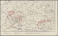
- Beinecke Rare Book and Manuscript Library > [Military topographical map of showing country just to the west of Warrenton, VA].
- Published / Created:
- 1863
- Call Number:
- 783 W25 1863E
- Container / Volume:
- BRBL_00510
- Image Count:
- 1
- Resource Type:
- Maps, Atlases & Globes
- Found in:
- Beinecke Rare Book and Manuscript Library > [Military topographical map of country east and about Warrenton, VA].
- Published / Created:
- 1864
- Call Number:
- 783hc R41 1863
- Container / Volume:
- BRBL_00512
- Image Count:
- 1
- Resource Type:
- Maps, Atlases & Globes
- Found in:
- Beinecke Rare Book and Manuscript Library > [Military map of Richmond and vicinity].
- Published / Created:
- 1864
- Call Number:
- 785hc 1864
- Container / Volume:
- BRBL_00514
- Image Count:
- 1
- Resource Type:
- Maps, Atlases & Globes
- Found in:
- Beinecke Rare Book and Manuscript Library > [Military map of North Carolina : between Raleigh and Greensboro ca. 1864].
- Published / Created:
- [1864]
- Call Number:
- 783hc 1864B
- Container / Volume:
- BRBL_00714
- Image Count:
- 1
- Resource Type:
- Maps, Atlases & Globes
- Found in:
- Beinecke Rare Book and Manuscript Library > [Military manuscript map of Virginia, Richmond to Lynchburg and south to the North Carolina border].
- Published / Created:
- 1863
- Call Number:
- 783 C899 1863
- Container / Volume:
- BRBL_00510
- Image Count:
- 1
- Resource Type:
- Maps, Atlases & Globes
- Found in:
- Beinecke Rare Book and Manuscript Library > [Military and topographic map of region about Culpepper Courthouse, Va.].
- Published / Created:
- [19--].
- Call Number:
- 30em 350-650
- Container / Volume:
- BRBL_00037B
- Image Count:
- 2
- Resource Type:
- Maps, Atlases & Globes
- Found in:
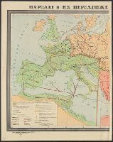
- Beinecke Rare Book and Manuscript Library > [Migrations of peoples in Europe during the 4th-7th centuries].
- Published / Created:
- [1886?].
- Call Number:
- 764gme 1886
- Container / Volume:
- BRBL_00462
- Image Count:
- 2
- Resource Type:
- Maps, Atlases & Globes
- Found in:
- Beinecke Rare Book and Manuscript Library > [Maps of the locations of the Providence, Webster, and Springfield Railroad Company within Massachusetts].
- Published / Created:
- [1870?]
- Call Number:
- 594 1870
- Container / Volume:
- BRBL_00319
- Image Count:
- 1
- Resource Type:
- Maps, Atlases & Globes
- Found in:
- Beinecke Rare Book and Manuscript Library > [Maps of the Island of Ceylon, Burmah, Siam, and Anam.]
- Published / Created:
- 1759
- Call Number:
- 911 1759
- Container / Volume:
- BRBL_00669
- Image Count:
- 1
- Resource Type:
- Maps, Atlases & Globes
- Found in:
- Beinecke Rare Book and Manuscript Library > [Mapa Anexo á un oficio dirigido por D. Pedro de Cevallos al Ministro de Estado D. Ricardo Wall, fecha 20 de Enero de 1759].
- Published / Created:
- 1802
- Call Number:
- Im B388 Zz802B
- Collection Title:
- The imperial guide : with picturesque plans of the great post roads, containing miniatures
- Image Count:
- 1
- Found in:
- Beinecke Rare Book and Manuscript Library > [Map: Talk on the Hill to Birmingham]
- Published / Created:
- 1802
- Call Number:
- Im B388 Zz802B
- Collection Title:
- The imperial guide : with picturesque plans of the great post roads, containing miniatures
- Image Count:
- 1
- Found in:
- Beinecke Rare Book and Manuscript Library > [Map: Stafford to Coventry]
- Published / Created:
- 1802
- Call Number:
- Im B388 Zz802B
- Collection Title:
- The imperial guide : with picturesque plans of the great post roads, containing miniatures
- Image Count:
- 1
- Found in:
- Beinecke Rare Book and Manuscript Library > [Map: Lancaster to Worsley]
- Published / Created:
- 1802
- Call Number:
- Im B388 Zz802B
- Collection Title:
- The imperial guide : with picturesque plans of the great post roads, containing miniatures
- Image Count:
- 1
- Found in:
- Beinecke Rare Book and Manuscript Library > [Map: Islip to Paddington]
- Published / Created:
- 1802
- Call Number:
- Im B388 Zz802B
- Collection Title:
- The imperial guide : with picturesque plans of the great post roads, containing miniatures
- Image Count:
- 1
- Found in:
- Beinecke Rare Book and Manuscript Library > [Map: Coventry to Stony Stratford]
- Published / Created:
- 1802
- Call Number:
- Im B388 Zz802B
- Collection Title:
- The imperial guide : with picturesque plans of the great post roads, containing miniatures
- Image Count:
- 1
- Found in:
- Beinecke Rare Book and Manuscript Library > [Map: Carlisle to Bolton]
- Published / Created:
- 191-.
- Call Number:
- 11hcf 1919A-13
- Container / Volume:
- BRBL_00010M
- Image Count:
- 1
- Resource Type:
- Maps, Atlases & Globes
- Found in:
- Beinecke Rare Book and Manuscript Library > [Map used discussions of in Rumanian-Yugoslav Committee, regarding Rumanian-Hungarian boundary, March 1919.]
- Published / Created:
- 1919
- Call Number:
- 11hcf 1919E-3
- Container / Volume:
- BRBL_00010ZA
- Image Count:
- 1
- Resource Type:
- Maps, Atlases & Globes
- Found in:
- Beinecke Rare Book and Manuscript Library > [Map showing the Trieste-Isonzo region, including Fiume.]
- Published / Created:
- [1898]
- Call Number:
- 855hc 1898H
- Container / Volume:
- BRBL_00765
- Image Count:
- 1
- Resource Type:
- Maps, Atlases & Globes
- Found in:
- Beinecke Rare Book and Manuscript Library > [Map showing fortifications around the mouth of the San Juan River, Cuba during the War of 1898.]
- Published / Created:
- 1899
- Call Number:
- 848 J953 1899
- Container / Volume:
- BRBL_00633
- Image Count:
- 1
- Resource Type:
- Maps, Atlases & Globes
- Found in:
- Beinecke Rare Book and Manuscript Library > [Map showing distances from Juneau, Skagway, and Dyea to various points within Alaska].
- Published / Created:
- [1827?]
- Call Number:
- 755 1827
- Container / Volume:
- BRBL_00439
- Image Count:
- 1
- Resource Type:
- Maps, Atlases & Globes
- Found in:
- Beinecke Rare Book and Manuscript Library > [Map showing disputed boundary between U.S. and Canada] Printed at the lithographic Establishment Quarter Master General's Office Horse Guards. Drawn by L. Herbert.
- Published / Created:
- 191-.
- Call Number:
- 11hc 1918-Z2
- Container / Volume:
- BRBL_00010G
- Image Count:
- 2
- Resource Type:
- Maps, Atlases & Globes
- Found in:
- Beinecke Rare Book and Manuscript Library > [Map showing area surrounding Coucy, France.]
- Published / Created:
- An VIII [1800]
- Call Number:
- 1978 +173
- Collection Title:
- Recueil de cartes géographiques, pour la description de l'Indostan; par le Major J. Rennell
- Image Count:
- 1
- Found in:
- Beinecke Rare Book and Manuscript Library > [Map of] Thibet
- Published / Created:
- 1739
- Call Number:
- 1975 2757
- Collection Title:
- El atlas abreviado, ò, El nuevo compendio de la geografia universal, politica, historica, i curiosa
- Image Count:
- 1
- Resource Type:
- Maps, Atlases & Globes
- Found in:
- Beinecke Rare Book and Manuscript Library > [Map of] Mogol
- Published / Created:
- 1705
- Call Number:
- 1977 +394
- Collection Title:
- Navigantium atque itinerantium bibliotheca: or, A compleat collection of voyages and travels
- Container / Volume:
- Volume 2
- Image Count:
- 1
- Found in:
- Beinecke Rare Book and Manuscript Library > [Map of] Asia
- Published / Created:
- between 1868 and 1889?]
- Call Number:
- 80 1900
- Container / Volume:
- BRBL_00536
- Image Count:
- 2
- Resource Type:
- Maps, Atlases & Globes
- Found in:
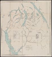
- Beinecke Rare Book and Manuscript Library > [Map of western United States showing military departments].
- Creator:
- Qazwīnī, Zakarīyā ibn Muḥammad, 1208 or 9-1283 or 4.
- Published / Created:
- [15--?]
- Call Number:
- Arabic MSS 575
- Image Count:
- 2
- Resource Type:
- Maps, Atlases & Globes
- Found in:
- Beinecke Rare Book and Manuscript Library > [Map of the world] / [Zakarīyā ibn Muḥammad al-Qazwīnī]. -- [15--?].
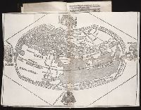
- Published / Created:
- [1509]
- Call Number:
- Taylor 46
- Collection Title:
- Cosmographia Pii Papae in Asiæ & Europæ eleganti descriptione : Asia. Historias rerum vbique
- Image Count:
- 1
- Found in:
- Beinecke Rare Book and Manuscript Library > [Map of the world]
- Published / Created:
- 1618?
- Call Number:
- Taylor 278
- Collection Title:
- Jovrnal ou Description dv merveillevx voyage de Gvillavme Schovten, hollandois natif de Hoorn
- Image Count:
- 1
- Found in:
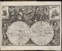
- Beinecke Rare Book and Manuscript Library > [Map of the world in two hemispheres]
- Published / Created:
- [19--?]
- Call Number:
- 40gme 1865
- Container / Volume:
- BRBL_00230
- Image Count:
- 2
- Resource Type:
- Maps, Atlases & Globes
- Found in:
- Beinecke Rare Book and Manuscript Library > [Map of the railways of Italy].
- Published / Created:
- 191-.
- Call Number:
- 11hcf 1919E-1
- Image Count:
- 1
- Resource Type:
- Maps, Atlases & Globes
- Found in:
- Beinecke Rare Book and Manuscript Library > [Map of the countries around the Western Mediterranean.]
- Published / Created:
- [1903?]
- Call Number:
- 771 N49 1903
- Image Count:
- 1
- Resource Type:
- Maps, Atlases & Globes
- Found in:
- Beinecke Rare Book and Manuscript Library > [Map of the city of New York showing transportation routes].
- Creator:
- Coronelli, Vincenzo, 1650-1718
- Published / Created:
- 1696?]
- Call Number:
- 29 1696
- Container / Volume:
- BRBL_00028
- Image Count:
- 2
- Resource Type:
- Maps, Atlases & Globes
- Found in:
- Beinecke Rare Book and Manuscript Library > [Map of the area of the western Indian Ocean from the southern Arabian Peninsula to the southern tip of India.]
- Published / Created:
- [1685?]
- Call Number:
- 11 1685
- Container / Volume:
- BRBL_00003
- Image Count:
- 1
- Resource Type:
- Maps, Atlases & Globes
- Found in:
- Beinecke Rare Book and Manuscript Library > [Map of the World in Two Hempispheres].
- Published / Created:
- [1918?]
- Call Number:
- 11hc 1918Y
- Container / Volume:
- BRBL_00010F
- Image Count:
- 2
- Resource Type:
- Maps, Atlases & Globes
- Found in:
- Beinecke Rare Book and Manuscript Library > [Map of the Western Front].
- Creator:
- Schnierl, Hans Conrad
- Published / Created:
- 1637
- Call Number:
- 1983 Folio 19
- Collection Title:
- [Atlas factice of 96 maps by Blaeu, Visscher, Jansson, Hondius and others]
- Image Count:
- 1
- Found in:
- Beinecke Rare Book and Manuscript Library > [Map of the Valtellina valley in northern Italy]
- Call Number:
- 1974 +231
- Collection Title:
- A new and elegant general atlas, comprising all the new discoveries, to the present time
- Image Count:
- 1
- Found in:
- Beinecke Rare Book and Manuscript Library > [Map of the United States of America]
- Published / Created:
- 1942?]
- Call Number:
- 352cbf 1942
- Container / Volume:
- BRBL_00109
- Image Count:
- 1
- Resource Type:
- Maps, Atlases & Globes
- Found in:
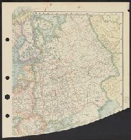
- Beinecke Rare Book and Manuscript Library > [Map of the Soviet Union].
- Published / Created:
- 19--.
- Call Number:
- 761 R16 1880
- Container / Volume:
- BRBL_00449
- Image Count:
- 1
- Resource Type:
- Maps, Atlases & Globes
- Found in:
- Beinecke Rare Book and Manuscript Library > [Map of the Rangeley Lake District, Maine] / copied from the surveys of Ballard and Perham & co. from a scale of 2 miles to an inch by Osgood Carleton.
- Creator:
- Lewis, Samuel, 1753 or 4-1822
- Call Number:
- 1974 +231
- Collection Title:
- A new and elegant general atlas, comprising all the new discoveries, to the present time
- Image Count:
- 1
- Found in:
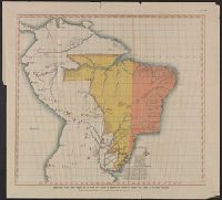
- Beinecke Rare Book and Manuscript Library > [Map of the Louisiana Territory]
- Published / Created:
- 1838?]
- Call Number:
- 596 1838
- Container / Volume:
- BRBL_00320
- Image Count:
- 2
- Resource Type:
- Maps, Atlases & Globes
- Found in:
- Beinecke Rare Book and Manuscript Library > [Map of the Eastern Frontier of British India, with the adjacent Countries ... By Captain R. Boileau Pemberton, 44th Regt. N.I.].
- Published / Created:
- 191-.
- Call Number:
- 11hcf 1919-7
- Container / Volume:
- BRBL_00010M
- Image Count:
- 1
- Resource Type:
- Maps, Atlases & Globes
- Found in:
- Beinecke Rare Book and Manuscript Library > [Map of the Caucasus.]
- Published / Created:
- 1918
- Call Number:
- 11hcf 1919A-1
- Container / Volume:
- BRBL_00010M
- Image Count:
- 1
- Resource Type:
- Maps, Atlases & Globes
- Found in:
- Beinecke Rare Book and Manuscript Library > [Map of the Balkan Peninsula showing Sofiya and Istambul] : Map used by Clive Day at discussions of Balkan Territorial Committee, April, 1918.
- Published / Created:
- [1542]
- Call Number:
- Taylor 86
- Collection Title:
- Rvdimenta cosmographica
- Image Count:
- 1
- Found in:
- Beinecke Rare Book and Manuscript Library > [Map of the Balkan Peninsula including Macedonia, Blugaria, Moldova]
- Published / Created:
- [1542]
- Call Number:
- Taylor 86
- Collection Title:
- Rvdimenta cosmographica
- Image Count:
- 1
- Found in:
- Beinecke Rare Book and Manuscript Library > [Map of the Balkan Peninsula including Macedonia and Greece]
- Published / Created:
- Undated
- Call Number:
- 1983 Folio 1
- Collection Title:
- Chertezhnai'a' kniga Sibiri, sostavlennai'a' tobol'skim synom boi'a'rskim Semenom Remezovym v 1701
- Image Count:
- 1
- Resource Type:
- Books, Journals & Pamphlets
- Found in:
- Beinecke Rare Book and Manuscript Library > [Map of southern Siberia]
- Published / Created:
- [1725?]
- Call Number:
- 40 1725
- Container / Volume:
- BRBL_00197
- Image Count:
- 2
- Resource Type:
- Maps, Atlases & Globes
- Found in:
- Beinecke Rare Book and Manuscript Library > [Map of southern Italy to Africa and adjacent regions].
- Published / Created:
- 191-.
- Call Number:
- 11hcf 1919E-28
- Container / Volume:
- BRBL_00010ZA
- Image Count:
- 1
- Resource Type:
- Maps, Atlases & Globes
- Found in:
- Beinecke Rare Book and Manuscript Library > [Map of southern Europe and the Adriatic Sea .]
- Creator:
- Rogers, William, b. ca. 1545, engraver
- Published / Created:
- Undated
- Call Number:
- Taylor 216A
- Collection Title:
- Iohn Huighen van Linschoten, his Discours of Voyages into ye Easte & West Indies : deuided into
- Image Count:
- 1
- Found in:
- Beinecke Rare Book and Manuscript Library > [Map of southern Africa and Madagascar]
- Published / Created:
- [1700?]
- Call Number:
- 53 1700A
- Container / Volume:
- BRBL_00283
- Image Count:
- 1
- Resource Type:
- Maps, Atlases & Globes
- Found in:
- Beinecke Rare Book and Manuscript Library > [Map of southeast Europe and the Black Sea] C. Berey Sculp.
- Published / Created:
- 1922?]
- Call Number:
- 825ad An23 1922
- Container / Volume:
- BRBL_00575
- Image Count:
- 1
- Resource Type:
- Maps, Atlases & Globes
- Found in:
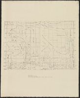
- Beinecke Rare Book and Manuscript Library > [Map of sections in townships 20 S and 21 S, and ranges 19 E and 20 E, Anderson County, Kansas] / F.S.T. 3/25/'22, Garnett, Kas.
- Published / Created:
- 1915?]
- Call Number:
- 884 1915A
- Container / Volume:
- BRBL_00654
- Image Count:
- 1
- Resource Type:
- Maps, Atlases & Globes
- Found in:
- Beinecke Rare Book and Manuscript Library > [Map of region around Tamiahua Lagoon].