Skip to search
Skip to main content
Skip to first result
Search
You Searched For
Date
Unknown
"New England"
Genre
Maps
Date Created
[Missing]
New Search
Search Results
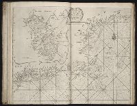
Call Number:
1978 Folio 10
Collection Title:
... : also a new description of Newfound-Land, New -England , New -York, east and west New-Jerzey, Dellewar-Bay
Image Count:
1
Subject (Geographic):
New England --Maps --Early works to
Subject (Topic):
Navigation --Early works to 1800, Pilot guides --Atlantic Coast (U.S.) --Early works to 1800, and Pilot guides --Caribbean Area --Early works to 1800
Collection Created:
London : Printed for Thomas Page, William and Fisher Mount, in Postern-Row on Tower-hill, MDCCXXV [1725]
Found in:
Beinecke Rare Book and Manuscript Library > A large draught of New England, New York, and Long Island
Creator:
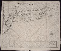
Call Number:
755 1776G
Container / Volume:
BRBL_00430
Image Count:
1
Resource Type:
Maps, Atlases & Globes
Alternative Title:
, Nova-Scotia, New -England , New -York, New
Description:
B.B. McCorkle, New England in early
Subject (Geographic):
New England --Maps--Early works to 1800
Subject (Name):
Holland, Samuel, 1728-1801, Pownall, Thomas, 1722-1805, and Robert Sayer and John Bennett (Firm). American military pocket atlas
Found in:
Beinecke Rare Book and Manuscript Library > A general map of the Northern British Colonies in America, which comprehends the Province of Quebec, the government of Newfoundland, Nova-Scotia, New-England and New York : from the surveys of Capt. Cook & Capt. Carver, regulated by the astronomic & trigo
Call Number:
1973 Folio 76
Collection Title:
of New-found-land, New -England , New -York, Dellewar-Bay, Virginia, Mary-land and Carrolina, &c
Image Count:
1
Description:
Most maps numbered in pencil on verso, some on recto.
Subject (Geographic):
New England --Maps --Early works to
Subject (Topic):
Navigation --Early works to 1800, Pilot guides --Atlantic Coast (U.S.) --Early works to 1800, and Pilot guides --Caribbean Area --Early works to 1800
Collection Created:
London : Printed for John Thornton, at the sign of the England, Scotland, and Ireland, in the Minories, and Richard Mount, at the Postern on Tower-Hill, 1698London : Printed for John Thornton, at the sign of the England, Scotland, and Ireland, in the Minories, and Richard Mount, at the Postern on Tower-Hill, 1698
Found in:
Beinecke Rare Book and Manuscript Library > Part of New England, New York, east New Iarsey, and Long Iland
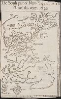
Call Number:
Taylor 322
Collection Title:
Nevv Englands prospect; a true, lively, and experimentall description of that part of America
Image Count:
1
Description:
Preceding p. 1. and Teaching resource: Professor John Mack Faragher, History 141: The American West.
Subject (Geographic):
Massachusetts --Description and travel and Massachusetts --History --Colonial period, ca. 1600-1775
Subject (Topic):
Indians of North America --Massachusetts and Massachuset language --Glossaries, vocabularies, etc
Collection Created:
London, Printed by T. Cotes for I. Bellamie, 1634
Found in:
Beinecke Rare Book and Manuscript Library > The south part of New-England, as it is planted this yeare, 1634
Published / Created:
undated
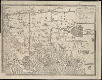
Call Number:
Vanderbilt 74
Collection Title:
The present state of New -England ; being a narrative of the troubles with the Indians in New
Image Count:
2
Description:
Imperfect: map wanting and supplied in facsimile; only a remnant of original map remains. This copy has what is considered the correct map for this edition, the mound immediately beneath the title being designated as "The Wine Hills", the Boston edition h
Subject (Geographic):
New England --History --Colonial period
Subject (Topic):
Indians of North America --New England
Collection Created:
London : Printed for Tho. Parkhurst ... , 1677
Found in:
Beinecke Rare Book and Manuscript Library > A map of New-England, being the first that ever was here cut, and done by the best pattern that could be had, which being in some places defective, it made the other less exact, yet it doth sufficiently shew the scituation of the countrey, and convenientl
Call Number:
1973 Folio 116
Collection Title:
... : also a new description of Newfoundland, New -England , New -York, east and west New-Jersey, Dellawar-Bay
Image Count:
1
Subject (Geographic):
New England --Maps --Early works to
Subject (Topic):
Navigation --Early works to 1800, Pilot guides --Atlantic Coast (U.S.) --Early works to 1800, and Pilot guides --Caribbean Area --Early works to 1800
Collection Created:
London :
Found in:
Beinecke Rare Book and Manuscript Library > A chart of the sea coast of Newfoundland, New Scotland, New England, New York, New Jersey, with Virginia and Maryland
Call Number:
1973 Folio 114
Collection Title:
... : also a new description of Newfoundland, New -England , New -York, east and west New-Jersey, Dellavar-Bay
Image Count:
1
Resource Type:
Maps, Atlases & Globes
Subject (Geographic):
New England --Maps --Early works to
Subject (Topic):
Navigation --Early works to 1800, Pilot guides --Atlantic Coast (U.S.) --Early works to 1800, and Pilot guides --Caribbean Area --Early works to 1800
Collection Created:
London : Printed for W. and J. Mount, T. Page and son, on Tower-Hill, MDCCLIX [1759]
Found in:
Beinecke Rare Book and Manuscript Library > A chart of the sea coast of Newfoundland, New Scotland, New England, New York, New Jersey, with Virginia and Maryland
Call Number:
1974 Folio 72
Collection Title:
... : also a new description of Newfoundland, New -England , New -York, east and west New-Jersey, Dellavar-Bay
Image Count:
1
Subject (Geographic):
Atlantic Coast (North America) --Maps --Early works to 1800, Atlantic Ocean --Maps --Early works to 1800, and Newfoundland and Labrador --Maps --Early works to 1800
Subject (Topic):
Navigation --Early works to 1800, Pilot guides --Atlantic Coast (U.S.) --Early works to 1800, and Pilot guides --Caribbean Area --Early works to 1800
Collection Created:
London : Printed for W. and J. Mount, T. Page and son, on Tower-Hill, MDCCLX [1760]
Found in:
Beinecke Rare Book and Manuscript Library > A chart of the sea coast of Newfoundland, New Scotland, New England, New York, New Jersey, with Virginia and Maryland
Call Number:
1978 Folio 10
Collection Title:
... : also a new description of Newfound-Land, New -England , New -York, east and west New-Jerzey, Dellewar-Bay
Image Count:
1
Subject (Geographic):
New England --Maps --Early works to
Subject (Topic):
Navigation --Early works to 1800, Pilot guides --Atlantic Coast (U.S.) --Early works to 1800, and Pilot guides --Caribbean Area --Early works to 1800
Collection Created:
London : Printed for Thomas Page, William and Fisher Mount, in Postern-Row on Tower-hill, MDCCXXV [1725]
Found in:
Beinecke Rare Book and Manuscript Library > A chart of the sea coast of New Found Land, New Scotland, New England, New York, New Jersey, with Virginia and Maryland
Creator:
Call Number:
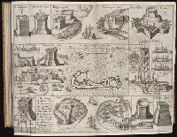
2003 +39
Collection Title:
The generall historie of Virginia, New -England , and the Summer Isles : with the names of the
Image Count:
1
Abstract:
Inset map of Bermuda with surrounding vignettes of various forts and buildings.
Description:
Tipped in between p. 168-169
Subject (Geographic):
Bermuda Islands--History
Subject (Topic):
Fortifications and Voyages and travels.
Collection Created:
London : Printed by I.[ohn] D.[awson] and I.[ohn] H.[aviland] for Michael Sparkes, 1624
Found in:
Beinecke Rare Book and Manuscript Library > The Summer Ils
Branch:v1.61.6 ,Deployed:2024-06-12T09:55:33-04:00