Search
You Searched For
Search Results
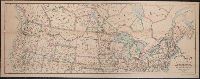
- Published / Created:
- c1883.
- Call Number:
- 75gme 1883C
- Container / Volume:
- BRBL_00413
- Image Count:
- 2
- Resource Type:
- Maps, Atlases & Globes
- Subject (Geographic):
- United States--Maps
- Subject (Topic):
- Railroads--United States--Maps
- Found in:
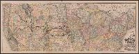
- Beinecke Rare Book and Manuscript Library > Official map of the Union Pacific Railway : through Kansas & Nebraska and from Colorado, Wyoming, Montana, Utah, Nevada, Idaho, Washington, Oregon & California.
- Creator:
- Rand McNally and Company
- Call Number:
- 75gme 1872
- Container / Volume:
- BRBL_00412
- Image Count:
- 1
- Resource Type:
- Maps, Atlases & Globes
- Subject (Geographic):
- United States--Maps.
- Subject (Topic):
- Railroads--United States--Maps.
- Found in:
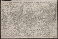
- Beinecke Rare Book and Manuscript Library > Railway and distance map accompanying Rand, McNally & Co.'s Railway Guide.
- Creator:
- George F. Cram Company
- Published / Created:
- 1873
- Call Number:
- 75 1873
- Container / Volume:
- BRBL_00405
- Image Count:
- 2
- Resource Type:
- Maps, Atlases & Globes
- Subject (Geographic):
- United States--Maps
- Subject (Topic):
- Railroads--United States--Maps
- Found in:
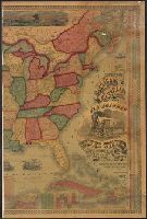
- Beinecke Rare Book and Manuscript Library > The Improved American Union Railroad map of the United States, British provinces, West Indies, Mexico and Central America.
- Published / Created:
- 186-]
- Call Number:
- 754gme 1860B
- Container / Volume:
- BRBL_00420
- Image Count:
- 1
- Resource Type:
- Maps, Atlases & Globes
- Subject (Geographic):
- United States--Maps
- Subject (Topic):
- Railroads--United States--Maps
- Found in:
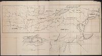
- Beinecke Rare Book and Manuscript Library > [Railroads of the Northern United States from Iowa to Boston, Massachusetts]
- Creator:
- Burr, Henry A
- Published / Created:
- 1850
- Call Number:
- 75 1850
- Container / Volume:
- BRBL_00400
- Image Count:
- 2
- Resource Type:
- Maps, Atlases & Globes
- Subject (Geographic):
- United States--Maps
- Subject (Topic):
- Railroads--United States--Maps
- Found in:
- Beinecke Rare Book and Manuscript Library > Disturnell's new map of the United States and Canada : showing all the canals, rail roads, telegraph lines and principal stage routes / drawn by Henry A. Burr, topographer to the Post Office Dep't., Washington, D.C. ; engraved by J.M. Atwood, N.Y.
- Published / Created:
- 1870
- Call Number:
- 80 1870B
- Container / Volume:
- BRBL_00535
- Image Count:
- 1
- Resource Type:
- Maps, Atlases & Globes
- Subject (Geographic):
- United States--Maps
- Subject (Topic):
- Railroads--United States--Maps
- Found in:
- Beinecke Rare Book and Manuscript Library > Map of the North West : from explorations by the United States Engineers & Royal Engineers of England and Union & Northern Pacific R.R. surveys.
- Creator:
- Berthrong, I. P
- Published / Created:
- 1908
- Call Number:
- 75j 1908
- Container / Volume:
- BRBL_00414A
- Image Count:
- 1
- Resource Type:
- Maps, Atlases & Globes
- Subject (Geographic):
- United States--Maps
- Subject (Topic):
- Explorers--United States--Maps
- Found in:
- Beinecke Rare Book and Manuscript Library > United States showing routes of principal explorers and early roads and highways [map] / from data prepared by Frank Bond ; by I. B. Berthrong.
- Creator:
- Berthrong, I. P
- Published / Created:
- 1908
- Call Number:
- 75gmb 1908
- Container / Volume:
- BRBL_00411
- Image Count:
- 1
- Resource Type:
- Maps, Atlases & Globes
- Subject (Geographic):
- United States--Maps
- Subject (Topic):
- Explorers--United States--Maps
- Found in:
- Beinecke Rare Book and Manuscript Library > United States showing routes of principal explorers and early roads and highways [map] / from data prepared by Frank Bond ; by I. B. Berthrong.
- Creator:
- Berthrong, I. P
- Published / Created:
- 1908
- Call Number:
- 75j 1908
- Container / Volume:
- BRBL_00414A
- Image Count:
- 1
- Resource Type:
- Maps, Atlases & Globes
- Subject (Geographic):
- United States--Maps
- Subject (Topic):
- Explorers--United States--Maps
- Found in:
- Beinecke Rare Book and Manuscript Library > United States showing routes of principal explorers and early roads and highways [map] / from data prepared by Frank Bond ; by I. B. Berthrong.
- Creator:
- United States. Office of Farm Management
- Published / Created:
- 1915
- Call Number:
- 75gce 1915
- Container / Volume:
- BRBL_00410
- Image Count:
- 1
- Resource Type:
- Maps, Atlases & Globes
- Subject (Geographic):
- United States--Maps
- Subject (Topic):
- Irrigation--United States--Maps
- Found in:
- Beinecke Rare Book and Manuscript Library > Irrigation map of the United States / engraved and printed by the U.S. Geological Survey ; outline of irrigated areas based upon data collected by the Bureau of the Census, 1910 ; revised by Irrigation Division, Office of Experimental Stations, and by the