Search
You Searched For
Search Results
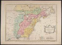
- Creator:
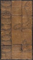
- Ughi, Lodovico
- Published / Created:
- [1735?]
- Call Number:
- 40 V55 1735
- Container / Volume:
- BRBL_00222
- Image Count:
- 8
- Resource Type:
- Maps, Atlases & Globes
- Found in:
- Beinecke Rare Book and Manuscript Library > Iconografica rappresentatione della inclita città di Venezia consacrata al reggio serenissimo dominio Veneto / Lodovico Ughi.
- Published / Created:
- [ca. 1850]
- Call Number:
- 40gme 1850
- Container / Volume:
- BRBL_00230
- Image Count:
- 8
- Resource Type:
- Maps, Atlases & Globes
- Found in:
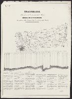
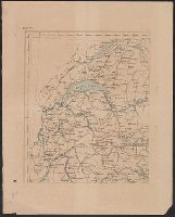
- Beinecke Rare Book and Manuscript Library > Topografia della zona di terrano corsa della strada : Profilo di livellazione delle pendenze della Strada, e della linea battuta della Strada.
- Published / Created:
- 1788
- Call Number:
- 39 SE84 1788
- Container / Volume:
- BRBL_00191
- Image Count:
- 8
- Resource Type:
- Maps, Atlases & Globes
- Found in:
- Beinecke Rare Book and Manuscript Library > Plano geométrico de la ciudad de Sevilla ... / por Don Thomás Lopez de Vargas y Machuca ...
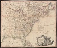
- Creator:
- Mitchell, John, 1711-1768
- Published / Created:
- [1775?]
- Call Number:
- 71 1755A
- Container / Volume:
- BRBL_00363
- Image Count:
- 8
- Resource Type:
- Maps, Atlases & Globes
- Found in:
- Beinecke Rare Book and Manuscript Library > A map of the British colonies in North America : with the roads, distances, limits, and extent of the settlements, humbly inscribed to the Right Honourable the Earl of Halifax, and the other Right Honourable the Lords Commissioners for Trade & Plantations
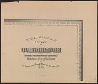
- Creator:
- Mexico. Comisión Geográfico-Exploradora
- Published / Created:
- 1908
- Call Number:
- 8816 1908
- Container / Volume:
- BRBL_00651
- Image Count:
- 8
- Resource Type:
- Maps, Atlases & Globes
- Found in:
- Beinecke Rare Book and Manuscript Library > Carta general del Estado de Tamaulipas / levantada á iniciativa de su actual gobernador, co., Pedro Argüelles, por la Comisión Geográfico-Exploradora.
- Creator:
- Holtedahl, Olaf, 1885-1975
- Published / Created:
- 1940
- Call Number:
- 344cea 1940
- Container / Volume:
- BRBL_00095
- Image Count:
- 8
- Resource Type:
- Maps, Atlases & Globes
- Found in:
- Beinecke Rare Book and Manuscript Library > Dybdekart over de norske kystfarvann med tilgrensende havstrok.
- Published / Created:
- ca. 1860?]
- Call Number:
- 40 1858
- Container / Volume:
- BRBL_00201
- Image Count:
- 8
- Resource Type:
- Maps, Atlases & Globes
- Found in:
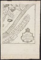
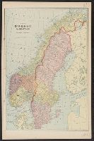
- Beinecke Rare Book and Manuscript Library > Carta corografica strategica dell' alta Italia alla scala di 1 a 600000.
- Creator:
- Giunta, I.R
- Published / Created:
- 1847
- Call Number:
- 40 V55 1847A
- Container / Volume:
- BRBL_00223
- Image Count:
- 8
- Resource Type:
- Maps, Atlases & Globes
- Found in:
- Beinecke Rare Book and Manuscript Library > Mappa del comune censuario di S. Croce : porzione della citta di Venezia, distretto I, provincia di Venezia, rettificata nell' anno 1842.
- Creator:
- Russia. Armii͡a. Voenno-topograficheskoe depo
Russia. Армия. Военно-топографическое депо
- Published / Created:
- 1884
- Call Number:
- 54 1884
- Container / Volume:
- BRBL_00290
- Image Count:
- 10
- Resource Type:
- Maps, Atlases & Globes
- Found in:
- Beinecke Rare Book and Manuscript Library > Karta Azīi︠a︡tskoĭ Rossīi s prilegai︠u︡shchimi k neĭ vladi︠e︡nii︠a︡mi [cartographic material] / sostavlena pri Voenno Topograficheskom otdi︠e︡li︠e︡ Glavnago Shtaba ; pod redakt︠s︡. gener. M. Bolʹsheva.
- Creator:
- Oliver, William T
- Published / Created:
- c1893.
- Call Number:
- 764gmb 1893
- Container / Volume:
- BRBL_00462
- Image Count:
- 10
- Resource Type:
- Maps, Atlases & Globes
- Found in:
- Beinecke Rare Book and Manuscript Library > Cyclists' road map of Massachusetts / prepared expressly for the Mass. Div. L.A.W., by William T. Oliver.
- Published / Created:
- [1789]
- Call Number:
- 38 1789
- Container / Volume:
- BRBL_00152
- Image Count:
- 25
- Resource Type:
- Maps, Atlases & Globes
- Found in:
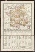
- Beinecke Rare Book and Manuscript Library > Carte générale de la France par départements ... de Cassini et des 25 Flles de celle de la Belgique de Ferraris. Par Ch. Picquet, Geog. e. Graveur ...
- Creator:
- Cartes Taride (Firm)
- Published / Created:
- 1901-
- Call Number:
- Series 38gmb 1920
- Container / Volume:
- BRBL_00038A
- Image Count:
- 25
- Resource Type:
- Maps, Atlases & Globes
- Found in:
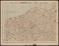
- Beinecke Rare Book and Manuscript Library > Carte routière pour automobilistes & cyclistes [cartographic material] : [France].
- Creator:
- Argentina. Comisión Argentina Demarcadora de Limites con el Brasil
- Published / Created:
- 1904]
- Call Number:
- 911fab 1904A
- Container / Volume:
- BRBL_00671
- Image Count:
- 32
- Resource Type:
- Maps, Atlases & Globes
- Found in:
- Beinecke Rare Book and Manuscript Library > Planos topográficos: Islas del Río Uruguay, islas del Rio Iguazú.
- Creator:
- Chishitsu Chōsajo (Japan)
- Published / Created:
- 1912-15.
- Call Number:
- 57 1915
- Container / Volume:
- BRBL_00302
- Image Count:
- 24
- Resource Type:
- Maps, Atlases & Globes
- Found in:
- Beinecke Rare Book and Manuscript Library > Imperial Geological Survey of Japan topographical map : Division I-[V].
- Creator:
- James, Edwin, 1797-1861
- Call Number:
- Zc20 +822ja
- Image Count:
- 41
- Resource Type:
- Maps, Atlases & Globes
- Found in:
- Beinecke Rare Book and Manuscript Library > Account of an expedition from Pittsburgh to the Rocky Mountains : performed in the years 1819 and '20, by order of the Hon. J.C. Calhoun, Sec'y of War ; under the command of Major Stephen H. Long : from the notes of Major Long, Mr. T. Say, and other gentlemen of the exploring party / compiled by Edwin James, botanist and geologist for the expedition ; in two vols., with an atlas.
- Creator:
- Comisión Chilena de Límites
- Published / Created:
- 1912?]
- Call Number:
- 96 1908
- Container / Volume:
- BRBL_00766
- Image Count:
- 41
- Resource Type:
- Maps, Atlases & Globes
- Found in:
- Beinecke Rare Book and Manuscript Library > Mapas de la región Andina [cartographic material] / [por la Comisión Chilena de Límites].
- Published / Created:
- 1896
- Call Number:
- 777cbf B21 1894
- Container / Volume:
- BRBL_00504
- Image Count:
- 36
- Resource Type:
- Maps, Atlases & Globes
- Found in:
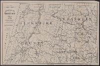
- Beinecke Rare Book and Manuscript Library > City of Baltimore topographical survey / made under the direction of H.T. Douglas, chief engineer.
- Creator:
- Habenicht, Hermann, 1844-1917
- Published / Created:
- 1887
- Call Number:
- 60 1887
- Container / Volume:
- BRBL_00327
- Image Count:
- 27
- Resource Type:
- Maps, Atlases & Globes
- Found in:
- Beinecke Rare Book and Manuscript Library > Spezial-Karte von Afrika im Massstab von 1:4 000 000 / entworfen von Hermann Habenicht ; bearbeitet von demselben, Bruno Domann und Dr. Richard Lüddecke ; aut. von C. Barich und P. Ihle.
- Creator:
- Newlands, Francis G. (Francis Griffith), 1848-1917
Stewart, T. K
- Published / Created:
- [1890]
- Call Number:
- Zc69 +890ne
- Image Count:
- 31
- Resource Type:
- Books, Journals & Pamphlets
- Found in:
- Beinecke Rare Book and Manuscript Library > An address to the people of Nevada on water storage and irrigation / by Francis G. Newlands.
- Call Number:
- WA MSS S-2670
- Collection Title:
- Peter Palmquist collection of Humboldt County, California, male photographers
- Container / Volume:
- Box 64 | Folder 7
- Image Count:
- 46
- Resource Type:
- Prints & Photographs
- Found in:
- Beinecke Rare Book and Manuscript Library > Freeman Art Co.
- Published / Created:
- [ca. 1859-1860]
- Call Number:
- WA Photos 231
- Image Count:
- 113
- Resource Type:
- Prints & Photographs
- Found in:
- Beinecke Rare Book and Manuscript Library > Views of San Francisco.
- Published / Created:
- [1892]
- Call Number:
- 36 F84 +1892
- Container / Volume:
- BRBL_00123A
- Image Count:
- 43
- Resource Type:
- Maps, Atlases & Globes
- Found in:
- Beinecke Rare Book and Manuscript Library > Geometrischer Plan von Frankfurt a/Main / herausgegeben im Auftrage des Magistrats vom Tiefbau-Amt.
- Creator:
- Rocque, John, -1762
- Published / Created:
- 1746. and 1913-1919.
- Call Number:
- 32 L84 1746/1919
- Container / Volume:
- BRBL_00738
- Image Count:
- 49
- Resource Type:
- Maps, Atlases & Globes
- Found in:
- Beinecke Rare Book and Manuscript Library > A plan of the cities of London and Westminster, and borough of Southwark, with the contiguous buildings; from an actual survey, taken by John Rocque and engraved by John Pine.
- Creator:
- Austro-Hungarian Monarchy. Militärgeographisches Institut
- Published / Created:
- 1882-1886.
- Call Number:
- 304 1886
- Container / Volume:
- Series Box 1
- Image Count:
- 49
- Resource Type:
- Maps, Atlases & Globes
- Found in:
- Beinecke Rare Book and Manuscript Library > Übersichts-Karte von Mittel-Europa, im Masse 1:750.000 der Natur / bearbeitet und herausgegeben vom K.K. Militär-geographischen Institute.
- Creator:
- Duval, P. (Pierre), 1619-1682.
- Published / Created:
- 1671
- Call Number:
- 1973 Folio 31
- Image Count:
- 78
- Resource Type:
- Maps, Atlases & Globes
- Found in:
- Beinecke Rare Book and Manuscript Library > Cartes de geographie, les plus nouvelles et les plus fideles, auecque leurs diuisions régulieres, par P. du Val ...
- Call Number:
- WA MSS 443
- Collection Title:
- Isaac Ingalls Stevens papers
- Container / Volume:
- Box 2 | Folder 29
- Image Count:
- 51
- Resource Type:
- Archives or Manuscripts
- Found in:
- Beinecke Rare Book and Manuscript Library > [Delacy, Walter Washington]
- Published / Created:
- 1836-1839, undated
- Call Number:
- WA MSS S-2678
- Collection Title:
- Ethan Allen Hitchcock collection on Indian removal
- Container / Volume:
- Box 3 | Folder 14
- Image Count:
- 1
- Resource Type:
- Archives or Manuscripts
- Found in:
- Beinecke Rare Book and Manuscript Library > Florida Indians
- Creator:
- Fairfax, Wilson M. C.
McMurtrie, W. B. (William Birch)
- Published / Created:
- 1853
- Call Number:
- WA MSS S-2369
- Collection Title:
- Franz R. and Kathryn M. Stenzel Research Files on Western American Art
- Container / Volume:
- bsd | Folder 1612
- Image Count:
- 1
- Resource Type:
- Maps, Atlases & Globes
- Found in:
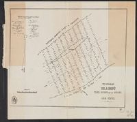
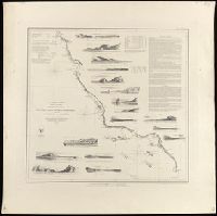
- Beinecke Rare Book and Manuscript Library > McMurtrie, William B. "Reconnaissance of the Western Coast of the United States [Lower Sheet] San Francisco to San Diego." Engraving (in Series I)
- Creator:
- Lindenkohl, A.
McMurtrie, W. B. (William Birch)
- Published / Created:
- 1854
- Call Number:
- WA MSS S-2369
- Collection Title:
- Franz R. and Kathryn M. Stenzel Research Files on Western American Art
- Container / Volume:
- bsd | Folder 1612
- Image Count:
- 1
- Resource Type:
- Maps, Atlases & Globes
- Found in:
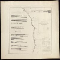
- Beinecke Rare Book and Manuscript Library > McMurtrie, William B. "Reconnaissance of the Western Coast of the United States. Middle Sheet From San Francisco to Umpquah River." Engraving (in Series I)
- Creator:
- Lindenkohl, A
McMurtrie, W. B. (William Birch)
- Published / Created:
- 1855
- Call Number:
- WA MSS S-2369
- Collection Title:
- Franz R. and Kathryn M. Stenzel Research Files on Western American Art
- Container / Volume:
- bsd | Folder 1612
- Image Count:
- 1
- Resource Type:
- Maps, Atlases & Globes
- Found in:
- Beinecke Rare Book and Manuscript Library > McMurtrie, William B. "Reconnaissance of the Western Coast of the United States [Northern Sheet] From Umpquah River to the Boundary." Engraving (in Series I)
- Creator:
- L'Isle, Guillaume de, 1675-1726
- Published / Created:
- [1730?]
- Call Number:
- 755 1730
- Container / Volume:
- BRBL_00426
- Image Count:
- 1
- Resource Type:
- Maps, Atlases & Globes
- Found in:
- Beinecke Rare Book and Manuscript Library > Carte de la Louisiane et du cours du Mississipi / dressée sur un grand nombre de memoires entr'autres sur ceux de Mr. le Maire, par Guillme. de L'Isle de l'Academie Rle. des Sciences.
- Published / Created:
- [1796?]
- Call Number:
- 755 1800A
- Container / Volume:
- BRBL_00437
- Image Count:
- 1
- Resource Type:
- Maps, Atlases & Globes
- Found in:
- Beinecke Rare Book and Manuscript Library > Bowles's New one-sheet map of the United States of America; with the territories belonging to Great Britain and Spain.
- Published / Created:
- [1800?]
- Call Number:
- 755 1800B
- Container / Volume:
- BRBL_00437
- Image Count:
- 1
- Resource Type:
- Maps, Atlases & Globes
- Found in:
- Beinecke Rare Book and Manuscript Library > Carte de la Partie Septentrionale des Etats Unis, comprenant le Canada, la Nouvelle Ecosse ... et de New-Jersey. Tardieu Sculp. André Scrip.
- Published / Created:
- 1805
- Call Number:
- 755 1805B
- Container / Volume:
- BRBL_00437
- Image Count:
- 1
- Resource Type:
- Maps, Atlases & Globes
- Found in:
- Beinecke Rare Book and Manuscript Library > A new map of the United States of North America ... with Upper and Lower Canada &c ... by John Cary, Engraver.
- Creator:
- Kitchin, Thomas, d. 1784
- Published / Created:
- 1780?]
- Call Number:
- 755 1760
- Container / Volume:
- BRBL_00428
- Image Count:
- 1
- Resource Type:
- Maps, Atlases & Globes
- Found in:
- Beinecke Rare Book and Manuscript Library > British dominions in America : drawn from the latest and best authorities / by Thos. Kitchin, hydrographer to his majesty.
- Creator:
- Seutter, Matthaeus, 1678-1756
- Published / Created:
- 1730?]
- Call Number:
- 755 1735B
- Container / Volume:
- BRBL_00426
- Image Count:
- 1
- Resource Type:
- Maps, Atlases & Globes
- Found in:
- Beinecke Rare Book and Manuscript Library > Recens edita totius Novi Belgii in America Septentrionali siti / delineatio cura et sumptibus Matthaei Seutteri, Sac. Caes. Maj. Geographi August. Vind.
- Published / Created:
- [1800?]
- Call Number:
- 755 1800E
- Container / Volume:
- BRBL_00437
- Image Count:
- 1
- Resource Type:
- Maps, Atlases & Globes
- Found in:
- Beinecke Rare Book and Manuscript Library > Bowles's new one-sheet map of the independent States of Virginia, ... Rhode Island, &c ... Habitations and hunting countries of the Confederate Indians; by Lewis Evans.
- Published / Created:
- 1805
- Call Number:
- 755 1805B
- Container / Volume:
- BRBL_00437
- Image Count:
- 1
- Resource Type:
- Maps, Atlases & Globes
- Found in:
- Beinecke Rare Book and Manuscript Library > A new map of the United States of North America ... with Upper and Lower Canada &c ... by John Cary, Engraver.
- Creator:
- Rhode, Johann Christoph, cartographer
- Call Number:
- 755 1755AA
- Container / Volume:
- BRBL_00427
- Image Count:
- 1
- Resource Type:
- Maps, Atlases & Globes
- Found in:
- Beinecke Rare Book and Manuscript Library > Theatrum belli in America Septentrionali / II. foliis comprehensum jussu Acad. Reg. Scient. et Eleg. Litt. exhibet I. C. Rhode Ac: Geogr. ; Berger, sculpsit berol.
- Published / Created:
- [1734?]
- Call Number:
- 755 1734
- Container / Volume:
- BRBL_00426
- Image Count:
- 1
- Resource Type:
- Maps, Atlases & Globes
- Found in:
- Beinecke Rare Book and Manuscript Library > Novissima tabula regionis Ludovicianae, gallice dictae la Louisiane ... / delineata ... â Guil. Insulano ... ; M.L. [?] sc.
- Published / Created:
- 1813
- Call Number:
- 755 1813C
- Container / Volume:
- BRBL_00439
- Image Count:
- 1
- Resource Type:
- Maps, Atlases & Globes
- Found in:
- Beinecke Rare Book and Manuscript Library > An improved Map of the United States by Shelton & Kensett. Engraved by A. Doolittle, New Haven. AE 60. Copyright secured & entered according to Act of Congress, Nov. 8th 1813.
- Published / Created:
- 1806
- Call Number:
- 755 1806A
- Container / Volume:
- BRBL_00438
- Image Count:
- 1
- Resource Type:
- Maps, Atlases & Globes
- Found in:
- Beinecke Rare Book and Manuscript Library > A new map of part of the United States of North America ... by John Cary, Engraver.
- Published / Created:
- [1801?]
- Call Number:
- 755 1801
- Container / Volume:
- BRBL_00437
- Image Count:
- 1
- Resource Type:
- Maps, Atlases & Globes
- Found in:
- Beinecke Rare Book and Manuscript Library > Carte de la Partie Septentrionale des Etats-Unis. Gravé par Tardieu.
- Creator:
- Homann, Johann Baptist, 1663-1724
- Published / Created:
- 1759?]
- Call Number:
- 755 1759A
- Container / Volume:
- BRBL_00428
- Image Count:
- 1
- Resource Type:
- Maps, Atlases & Globes
- Found in:
- Beinecke Rare Book and Manuscript Library > Nova Anglia septentrionali Americae implantata Anglorumque coloniis florentissima geographice exhibita / [cartographic material] / a Ioh. Baptista Homann ...
- Published / Created:
- [1806?]
- Call Number:
- 755 1806C
- Container / Volume:
- BRBL_00438
- Image Count:
- 1
- Resource Type:
- Maps, Atlases & Globes
- Found in:
- Beinecke Rare Book and Manuscript Library > Carte Générale des États-Unis de L'Amerique Septentrionale, rensemant aussi, quelquis Provinces Angloises adjacentes. André Scrip. Tardieu Sculp.
- Published / Created:
- 1806
- Call Number:
- 755 1806
- Container / Volume:
- BRBL_00438
- Image Count:
- 1
- Resource Type:
- Maps, Atlases & Globes
- Found in:
- Beinecke Rare Book and Manuscript Library > A map of the United States and Canada, New Scotland, New Brunswick and Newfoundland. Dresée par Lapie ... Gravée par P.A.F. Tardieu. Ecrit par J.J. Pachoux.
- Published / Created:
- 1809
- Call Number:
- 755 1809
- Container / Volume:
- BRBL_00438
- Image Count:
- 1
- Resource Type:
- Maps, Atlases & Globes
- Found in:
- Beinecke Rare Book and Manuscript Library > The United States of North America : with the British territories and those of Spain.
- Published / Created:
- 1816
- Call Number:
- 755 1816
- Container / Volume:
- BRBL_00439
- Image Count:
- 1
- Resource Type:
- Maps, Atlases & Globes
- Found in:
- Beinecke Rare Book and Manuscript Library > Northern Section of the United States including Canada, etc., by John Melish. Second edition with Additions and improvements.
- Creator:
- Palairet, Jean, 1697-1774
- Published / Created:
- 1756
- Call Number:
- 755 1756D
- Container / Volume:
- BRBL_00428
- Image Count:
- 1
- Resource Type:
- Maps, Atlases & Globes
- Found in:
- Beinecke Rare Book and Manuscript Library > Carte des possessions angloises & françoises du continent de l'Amérique septentrionale / par I. Palairet, Londres ; Thos. Kitchin, sculpt.
- Published / Created:
- 1817
- Call Number:
- 755 1817
- Container / Volume:
- BRBL_00439
- Image Count:
- 1
- Resource Type:
- Maps, Atlases & Globes
- Found in:
- Beinecke Rare Book and Manuscript Library > Northern Provinces of the United States. Hewitt Sc., London.