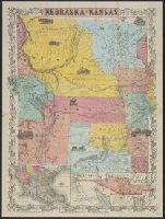
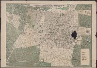
Includes text advertising real estate services by C.H. Anderson, Pierre, S.D., Library's copy stamped in bottom margin: Burg Brown, Att'y, Corning, Iowa., Prime meridians: Greenwich and Washington., and Shows counties, railroads, and drainage.
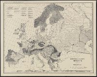
Map of the territory acquired from Mexico by the Gadsden Treaty, 1854.
Description:
Covers Nebraska extending to the Canadian border and westward to Oregon and Kansas including present day Colorado., Includes ill. and insets of United States and "Map of the territory acquired from Mexico by the Gadsden Treaty, 1854.", and Relief shown by hachures.
Publisher:
s.n.,
Subject (Geographic):
Kansas--Maps, Nebraska--Maps, and West (U.S.)--Maps