Search
You Searched For
Search Results
- Published / Created:
- 1904
- Call Number:
- 739 1904
- Container / Volume:
- BRBL_00388
- Image Count:
- 1
- Resource Type:
- Maps, Atlases & Globes
- Publisher:
- Department of the Interior ;
- Found in:
- Beinecke Rare Book and Manuscript Library > British Columbia railway belt / [by] James White, F.R.G.S., Geographer: Department of the Interior; Honourable Clifford Sifton, Minister; James S. Smart, Deputy Minister.
- Published / Created:
- 1878
- Call Number:
- 75GM 1878
- Container / Volume:
- BRBL_00410
- Image Count:
- 1
- Resource Type:
- Maps, Atlases & Globes
- Publisher:
- Dept. of the Interior,
- Found in:
- Beinecke Rare Book and Manuscript Library > Map of the United States : exhibiting the grants of lands made by the General government to aid the construction of railroads and wagon roads / Dept. of the Interior. U.S. Geographical and Geological Survey of the Rocky Mountain Region J.W. Powell, in Cha
- Published / Created:
- 1878
- Call Number:
- 75gme 1878
- Container / Volume:
- BRBL_00412
- Image Count:
- 1
- Resource Type:
- Maps, Atlases & Globes
- Publisher:
- Dept. of the Interior,
- Found in:
- Beinecke Rare Book and Manuscript Library > Map of the United States : exhibiting the grants of lands made by the General government to aid the construction of railroads and wagon roads / Dept. of the Interior. U.S. Geographical and Geological Survey of the Rocky Mountain Region J.W. Powell, in Cha
- Published / Created:
- 1912]
- Call Number:
- 737 Ed58 1912
- Container / Volume:
- BRBL_00385
- Image Count:
- 1
- Resource Type:
- Maps, Atlases & Globes
- Publisher:
- Department of the Interior,
- Found in:
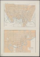
- Beinecke Rare Book and Manuscript Library > Edmonton.
- Creator:
- Canada. Natural Resources Intelligence Branch
- Published / Created:
- [1917]
- Call Number:
- 73gb 1917
- Container / Volume:
- BRBL_00376
- Image Count:
- 1
- Resource Type:
- Maps, Atlases & Globes
- Publisher:
- Dept. of the Interior,
- Found in:
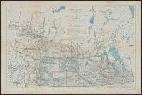
- Beinecke Rare Book and Manuscript Library > Map of Manitoba, Saskatchewan & Alberta : showing the number of quarter sections available for homestead entry in each township, also the pre-emption and purchased homestead area as defined by the Dominion Lands Act 1908 / prepared in the Natural Resource
- Creator:
- Canada. Natural Resources Intelligence Branch
- Published / Created:
- 1919
- Call Number:
- 73fbc 1919
- Container / Volume:
- BRBL_00375B
- Image Count:
- 1
- Resource Type:
- Maps, Atlases & Globes
- Publisher:
- Dept. of the Interior,
- Found in:
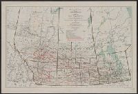
- Beinecke Rare Book and Manuscript Library > Map of Manitoba, Saskatchewan and Alberta : showing the land registration and judicial districts / prepared in the Natural Resources Intelligence Branch under the direction of F.C.C. Lynch, Superintendent.
- Published / Created:
- 1925
- Call Number:
- 736 P26 1925
- Container / Volume:
- BRBL_00382
- Image Count:
- 1
- Resource Type:
- Maps, Atlases & Globes
- Publisher:
- Dept. of the Interior,
- Found in:
- Beinecke Rare Book and Manuscript Library > Map of The Pas mineral area and adjacent territory to the north, Manitoba and Saskatchewan / ǂc compiled, drawn and printed by the Topographical Survey of Canada.
- Creator:
- Lynch, F. C. C. (Francis Christopher Chisholm), 1884-
- Published / Created:
- [1921].
- Call Number:
- 73g 1921
- Container / Volume:
- BRBL_00376
- Image Count:
- 1
- Resource Type:
- Maps, Atlases & Globes
- Publisher:
- Dept. of the Interior,
- Found in:
- Beinecke Rare Book and Manuscript Library > Map of the Dominion of Canada : indicating natural resources, transportation and trade routes / prepared in the Natural Resources Intelligence Branch under the direction of F.C.C. Lynch, Superintendent.
- Creator:
- Canada. Topographical Survey
- Published / Created:
- 1925
- Call Number:
- 737 L14 1925
- Container / Volume:
- BRBL_00385
- Image Count:
- 1
- Resource Type:
- Maps, Atlases & Globes
- Publisher:
- Canada.Dept of the Interior,
- Found in:
- Beinecke Rare Book and Manuscript Library > Plan of Lake Louise and vicinity [map] / drawn and printed by the Topographical Survey of Canada.
- Published / Created:
- 1910
- Call Number:
- 736gc 1910
- Container / Volume:
- BRBL_00383
- Image Count:
- 1
- Resource Type:
- Maps, Atlases & Globes
- Publisher:
- Dept. of the Interior,
- Found in:
- Beinecke Rare Book and Manuscript Library > Sketch map showing timber conditions along part of the proposed route of the Hudson Bay Railway.