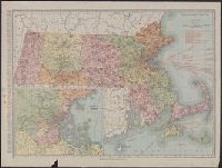
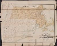
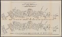
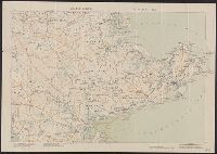
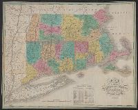
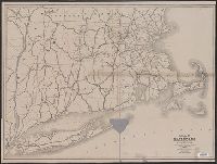
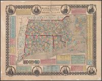
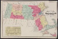
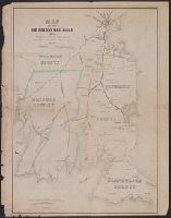
Search
You Searched For
Search Results
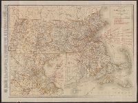
- Creator:
- Rand McNally and Company
- Published / Created:
- [1911]
- Call Number:
- 764 1911
- Container / Volume:
- BRBL_00453
- Image Count:
- 1
- Resource Type:
- Maps, Atlases & Globes
- Description:
- principal cities, list of Massachusetts
- Subject (Geographic):
- Massachusetts--Maps
- Subject (Topic):
- Railroads--Massachusetts--Maps
- Found in:
- Beinecke Rare Book and Manuscript Library > Massachusetts.
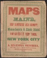
- Published / Created:
- 1846
- Call Number:
- 76 1846A
- Container / Volume:
- BRBL_00445
- Image Count:
- 7
- Resource Type:
- Maps, Atlases & Globes
- Found in:
- Beinecke Rare Book and Manuscript Library > Maps of Maine, New Hampshire and Vermont, Massachusetts & Rhode Island, Connecticut, New York and New York City.
- Creator:
- Massachusetts. Board of Railroad Commissioners
- Published / Created:
- 1882
- Call Number:
- 764gme 1882
- Container / Volume:
- BRBL_00462
- Image Count:
- 1
- Resource Type:
- Maps, Atlases & Globes
- Description:
- Shows railroads in Massachusetts and
- Subject (Geographic):
- Massachusetts--Maps
- Subject (Topic):
- Railroads--Massachusetts--Maps
- Found in:
- Beinecke Rare Book and Manuscript Library > Map of the railroads of the state of Massachusetts : accompanying the report of the Railroad Commissioners.
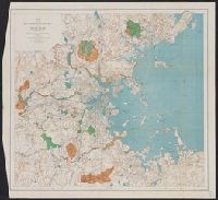
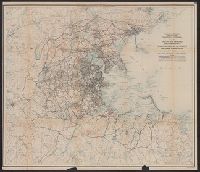
- Creator:
- Massachusetts. Metropolitan Park Commission
- Published / Created:
- 1908
- Call Number:
- 764 B65 1908
- Container / Volume:
- BRBL_00456
- Image Count:
- 1
- Resource Type:
- Maps, Atlases & Globes
- Subject (Geographic):
- Massachusetts--Maps
- Subject (Topic):
- Recreation areas--Massachusetts
- Found in:
- Beinecke Rare Book and Manuscript Library > Plan for proposed park and parkways : from Charles River Reservation to West Roxbury Parkway connecting the northern and southern group of metropolitan parks.
- Creator:
- Massachusetts. Metropolitan Park Commission
- Published / Created:
- 1893
- Call Number:
- 764 B65 1893
- Container / Volume:
- BRBL_00456
- Image Count:
- 1
- Resource Type:
- Maps, Atlases & Globes
- Subject (Topic):
- Open spaces--Massachusetts--Boston
- Found in:
- Beinecke Rare Book and Manuscript Library > Map of the metropolitan district of Boston, Massachusetts : showing the existing public reservations and such new open spaces as are proposed by Charles Eliot, Landscape Architect, in his report to the Metropolitan Park Commission.
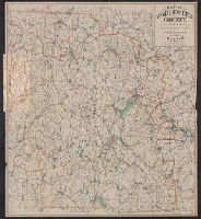
- Creator:
- Geo. H. Walker & Co
- Published / Created:
- c1904.
- Call Number:
- 764 W89 1904
- Container / Volume:
- BRBL_00460
- Image Count:
- 1
- Resource Type:
- Maps, Atlases & Globes
- Alternative Title:
- Worcester County, Massachusetts
- Description:
- , Massachusetts.
- Subject (Topic):
- Cycling--Massachusetts--Worcester
- Found in:
- Beinecke Rare Book and Manuscript Library > Map of Worcester County, Mass. / published by Geo. H. Walker & Co.
- Published / Created:
- 1884
- Call Number:
- 764gme 1884
- Container / Volume:
- BRBL_00462
- Image Count:
- 1
- Resource Type:
- Maps, Atlases & Globes
- Description:
- Shows railroads in Massachusetts and
- Subject (Geographic):
- Massachusetts--Maps
- Found in:
- Beinecke Rare Book and Manuscript Library > Map of the railroads of the state of Massachusetts : accompanying the report of the Railroad Commissioners.
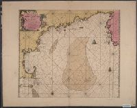
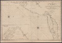
- Published / Created:
- [1684?]
- Call Number:
- 755 1684B
- Container / Volume:
- BRBL_00424
- Image Count:
- 1
- Resource Type:
- Maps, Atlases & Globes
- Description:
- Massachusetts and Nova Scotia.
- Found in:
- Beinecke Rare Book and Manuscript Library > Pas-Kaart. Vande Zee Kusten inde Boght van Niew Engeland Tusschen de Staaten Hoek en C. de Sable. Door vooght Geometra ... Boek en zee Kaart Verkoper met Privlegie voor 15 Iaaren.
- Published / Created:
- c1891
- Call Number:
- 764 P74 1891
- Container / Volume:
- BRBL_00459
- Image Count:
- 1
- Resource Type:
- Maps, Atlases & Globes
- Description:
- Massachusetts. [Unknown ed.] p. 102-103.
- Subject (Geographic):
- Massachusetts--Maps
- Found in:
- Beinecke Rare Book and Manuscript Library > Massachusetts atlas plate no. 6 [Southern Norfolk and Plymouth counties].
- Creator:
- Shurtleff, Arthur A. (Arthur Asahel), 1870-1957
- Published / Created:
- [1909]
- Call Number:
- 764 B65 1909E
- Container / Volume:
- BRBL_00456A
- Image Count:
- 1
- Resource Type:
- Maps, Atlases & Globes
- Publisher:
- Commonwealth of Massachusetts
- Subject (Name):
- Massachusetts. Metropolitan
- Subject (Topic):
- City planning--Massachusetts--Boston
- Found in:
- Beinecke Rare Book and Manuscript Library > [Boston, Mass., Cambridge Bridge to North Station : proposed redevelopment] / Arthur A. Shurtleff.
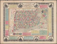
- Creator:
- Rand McNally and Company
- Published / Created:
- [1921]
- Call Number:
- 764 1921
- Container / Volume:
- BRBL_00453
- Image Count:
- 2
- Resource Type:
- Maps, Atlases & Globes
- Alternative Title:
- Standard map of Massachusetts
- Description:
- principal cities, list of Massachusetts
- Subject (Geographic):
- Massachusetts--Maps
- Subject (Topic):
- Railroads--Massachusetts--Maps
- Found in:
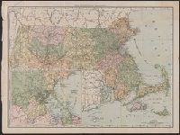
- Beinecke Rare Book and Manuscript Library > Rand McNally standard map of Massachusetts.
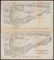
- Creator:
- Shurtleff, Arthur A. (Arthur Asahel), 1870-1957
- Published / Created:
- [1909]
- Call Number:
- 764 B65 1909D
- Container / Volume:
- BRBL_00456A
- Image Count:
- 1
- Resource Type:
- Maps, Atlases & Globes
- Publisher:
- Commonwealth of Massachusetts
- Subject (Name):
- Massachusetts. Metropolitan
- Subject (Topic):
- City planning--Massachusetts--Boston
- Found in:
- Beinecke Rare Book and Manuscript Library > [Boston, Mass., Providence R.R. property : proposed redevelopment] / Arthur A. Shurtleff.
- Creator:
- Shurtleff, Arthur A. (Arthur Asahel), 1870-1957
- Published / Created:
- 1909
- Call Number:
- 764 B65 1909B
- Container / Volume:
- BRBL_00456
- Image Count:
- 1
- Resource Type:
- Maps, Atlases & Globes
- Publisher:
- Commonwealth of Massachusetts
- Subject (Name):
- Massachusetts. Metropolitan
- Subject (Topic):
- Highway planning--Massachusetts--Boston
- Found in:
- Beinecke Rare Book and Manuscript Library > Map of the existing and proposed circumferential thoroughfares of the district / Arthur A. Shurtleff.
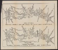
- Creator:
- Shurtleff, Arthur A. (Arthur Asahel), 1870-1957
- Published / Created:
- [1909]
- Call Number:
- 764 B65 1909G
- Container / Volume:
- BRBL_00456A
- Image Count:
- 1
- Resource Type:
- Maps, Atlases & Globes
- Publisher:
- Commonwealth of Massachusetts
- Subject (Name):
- Massachusetts. Metropolitan
- Subject (Topic):
- Highway planning--Massachusetts--Boston
- Found in:
- Beinecke Rare Book and Manuscript Library > [Boston, Mass., between Allston and Somerville : proposed redevelopment] / Arthur A. Shurtleff.
- Creator:
- Shurtleff, Arthur A. (Arthur Asahel), 1870-1957
- Published / Created:
- [1909]
- Call Number:
- 764 B65 1909F
- Container / Volume:
- BRBL_00456A
- Image Count:
- 1
- Resource Type:
- Maps, Atlases & Globes
- Publisher:
- Commonwealth of Massachusetts
- Subject (Name):
- Massachusetts. Metropolitan
- Subject (Topic):
- Highway planning--Massachusetts--Boston
- Found in:
- Beinecke Rare Book and Manuscript Library > [Boston, Mass., streets between Harvard and Wellington Bridges : proposed redevelopment] / Arthur A. Shurtleff.
- Creator:
- Walker, O. W. (Oscar W.)
- Published / Created:
- c1896.
- Call Number:
- 764 1896
- Container / Volume:
- BRBL_00453
- Image Count:
- 1
- Resource Type:
- Maps, Atlases & Globes
- Description:
- Massachusetts, p. 26-27.
- Found in:
- Beinecke Rare Book and Manuscript Library > Massachusetts atlas plate no. 2 [part of Essex County including Cape Ann].
- Published / Created:
- 1825
- Call Number:
- 76 1825A
- Container / Volume:
- BRBL_00444
- Image Count:
- 1
- Resource Type:
- Maps, Atlases & Globes
- Abstract:
- Massachusetts, Connecticut and Rhode Island, divided
- Alternative Title:
- Massachusetts Connecticut & Rhode
- Description:
- Cover title: Massachusetts Connecticut
- Subject (Geographic):
- Massachusetts--Maps.
- Found in:
- Beinecke Rare Book and Manuscript Library > Map of Massachusetts Connecticut and Rhode Island [cartographic material] : constructed from the latest authorities. 1825. / Drawn by D.H. Vance. Engraved by J.H. Young.
- Creator:
- Massachusetts. Board of Railroad Commissioners
- Published / Created:
- 1874
- Call Number:
- 764gme 1874
- Container / Volume:
- BRBL_00462
- Image Count:
- 1
- Resource Type:
- Maps, Atlases & Globes
- Subject (Geographic):
- Massachusetts--Maps
- Subject (Topic):
- Railroads--Massachusetts--Maps
- Found in:
- Beinecke Rare Book and Manuscript Library > Map of the railroads of the state of Massachusetts : accompanying the report of the railroad commissioners. 1874.
- Published / Created:
- [1815].
- Call Number:
- 755cea 1815
- Container / Volume:
- BRBL_00442
- Image Count:
- 1
- Resource Type:
- Maps, Atlases & Globes
- Found in:
- Beinecke Rare Book and Manuscript Library > A new chart of the coast of Connecticut. New York, New Jersey and the Delaware ... by Samuel Lambert, Salem. Wightman Sculpsit.
- Creator:
- Oliver, William T
- Published / Created:
- c1893.
- Call Number:
- 764gmb 1893
- Container / Volume:
- BRBL_00462
- Image Count:
- 10
- Resource Type:
- Maps, Atlases & Globes
- Subject (Geographic):
- Massachusetts--Maps
- Subject (Name):
- . Massachusetts Division
- Subject (Topic):
- Bicycle trails--Massachusetts--Maps
- Found in:
- Beinecke Rare Book and Manuscript Library > Cyclists' road map of Massachusetts / prepared expressly for the Mass. Div. L.A.W., by William T. Oliver.
- Creator:
- Ensign, Bridgman & Fanning
- Published / Created:
- 1855
- Call Number:
- 76 1855
- Container / Volume:
- BRBL_00445
- Image Count:
- 1
- Resource Type:
- Maps, Atlases & Globes
- Alternative Title:
- Massachusetts, Connecticut and Rhode
- Subject (Geographic):
- Massachusetts--Maps
- Subject (Topic):
- Cities and towns--Massachusetts--Maps
- Found in:
- Beinecke Rare Book and Manuscript Library > Township map of Massachusetts, Connecticut and Rhode Island.
- Creator:
- Russell, B. B. (Benjamin B.)
- Published / Created:
- 1874
- Call Number:
- 764 1874R
- Container / Volume:
- BRBL_00453
- Image Count:
- 1
- Resource Type:
- Maps, Atlases & Globes
- Found in:
- Beinecke Rare Book and Manuscript Library > Russell's map of Massachusetts.
- Creator:
- Geo. H. Walker & Co
- Published / Created:
- 1893
- Call Number:
- 764 M32 1893
- Container / Volume:
- BRBL_00458
- Image Count:
- 1
- Resource Type:
- Maps, Atlases & Globes
- Alternative Title:
- Latest map of Marblehead, Massachusetts
- Subject (Geographic):
- Massachusetts--Maps
- Found in:
- Beinecke Rare Book and Manuscript Library > Map of Marblehead, Mass.
- Creator:
- Rand McNally and Company
- Published / Created:
- 1907
- Call Number:
- 764 B65 1907A
- Container / Volume:
- BRBL_00456
- Image Count:
- 2
- Resource Type:
- Maps, Atlases & Globes
- Description:
- Verso: Trolley map of Massachusetts
- Subject (Geographic):
- Massachusetts--Maps
- Found in:
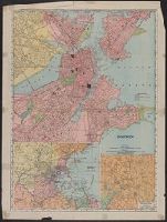
- Beinecke Rare Book and Manuscript Library > Boston.
- Creator:
- Kitchin, Thomas, d. 1784
- Published / Created:
- 1778
- Call Number:
- 76 1778
- Container / Volume:
- BRBL_00690
- Image Count:
- 2
- Resource Type:
- Maps, Atlases & Globes
- Abstract:
- ; Massachusetts as far north as Boston, including Cape
- Found in:
- Beinecke Rare Book and Manuscript Library > A map of the colony of Rhode Island [cartographic material] : with the adjacent parts of Connecticut, Massachusetts Bay, & c / by Thos. Kitchin Senr., Hydrographer to His Majesty.
- Published / Created:
- 1857
- Call Number:
- 75gme 1857
- Container / Volume:
- BRBL_00412
- Image Count:
- 2
- Resource Type:
- Maps, Atlases & Globes
- Description:
- Massachusetts, Connecticut and Rhode Island, ca. 1
- Found in:
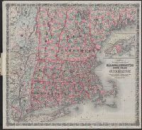
- Beinecke Rare Book and Manuscript Library > A new and complete Rail Road map of the United States / compiled from reliable sources by William Perris ; presented by the Home Insurance Company of New York ; Korff Brothers, Practical Lithographers, New York.
- Creator:
- G.W. & C.B. Colton & Co
- Published / Created:
- 1886
- Call Number:
- 76 1886
- Container / Volume:
- BRBL_00445
- Image Count:
- 1
- Resource Type:
- Maps, Atlases & Globes
- Alternative Title:
- Massachusetts, Rhode Island, and
- Found in:
- Beinecke Rare Book and Manuscript Library > Colton's railroad & township map of Massachusetts, Rhode Island and Connecticut : with parts of Maine, New Hampshire, Vermont & New York.
- Creator:
- Colton, J. H. (Joseph Hutchins), 1800-1893
- Published / Created:
- 1860
- Call Number:
- 764 1860
- Container / Volume:
- BRBL_00453
- Image Count:
- 1
- Resource Type:
- Maps, Atlases & Globes
- Found in:
- Beinecke Rare Book and Manuscript Library > Colton's Massachusetts and Rhode Island.
- Creator:
- Geo. H. Walker & Co
- Published / Created:
- c1891.
- Call Number:
- 764 1891A
- Container / Volume:
- BRBL_00453
- Image Count:
- 1
- Resource Type:
- Maps, Atlases & Globes
- Found in:
- Beinecke Rare Book and Manuscript Library > Massachusetts atlas plate no. 26.
- Creator:
- Geo. H. Walker & Co
- Published / Created:
- c1891.
- Call Number:
- 764 1891W
- Container / Volume:
- BRBL_00453
- Image Count:
- 1
- Resource Type:
- Maps, Atlases & Globes
- Found in:
- Beinecke Rare Book and Manuscript Library > Massachusetts atlas plate no. 27.
- Creator:
- Rand McNally and Company
- Published / Created:
- 1891
- Call Number:
- 764 1891
- Container / Volume:
- BRBL_00453
- Image Count:
- 1
- Resource Type:
- Maps, Atlases & Globes
- Found in:
- Beinecke Rare Book and Manuscript Library > Rand McNally & Co.'s Massachusetts.
- Creator:
- Ferguson, W. E
- Published / Created:
- 1850
- Call Number:
- 764gme 1850
- Container / Volume:
- BRBL_00462
- Image Count:
- 1
- Resource Type:
- Maps, Atlases & Globes
- Abstract:
- Map of eastern Massachusetts covering
- Subject (Topic):
- Railroads--Massachusetts--Maps
- Found in:
- Beinecke Rare Book and Manuscript Library > Map of the Old Colony Rail Road with its branches & connecting roads, prepared under the direction of the Committee of Investigation, Jany. 1850, S. Dwight Eaton, Engr.
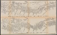
- Creator:
- Dearborn, Benjamin, 1754-1838
- Published / Created:
- [1814]
- Call Number:
- 764 B65 1814A
- Container / Volume:
- BRBL_00455
- Image Count:
- 2
- Resource Type:
- Maps, Atlases & Globes
- Description:
- Removed from Massachusetts House
- Subject (Topic):
- Drainage--Massachusetts--Boston
- Found in:
- Beinecke Rare Book and Manuscript Library > A plan of those parts of Boston and the towns in its vicinity : with the waters and flats adjacent which are immediately or remotely connected with the contemplated design of erecting perpetual tide-mills.
- Creator:
- United States Coast Survey
- Published / Created:
- [1875]
- Call Number:
- 764cea SA32 1875
- Container / Volume:
- BRBL_00461
- Image Count:
- 1
- Resource Type:
- Maps, Atlases & Globes
- Subject (Topic):
- Harbors--Massachusetts--Salem--Maps
- Found in:
- Beinecke Rare Book and Manuscript Library > Salem harbor, Massachusetts / United States Coast Survey ; topography by F. Dankworth ; sand by H.M. Knight ; lettering by J. Knight & S.E. Stull ; views by G. McCoy.
- Creator:
- Geo. H. Walker & Co
- Published / Created:
- c1904.
- Call Number:
- 764gmb T193 1904
- Container / Volume:
- BRBL_00462
- Image Count:
- 1
- Resource Type:
- Maps, Atlases & Globes
- Alternative Title:
- Massachusetts
- Found in:
- Beinecke Rare Book and Manuscript Library > City of Taunton.
- Creator:
- Appalachian Mountain Club
- Published / Created:
- 1890
- Call Number:
- 764 B65 1890A
- Container / Volume:
- BRBL_00456
- Image Count:
- 1
- Resource Type:
- Maps, Atlases & Globes
- Publisher:
- Massachusetts,
- Subject (Name):
- Massachusetts. Topographical Survey
- Found in:
- Beinecke Rare Book and Manuscript Library > Map of the country about Boston / Geo. S. Harris & Sons, lith.
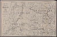
- Creator:
- Walling, Henry Francis, 1825-1888
- Published / Created:
- 1858
- Call Number:
- 764 B45 1858
- Container / Volume:
- BRBL_00454
- Image Count:
- 6
- Resource Type:
- Maps, Atlases & Globes
- Subject (Topic):
- Cities and towns--Massachusetts
- Found in:
- Beinecke Rare Book and Manuscript Library > Map of the county of Berkshire, Massachusetts : based upon the trigonometrical survey of the state / the details from actual surveys under the direction of Henry F. Walling, supt. of the state map.
- Creator:
- United States Coast Survey
- Published / Created:
- 1857
- Call Number:
- 764cea W86 1857
- Container / Volume:
- BRBL_00461
- Image Count:
- 1
- Resource Type:
- Maps, Atlases & Globes
- Subject (Topic):
- Harbors--Massachusetts--Woods Hole
- Found in:
- Beinecke Rare Book and Manuscript Library > The Harbor of Wood's Hole, Massachusetts / from a trigonometrical survey under the direction of A.D. Bache, superintendent of the Survey of the Coast of the United States. Triangulation by C.M. Eakin, assist. ; topography by W.M. Boyce assist. ; hydrograp
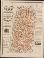
- Creator:
- Watson, Walter, civil engineer
- Published / Created:
- [1896].
- Call Number:
- 764 B45 1896
- Container / Volume:
- BRBL_00454
- Image Count:
- 1
- Resource Type:
- Maps, Atlases & Globes
- Subject (Topic):
- Railroads--Massachusetts--Berkshire
- Found in:
- Beinecke Rare Book and Manuscript Library > Railway and highway map of the famous Berkshire Hills region, showing also villages and points of interest : from official records and other information / by Walter Watson, C.E. for the Berkshire Life Insurance Co. of Pittsfield, Mass., 1883 (Corrected 18
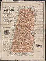
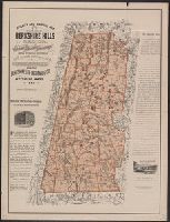
- Creator:
- Watson, Walter, civil engineer
- Published / Created:
- c1883.
- Call Number:
- 764 B45 1883
- Container / Volume:
- BRBL_00454
- Image Count:
- 1
- Resource Type:
- Maps, Atlases & Globes
- Subject (Topic):
- Railroads--Massachusetts--Berkshire
- Found in:
- Beinecke Rare Book and Manuscript Library > Railway and highway map of the famous Berkshire Hills region, showing also villages and points of interest : from official records and other information / by Walter Watson, C.E. for the Berkshire Life Insurance Co. of Pittsfield, Mass., 1883.
- Creator:
- Swett and Powers (Firm)
- Published / Created:
- [ca. 1851?]
- Call Number:
- 76gme 1850
- Container / Volume:
- BRBL_00446A
- Image Count:
- 1
- Resource Type:
- Maps, Atlases & Globes
- Description:
- , Massachusetts, and part of New York.
- Found in:
- Beinecke Rare Book and Manuscript Library > Map of the New York & Boston Railway : with its connections with other railways.
- Published / Created:
- 1909
- Call Number:
- 764 B65 1909A
- Container / Volume:
- BRBL_00456
- Image Count:
- 1
- Resource Type:
- Maps, Atlases & Globes
- Subject (Name):
- Massachusetts. Metropolitan
- Subject (Topic):
- Highway planning--Massachusetts--Boston
- Found in:
- Beinecke Rare Book and Manuscript Library > Map of the existing and proposed radial thoroughfares : of the district and their connections / Commonwealth of Massachusetts Metropolitan Improvements Commission.
- Published / Created:
- [1833?]
- Call Number:
- 764CA 1833
- Container / Volume:
- BRBL_00460
- Image Count:
- 1
- Resource Type:
- Maps, Atlases & Globes
- Subject (Geographic):
- Massachusetts--Maps
- Found in:
- Beinecke Rare Book and Manuscript Library > Geological map of Massachusetts By Edw. D. Hitchcock 1833 ...
- Published / Created:
- [1886].
- Call Number:
- 764gme D86 1886
- Container / Volume:
- BRBL_00462
- Image Count:
- 1
- Resource Type:
- Maps, Atlases & Globes
- Subject (Geographic):
- Massachusetts--Maps
- Found in:
- Beinecke Rare Book and Manuscript Library > Location of the Providence, Webster, and Springfield Railroad Extension in Dudley [Massachusetts].
- Published / Created:
- [1886?].
- Call Number:
- 764gme 1886
- Container / Volume:
- BRBL_00462
- Image Count:
- 2
- Resource Type:
- Maps, Atlases & Globes
- Subject (Geographic):
- Massachusetts--Maps
- Found in:
- Beinecke Rare Book and Manuscript Library > [Maps of the locations of the Providence, Webster, and Springfield Railroad Company within Massachusetts].
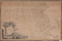
- Published / Created:
- 1801
- Call Number:
- 764FB 1801
- Container / Volume:
- BRBL_00462
- Image Count:
- 1
- Resource Type:
- Maps, Atlases & Globes
- Subject (Geographic):
- Massachusetts--Maps
- Found in:
- Beinecke Rare Book and Manuscript Library > Map of Massachusetts proper compiled from actual surveys made by Order of the General Court. And under the inspection of Agents of their Appointment. By Osgood Carleton.