Search
You Searched For
Search Results
- Published / Created:
- [1754]
- Call Number:
- 755 1754
- Container / Volume:
- BRBL_00728
- Image Count:
- 1
- Resource Type:
- Maps, Atlases & Globes
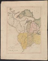
- Description:
- west to Lake Michigan.
- Found in:
- Beinecke Rare Book and Manuscript Library > An accurate map of the English colonies in North America, bordering on the river Ohio.
- Published / Created:
- 1783
- Call Number:
- 771 1783
- Container / Volume:
- BRBL_00477
- Image Count:
- 2
- Resource Type:
- Maps, Atlases & Globes
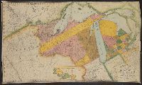
- Description:
- , Maryland, Ohio and Michigan. The French Colony
- Found in:
- Beinecke Rare Book and Manuscript Library > Map of the State of New York and Parts adjacent. Will Cockburn, 1780. With the improvements in the year 1783.
- Published / Created:
- [1810?]
- Call Number:
- 755 1810
- Container / Volume:
- BRBL_00438
- Image Count:
- 1
- Resource Type:
- Maps, Atlases & Globes
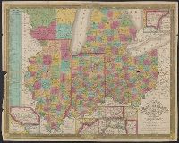
- Description:
- Illinois, Indiana, Ohio, Michigan, etc.
- Found in:
- Beinecke Rare Book and Manuscript Library > The Upper Territories of the United States. Kneass & Delleker Sc.
- Published / Created:
- 1819
- Call Number:
- 755 1819
- Container / Volume:
- BRBL_00439
- Image Count:
- 1
- Resource Type:
- Maps, Atlases & Globes
- Found in:
- Beinecke Rare Book and Manuscript Library > A new map of part of the United States, exhibiting the North West, Michigan, Indiana, and Illinois territory the States of Kentucky, Ohio, Virginia, Maryland and Pennsylvania ... John Cary, Engraver.
- Published / Created:
- 1830
- Call Number:
- 755 1830
- Container / Volume:
- BRBL_00440
- Image Count:
- 1
- Resource Type:
- Maps, Atlases & Globes
- Found in:
- Beinecke Rare Book and Manuscript Library > Map of the territories of Michigan and Ouisconsin on a scale of 30 geographical miles to an inch by John Farmer of Detroit, Engraved by Rawdon Clark & Co., Albany, NY.
- Published / Created:
- [1831?]
- Call Number:
- 811 1831
- Container / Volume:
- BRBL_00552
- Image Count:
- 1
- Resource Type:
- Maps, Atlases & Globes
- Subject (Geographic):
- Michigan--Maps
- Found in:
- Beinecke Rare Book and Manuscript Library > Michigan.
- Published / Created:
- 1832
- Call Number:
- 75 1832P
- Container / Volume:
- BRBL_00398
- Image Count:
- 1
- Resource Type:
- Maps, Atlases & Globes
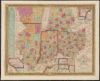
- Description:
- boundary before settlement of 1842; Michigan e
- Found in:
- Beinecke Rare Book and Manuscript Library > Map of the United States.
- Published / Created:
- 1835
- Call Number:
- 755 1835B
- Container / Volume:
- BRBL_00440
- Image Count:
- 1
- Resource Type:
- Maps, Atlases & Globes
- Found in:
- Beinecke Rare Book and Manuscript Library > Map of the States of Ohio, Indiana, and Illinois with the settled part of Michigan.
- Published / Created:
- 1835
- Call Number:
- 755 1835B
- Container / Volume:
- BRBL_00440
- Image Count:
- 1
- Resource Type:
- Maps, Atlases & Globes
- Found in:
- Beinecke Rare Book and Manuscript Library > Map of the States of Ohio, Indiana, and Illinois with the settled part of Michigan.